Research projects
Filter:
Filtered:
See also UK Polar Data Centre team or Atmospheric physics & chemistry
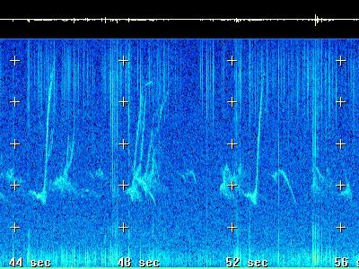
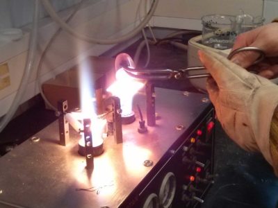
‘Sounds of Space’
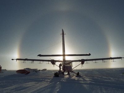
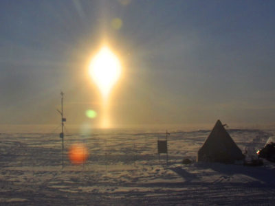
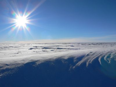
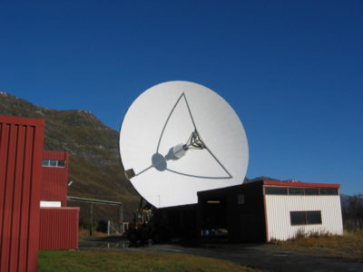
Using a Very Low Frequency receiver at Halley Research Station we can pick up radio waves made by our planet. We use these waves to investigate the science of space …
60 Second Science
We’ve challenged our science, engineering and support staff and their research collaborators to explain in 60 seconds what they do. Decide for yourself if they have met the challenge well! …
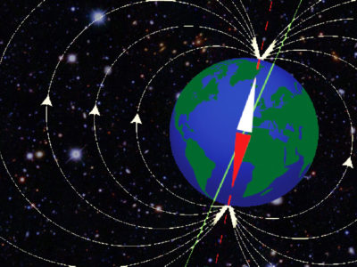
A High-Order Model of the Earth’s External and Induced Magnetic Field
For centuries people have used magnetic compasses to guide them on their way and explore new territories. This has led scientists to embark on their own journeys of discovery about …
A new polar research ship for Britain: project delivery
A new research platform to put UK scientists at the forefront of polar science

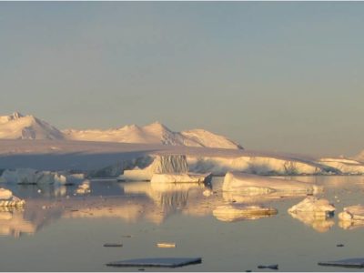
A23 repeat section
Understanding Antarctic Bottom Water (AABW) and its affect on global ocean circulation.
ABSCISSA
The source of sea-salt aerosols in the Polar Regions appears to be linked to sea ice surfaces, but exact details are unclear. Defining the sources is important given the critical …

ACSIS
Major changes are occurring across the North Atlantic climate system: in the ocean and atmosphere temperatures and circulation, in sea ice thickness and extent, and in key atmospheric constituents such …
AI for Earth Observation
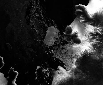
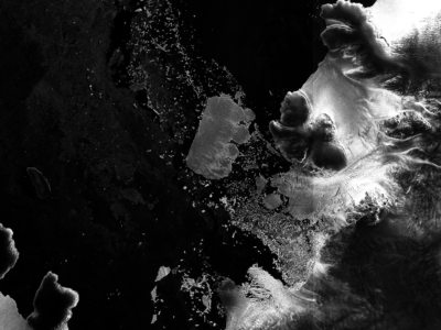
Recent increases in the spatial coverage and temporal resolution of 40 m resolution Synthetic Aperture Radar (SAR) imagery, is opening new opportunities to rapidly detect environmental observations e.g. ice sheet and iceberg position with greater positional accuracy. Our team are developing supervised and unsupervised machine learning techniques to automatically detect sea ice and iceberg position from Sentinel-1 SAR imagery.
AI for smart conservation
In the AI for smart conservation project, BAS are collaborating with local ecologists and conservation agencies to develop decision-making tools informed by sea ice forecasts. By combining satellite observations, GPS …
AI4EOAccelerator
The AI4EO Accelerator is a collaboration between Φ-Lab of the European Space Agency (ESA) and the UKRI Centre for Doctoral Training (CDT) in the Application of Artificial Intelligence to the …
Albatrosses from Space
Great (Diomedea) albatrosses face multiple threats to their long-term survival. Declines in albatross populations have been linked to incidental mortality (bycatch) in fisheries, predatory invasive species (including rats, mice and …
AMOP – Autonomous Marine Operations Planning
AMOP is developing Artificial Intelligence methods that aim to optimise the efficiency of Antarctic field operations, while maximising science delivery
ANGWIN
ANGWIN is now a SCAR action group. See the proposal that was presented at the Polar 2018 conference here: SCAR_Proposal.pdf ANGWIN (in the Cornish English dialect ANGWIN means “the white”) …
ANiSEED
This project will reconstruct millennial-scale ice sheet change in the western Amundsen Sea Embayment, Antarctica, using high-precision exposure dating.
Antarctic Climate over the last millennia
The Antarctic Peninsula and West Antarctica have warmed dramatically in recent decades, with some climate records indicating that these are among the most rapidly warming regions on Earth. The Antarctic …
Antarctic Coastal Winds
Winds along the Antarctic coast are small scale but have global importance. Climate models must have a realistic representation of these winds as they influence ice shelves, sea ice and …
Antarctic Digital Database
The SCAR ADD is a seamless compilation of topographic data for Antarctica to 60°S. It is the place to go to get data such as Antarctic coastline or contours for working in desktop GIS.
ApRES and groundwater
The aim of this study is to investigate whether a technique developed to measure the basal meltrate of ice shelves can be used to monitor groundwater in arid and semi-arid …

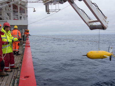
Arctic marine geophysics
This research focuses on investigating the glacial histories of Arctic ice sheets and ice caps using the marine geological record preserved on continental margins. By reconstructing past ice sheets, their …

Arctic PASSION
The Arctic is more affected by climate warming than any other region. To monitor the ongoing changes, to predict the evolution of the climate system and to develop mitigation measures, …
Arctic Summer-time Cyclones
The Arctic Summer-time Cyclone Project is a joint project of scientists from the University of Reading, University of East Anglia and the British Antarctic Survey with expertise in atmospheric dynamics, …
ASCCC
The ASCCC Project has been funded by ACE (Antarctic Circumnavigation Expedition) to investigate, quantify and understand the role of polar and subpolar seabeds in the carbon cycle, particularly in response …
Ascension Island Marine Sustainability (AIMS)
The project Ascension Island Marine Sustainability (AIMS) – A Fisheries and Marine Biodiversity Project Ascension Island harbours globally important marine biodiversity, potentially representing a unique assemblage of western and eastern …
Atmospheric Data Access System
An online data access tool to discover, visualise and access atmospheric and space weather data holdings from the polar regions.

Auroral Boundary Location Method
To estimate the poleward and equatorward boundaries of auroral emissions, we perform the following steps: Step 1 – Get an IMAGE FUV image The website maintained by the IMAGE …
Automated lithological mapping using airborne hyperspectral remote sensing
Antarctica is a unique and geographically remote environment. Field campaigns in the region encounter numerous challenges including the harsh polar climate, steep topography, and high infrastructure costs. Additionally, field campaigns …
AWERB
The BAS Animal Welfare & Ethics Review Body (AWERB) enforces British Antarctic Survey’s duty of care to protect animals. The AWERB review each and every application, from any project that …
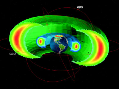
BAS-RBM
The radiation belts are the region of space around the Earth where high energy charged particles are trapped by the Earth’s magnetic field. The energy of the particles and their …
BBAS
The BBAS science programme was a British Antarctic Survey-funded project, part of the wider BBAS-AGASEA collaboration between BAS, the University of Texas Institute for Geophysics (UTIG), and the U.S. National …
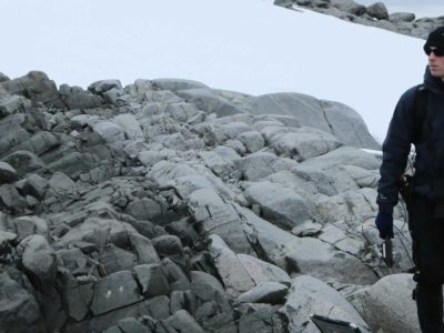
BEAMISH: Basal Conditions on Rutford Ice Stream
The polar ice sheets play a major role in controlling Earth’s sea level and climate, but our understanding of their history and motion is poor. The biggest uncertainty in predicting …
Bedmap
Bedmap is a collaborative community project with the aim to produce a new map and datasets of Antarctic ice thickness and bed topography for the international glaciology and geophysical community, …
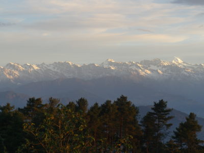
Bedmap Himalayas
Bedmap Himalayas is an ongoing BAS core-funded and grant-funded programme. It aims to measure how much water much is stored as glacier ice in High Mountain Asia. In warm weather, …
Bedmap2
understanding whats beneath the ice, opens new opportunities for detailed modelling of the past and future evolution of the Antarctic ice sheets
Bedmap3
Bedmap3 is a collaborative community project with the aim to produce a new map and datasets of Antarctic ice thickness and bed topography for the international glaciology and geophysical community, …
Beyond Epica
A decade ago, the European EPICA project completed drilling a deep ice core at Dome C, revealing the close link between climate and atmospheric greenhouse gases over the past 800,000 …

BID
The BAS Transformation Programme is a key driver of change across the organisation. Our ambition is to pull together our in-house expertise to rethink our future ways of working. In …
Biodiversity
Fragmentation occurs when parts of a habitat are lost due to for example change of land use, leaving behind smaller unconnected areas. This makes survival of the species of the …

Biodiversity at BAS Cambridge
Biodiversity@BAS is an initiative formed by BAS staff. Adopting current NERC Biodiversity policy and working closely with BAS Estates and Environment Office teams, its goal is to assist with the …
BIOPOLE
Overview Climate change is proceeding faster at the poles than any other region, with sea-ice retreating, glaciers melting and biotic communities being invaded by sub-polar species. These changes are affecting …
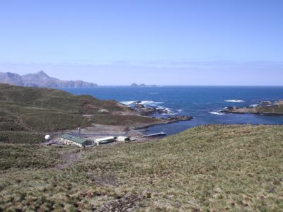
Bird Island Decarbonisation
In order to decarbonise our remote Bird Island Research Station on the sub-Antarctic Island of South Georgia we will be installing a solar photovoltaic and energy storage system.
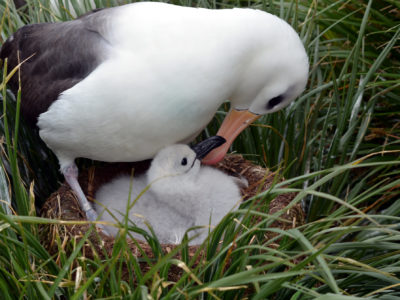
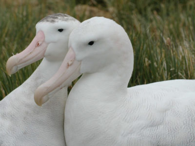
Black-browed Albatross Juvenile Tracking
Until the last decade, South Georgia held the third largest population of black-browed albatrosses at any island group (Phillips et al. 2016) [4]. However, assuming trends at surveyed sites are …
British Antarctic Oral History Project
Capturing the reminiscences and memories of those involved in British polar science
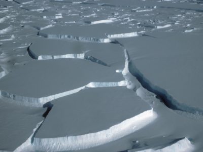
Brunt Ice Shelf movement
British Antarctic Survey is monitoring cracks on the Brunt Ice Shelf. Find out how here
Building data resources for managing the South Georgia & South Sandwich Islands Marine Protected Area
The South Georgia and South Sandwich Islands (SGSSI) Marine Protected Area (MPA) was established by the Government of South Georgia and the South Sandwich Islands in 2012, to ensure the …
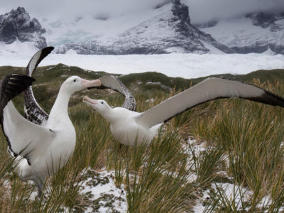
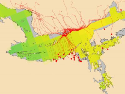
Bycatch risk of wandering albatrosses from radar detection
Wandering albatrosses are threatened by bycatch. Populations at South Georgia have declined catastrophically since the 1960s due to incidental mortality (bycatch) in fisheries (Pardo et al. 2017) [1]. This led …
Cambridge Centre for Climate Science
CCfCS promotes interdisciplinary research in climate science across the wide range of departments and institutes in Cambridge.
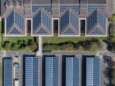
Cambridge HQ Decarbonisation
We are working on a raft of measures to reduce our carbon emissions at our Cambridge Headquarters, including installation of solar panels on the car park and roofs of buildings, and adding insulation to our Logistics building.
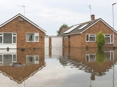
CANARI
Extreme weather events can have substantial impacts. For instance: the extensive UK flooding during the stormy winters of 2013/14 and 2015/16 resulted in £3 billion of damage to property and …
Changing biodiversity
Baseline study to monitor how marine biodiversity will respond to climate change
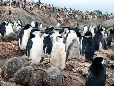
Chinstrap Penguin Tracking
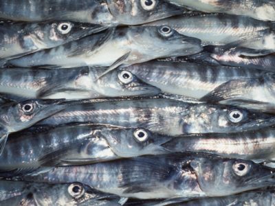
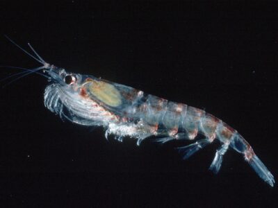
The commercial fishery for Antarctic krill (Euphausia superba) operates in the southwest Atlantic, in particular along the west Antarctic Peninsula, and over the shelf breaks of the South Shetland Islands, …
Climate and Ice during the Last Interglacial
During the Last Interglacial (129-116 thousand years ago, ka) CO2 and global temperature were both higher than they were before human industrialisation. By examining Last Interglacial climate, we thus gain …

Climate Code
This collaborative project is born from exploring novel ways of visualising environmental data and telling the climate change story. Read more about the project and the science behind it through the project page.
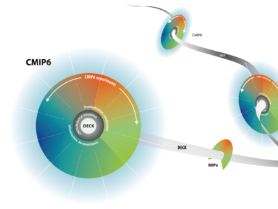
CMIP6
Header image from V. Eyring et al.: Overview of the CMIP6 experimental design and organization. https://www.geosci-model-dev.net/9/1937/2016/gmd-9-1937-2016.pdf The Coupled Model Intercomparison Project (CMIP) coordinates and designs global climate model simulations of …
Cold Skeletons
Does the cold affect how animals grow? Are skeletons different in Antarctic marine species, which survive almost permanently below 0°C? It is well known that animals grow at different rates …
COMICS
Investigating the twilight zone The four-year COMICS project, is led by the National Oceanography Centre, is a collaboration between the British Antarctic Survey and the universities of Queen Mary London, …
CONSEC
CONSEC is addressing the challenge to understand the links between the biodiversity, structure and function of Southern Ocean ecosystems and the impacts of rapid environmental changes to improve scientific knowledge …
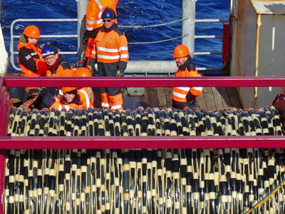
Continuous Plankton Recorder
Contemporary research has shown that the Southern Ocean is warming. Summer surface temperatures have risen by more than 1 degree Centigrade in the last 80 years and a strong upper-layer …
CRiceS
Sea ice is an integral, changing part of the global Earth system. The polar climate system affects lives and livelihoods across the world by regulating climate and weather; providing ecosystem …
CUPIDO
CUPIDO aims to address: what is the role of zooplankton in promoting the transport of plastic in the ocean?
and how this plastic transport interferes with zooplankton’s ability to store carbon in the deep ocean?
Darwin Plus SO Red Listing
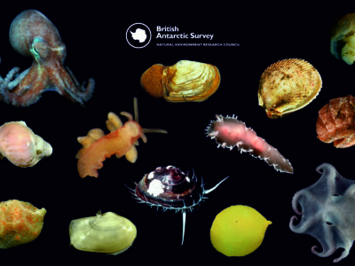
The IUCN Red List is the international standard for conservation, a crucial tool to communicate threats to species, which can be applied to all species and ecosystems. Molluscs represent a …

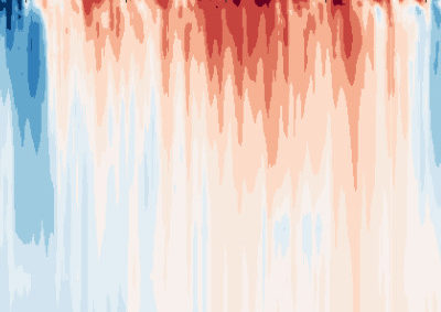
Data As Art
DATA AS ART is an ongoing science & art project in development at NERC’s British Antarctic Survey (BAS). It visualises science data (in its widest definition), to create stunning and …
DATA AS ART #01
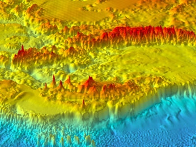
Echo sounder The bathymetry of the sea floor north-east of the volcanic Saunders Island in the South Sandwich Archipelago. Deeply-eroded canyons funnel sediment down the submarine slope of the volcano …
DATA AS ART #02
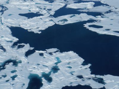
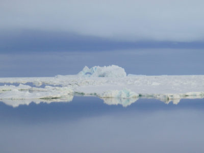
Sea ice An optical satellite image of sea ice in the marginal ice zone in the northern Weddell Sea. The image is approximately 100km across and shows swirling sea-ice patterns, …
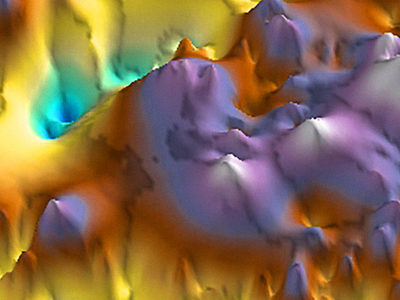
DATA AS ART #03
Radio echo A perspective view of the Gamburtsev Subglacial Mountains, imaged using airborne ice-penetrating radar to look through the overlying ice sheet. The rugged subglacial topography holds a record of …
DATA AS ART #04
Electron precipitation Space weather events involve large explosions on the Sun, called coronal mass ejections, which create geomagnetic storms. These storms are fierce enough to tear open the magnetic field …
DATA AS ART #05
Genetic antifreeze When many insects get cold they produce a special sugar that stops their cells from freezing and keeps them working at low temperatures. In any biochemical process there …
DATA AS ART #06
Ozone Hole The discovery of the Antarctic Ozone Hole is one of the most important scientific papers of recent decades. The discovery, in 1985, by British Antarctic Survey scientists Joe …
DATA AS ART #07
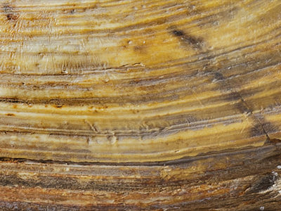
Thin section Thin sections of geological samples viewed under cross-polarised light can reveal valuable information about the origin of the rocks they come from. This helps understand the geological process …
DATA AS ART #08
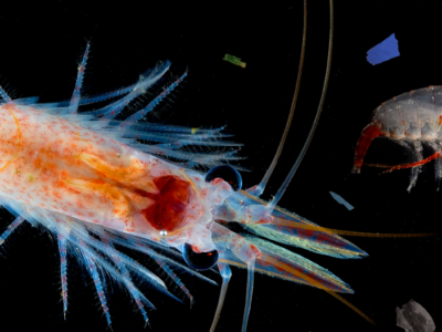
Krill ball Antarctic krill are a key species in the Antarctic ecosystem. They are a consumer and re-packager of phytoplankton (algae) and therefore part of the biological carbon pump; they …
DATA AS ART #09
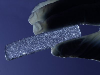
Volcanic ash Ice cores are cylinders of ice (approximately 10cm wide) drilled out of an ice sheet or glacier. On the East Antarctic Ice Sheet, these can be up to …
DATA AS ART #10
Ice layers Radio waves can be transmitted down through an ice sheet, ice stream or glacier and are reflected off the internal layers in the ice as well as off …
DATA AS ART #11
Swath bathymetry Most ice is lost from Antarctica through ice streams. To better predict the future of the Antarctic ice sheet it is important that we improve our understanding of …
DATA AS ART #12
Pollen and climate Artwork #12 shows how the amounts of different fossil spores and pollen from Antarctic rock samples change through geological time with changing climate. Each stacked graph is …
Data as Art: POLAR AESTHETICS
British Antarctic Survey has an ongoing science & art collaboration with Royal College of Art PhD candidate Wayne Binitie. Wayne has visited BAS a number of times to develop his …
DEFIANT
Overview While climate models suggest Antarctic sea ice extent should also reduce in response to rising atmospheric CO2 concentraions, satellite observations reveal that during 1979-2015 the opposite was in fact …
Depositional patterns and records in sediment drifts off the Antarctic Peninsula and West Antarctica
The biggest uncertainty in predictions of sea-level rise is what the contribution will be from the great ice sheets on Antarctica and Greenland as climate warms. The West Antarctic Ice …
Detecting rare earth elements with remote sensing
Rare earth elements (REEs) are a group of naturally occurring, chemically similar elements present in the Earth’s crust. Over the past decades these elements have become increasingly critical to many …
DI4EDS
Environmental research relies on digital infrastructure (hardware, software and methods) to provide services that help researchers answer questions about the environment around us, and innovators to work out ways that …
Digital Twins of the Polar Regions
Digital Twinning is next generation technology for data fusion and computer modelling enabling us to rapidly get answers to “what-if” questions. Digital Twins (DTs) are already in operation in industry …

Discovery Metadata System
A web-based system to discover polar datasets collected by UK-funded scientists
Diversity in UK Polar Science – Resources
This page is meant to be interactive. We would like you to explore the documents our project team has created: ask questions about them, use them, and help us make them more useful for you. Get in touch with us if you’d like to hear about our activities, participate in surveys and more.
Diversity in UK Polar Science – Steering Group
Enhancing diversity, equality and inclusion in UK Polar science
Diversity in UK Polar Science Initiative
Foreign, Commonwealth & Development Office helping increasing representation of people from under-represented groups engaged in Polar Science.
Diversity in UK Polar Science Initiative – Key outcomes
A series of events and activities to raise awareness of opportunities in UK Polar Science
DRAGON-WEX
DRAGON-WEX (the DRake pAssaGe and sOuthern oceaN – Wave EXperiment) is a NERC funded standard grant between the University of Bath and the British Antarctic Survey. We will implement and …
DRIIVE
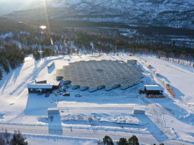
DRIIVE will use the new EISCAT_3D radar to understand multi-scale coupling in the Ionopshere and how it is influenced both by space weather and the lower atmosphere. The impact of …
DynOPO
Dynamics of the Orkney Passage Outflow (DynOPO) is a collaboration between BAS, the University of Southampton and the National Oceanography Centre (NOC). The project aims to investigate the flow of …
EC Copernicus Marine Environment Monitoring Service
The Copernicus marine environment monitoring service provides regular and systematic reference information on the state of the physical oceans and regional seas. The observations and forecasts produced by the service …
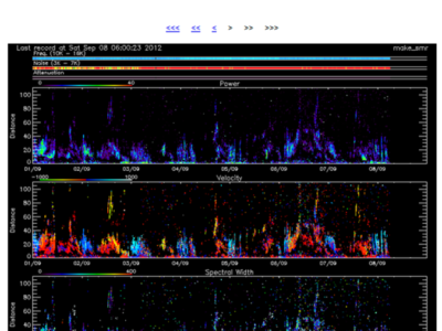
EISCAT Science Support
The UK EISCAT support group (UKESG) is a collaboration between the British Antarctic Survey and the Rutherford Appleton Laboratory, funded via the National Centre for Atmospheric Science (NCAS) EISCAT, the …
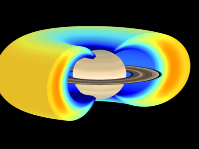
Electron Acceleration in the Radiation Belts of Earth, Jupiter & Saturn
Radiation belts of very high energy electrons and protons can form around some planets – at the Earth these large donut shaped regions in space are often called the Van …