Seabird Ecologist Deputy Science Leader IMP 3
Bycatch risk of wandering albatrosses from radar detection

Seabird sentinels: mapping bycatch risk of wandering albatrosses using bird-borne radar detection
- Start date:
- 1 July, 2019
- End date:
- 31 March, 2021
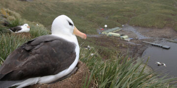
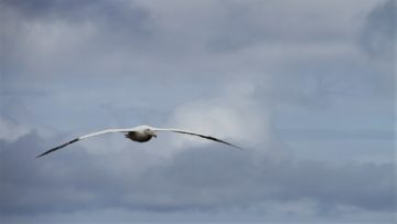
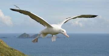
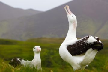
Wandering albatrosses are threatened by bycatch. Populations at South Georgia have declined catastrophically since the 1960s due to incidental mortality (bycatch) in fisheries (Pardo et al. 2017) [1]. This led to the development of the Conservation Action Plan by the Government of South Georgia and the South Sandwich Islands (GSGSSI), and their listing as a High Priority Population by the Agreement on the Conservation of Albatrosses and Petrels (ACAP).
Since 2014, bycatch of seabirds has been reduced to negligible levels in fisheries operating around South Georgia because of regulations introduced under the Convention on the Conservation of Antarctic Marine Living Resources (CCAMLR). However, elsewhere in the southern hemisphere, continuing poor practices and weak or no enforcement of regulations means that bycatch is still a major threat for wandering albatrosses – as well as for many other seabird populations (Phillips et al., 2016; Dias et al., 2019) [2] [3]. Limited vessel-based monitoring shows two areas of particular high risk for wandering albatrosses: the Patagonian Shelf and the South Atlantic subtropical frontal zone. The risks are compounded by Illegal, Unreported and Unregulated (IUU) fishing – a large but unquantified threat in the oceans. Identification of areas and periods when birds of different ages and sexes are most susceptible to bycatch is crucial information for stakeholders and policy makers, and used to improve regulations, target bycatch observer programmes and monitor compliance with recommended bycatch mitigation.
The overall objective of this project is to link habitat preference, at-sea activity patterns and detections from novel bird-borne radars to quantify interactions of tracked wandering albatrosses with legal and IUU fishing vessels. This will greatly improve previous coarse-scale analyses of overlap with fishing effort to clearly identify areas and periods of highest susceptibility to bycatch for different life-history classes (age, sex, breeding status). This is an innovative project and has the potential to be a “game-changer” given the capacity for identifying IUU vessels from bird-borne radar, and the potential future extension of the approach to other species. The work is led by the British Antarctic Survey in partnership with BirdLife International, and is funded by Darwin PLUS.
Season 2020-2021
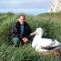
In December 2020, satellite-tags (PTTs) made by Sextant Technology were attached to wandering albatross chicks prior to their departure from Bird Island, and to sabbatical birds – those that had bred previously but are not doing so this season. Locations are shown on the following map. The tags use the Argos system, and have on-board GPS and a sensor to detect radar emissions from ships (all vessels use radar for safety and operational reasons). Proximity of a bird to a vessel is indicated by coloured dots – yellow (distant), orange (medium range), red (close). The irregularities in track lines is a feature of the raw GPS data stream.
Click on a track to find out how far the bird has gone from Bird Island.
Season 2019-2020
In December 2019, satellite-tags (PTTs) made by Sextant Technology were attached to wandering albatross chicks prior to their departure from Bird Island, and their locations are shown on the following map.
Unfortunately, the batteries did not recharge as expected from the solar panels on the devices, and the last locations were received in early February 2020.
Click on a track to find out how far the bird has gone from Bird Island.
Further reading
[1] Pardo, D., Forcada, J., Wood, A.G., Tuck, G.N., Ireland, L., Pradel, R., Croxall, J.P. and Phillips, R.A. (2017). Additive effects of climate and fisheries drive ongoing declines in multiple albatross species. Proceedings of the National Academy of Science of the Unites States of America 114, E10829-E10837.
[2] Phillips RA, Gales R, Baker GB, Double MC, Favero M, Quintana F, Tasker ML, Weimerskirch H, Uhart M, Wolfaardt A. (2016). The conservation status and priorities for albatrosses and large petrels. Biological Conservation, 201:169-83.
[3] Dias MP, Martin R, Pearmain EJ, Burfield IJ, Small C, Phillips RA, Yates O, Lascelles B, Borboroglu PG, Croxall JP. (2019). Threats to seabirds: a global assessment. Biological Conservation 237. 10.1016/j.biocon.2019.06.033.
The overall objective of this project is to link habitat preference, at-sea activity patterns and detections from novel bird-borne radars to quantify interactions of tracked wandering albatrosses with legal and Illegal, Unreported and Unregulated (IUU) fishing vessels.
-
-
E Fellow
-
PhD Student
Ana Bertoldi Carneiro – (BirdLife International)
-
Wandering albatross tracking at Bird Island
Read more of: Wandering albatross tracking at Bird IslandAlexandra Dodds is albatross zoological field assistant at the British Antarctic Survey Bird Island Research Station in South Georgia. The team have been working hard over the austral winter, conducting […]
-
Research shows ‘danger zones’ for wandering albatrosses
Read more of: Research shows ‘danger zones’ for wandering albatrossesOver half of wandering albatrosses breeding on Bird Island, in the sub-Antarctic, encounter fishing vessels when feeding, putting them at risk of being accidentally caught or killed in fishing gear, […]
-
Wind beneath their wings – study finds albatrosses fine-tuned to wind conditions
Read more of: Wind beneath their wings – study finds albatrosses fine-tuned to wind conditionsA new study of albatrosses has found that wind plays a bigger role in their decision to take flight than previously thought, and due to their differences in body size, […]
-
Bird Island Research Station
Read more of: Bird Island Research StationThe Bird Island Research Station focuses on the long-term study of seabirds and seals in one of the world’s richest wildlife sites.