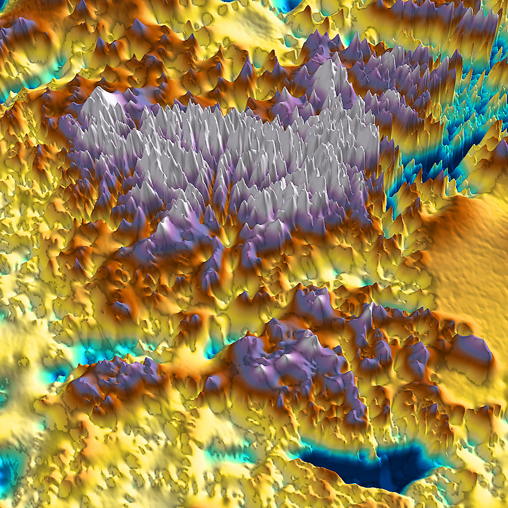
A perspective view of the Gamburtsev Subglacial Mountains, imaged using airborne ice-penetrating radar to look through the overlying ice sheet.
The rugged subglacial topography holds a record of the glacial processes which have sculpted the mountains. These include pre-glacial river valleys and subsequent local valley glaciers which eroded the mountain range. The record is preserved by the present blanketing ice sheet. This data, together with measurements of the Earth’s gravitational and magnetic fields, also help reveal the tectonic processes which originally built this unique mountain range.
DATA AS ART #03 Radio echo
Airborne radar data was collected during International Polar Year (2007-2009) as part of the international collaborative Antarctica’s Gamburtsev Province Project (AGAP), using geophysically-equipped Twin Otter aircraft from the British Antarctic Survey and the US Antarctic Program.
Data source:
Dr Tom Jordan
Aerogeophysicist
British Antarcic Survey