Geospatial Systems Architect
EC Copernicus Marine Environment Monitoring Service

EC Copernicus Marine Environment Monitoring Service
The Copernicus marine environment monitoring service provides regular and systematic reference information on the state of the physical oceans and regional seas. The observations and forecasts produced by the service support all marine applications.
For instance, the provision of data on currents, winds and sea ice help to improve ship routing services, offshore operations or search and rescue operations, thus contributing to marine safety.
The service also contributes to the protection and the sustainable management of living marine resources in particular for aquaculture, fishery research or regional fishery organisations.
Physical and marine biogeochemical components are useful for water quality monitoring and pollution control. Sea level rise helps to assess coastal erosion. Sea surface temperature is one of the primary physical impacts of climate change and has direct consequences on marine ecosystems. As a result of this, the service supports a wide range of coastal and marine environment applications.
Many of the data delivered by the service (e.g. temperature, salinity, sea level, currents, wind and sea ice) also play a crucial role in the domain of weather, climate and seasonal forecasting.
-

-

Head of MAGIC
-
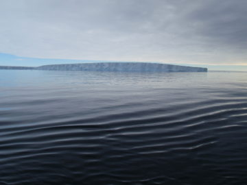
Giant West Antarctic iceberg disintegrates
Read more of: Giant West Antarctic iceberg disintegratesAn animation of the giant iceberg that calved off the Pine Island Glacier in West Antarctica just over two months ago shows an unexpected break up. Satellite images revealed a […]