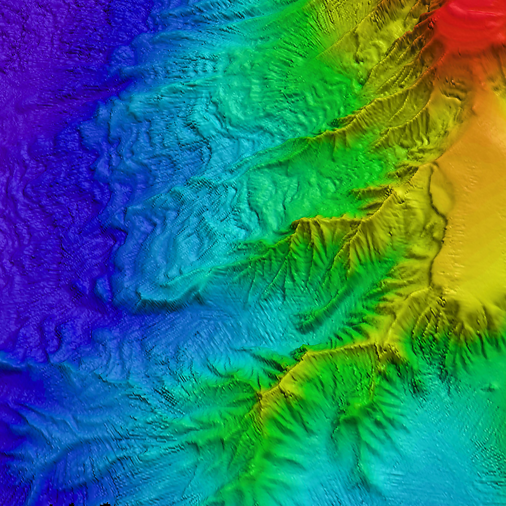
The bathymetry of the sea floor north-east of the volcanic Saunders Island in the South Sandwich Archipelago. Deeply-eroded canyons funnel sediment down the submarine slope of the volcano into deep water (shown blue).
The large volume of sediments being transported down the slope have produced highly-developed sediment wave-fields which trend across the slope. The high sedimentation rates indicate high erosion rates of the volcanically-active and glaciated island.
DATA AS ART #01 Echo sounder
This image uses bathymetry data collected using the hull-mounted Simrad EM120 multibeam echo-sounder on RRS James Clark Ross. Data collected during BAS cruise JR206. Location approximately 57º30’S, 26º00’W.
Data source:
Dr Philip Leat
Emeritus Fellow
British Antarcic Survey