Geospatial Systems Architect
Mapping and GIS team
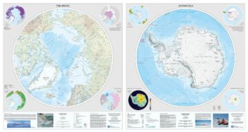
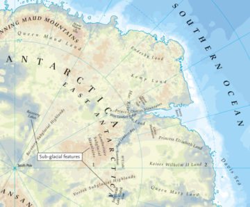
The Mapping and Geographic Information Centre (MAGIC) provides geospatial information, expertise and services to BAS and wider UK activity in the polar regions.
We maintain topographic mapping, collect new data and provide access to a wide range of spatial information and expertise to solve science and operational challenges.
Here you can explore our:
- Mapping and cartography
- Earth observation
- Geomatics and air observation
- Geographical information systems
- MAGIC people
- Projects/services
Mapping and cartography
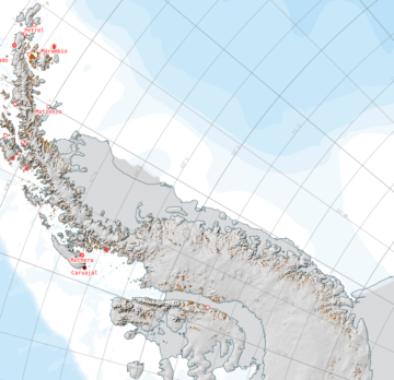
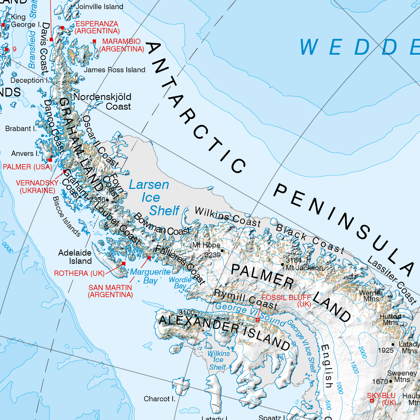
We produce a wide range of maps for all areas of scientific and operational work in the polar regions. These are used extensively by BAS staff, the public and the media, and anyone with an interest in the Antarctic and Arctic.
If you’d like details of some of our map collections, you can explore the BAS map catalogue.
We’re still populating the catalogue. You can download a list of books and maps we have for sale.
If you wish, you can buy physical copies of our published maps.
Unfortunately, we cannot sell individual maps or small orders. If that’s what you’re looking for, we recommend trying suppliers such as Stanfords, UK Antarctic Heritage Trust (UKAHT), and NHBS. They should be able to help.
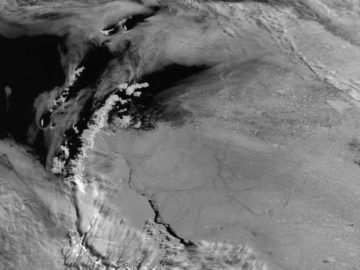
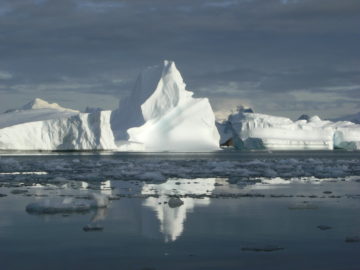
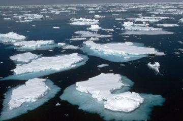
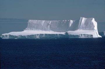
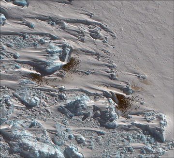
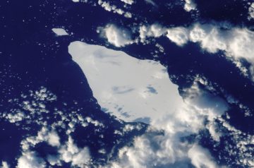
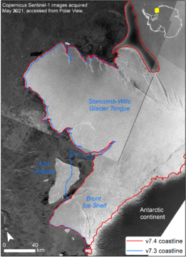
Earth observation
Earth observation by satellites provides a vast amount of information for mapping and monitoring the polar regions. In recent years, the number of satellite instruments focused on the poles has grown significantly.
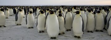
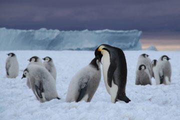
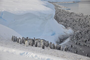
We support the use of these resources across BAS’s science and operations activities. Applications include monitoring wildlife population changes from space, to providing sea ice information to help ships make the best possible navigation decisions.
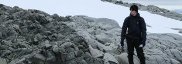
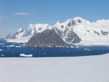
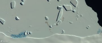
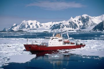
Geomatics and air survey
Geomatics is responsible for the collection and analysis of new geospatial data within MAGIC. We conduct terrestrial and aerial surveys, along with the downstream post-processing and photogrammetry workflows to extract topographic information.
<graphics>
From both crewed and uncrewed aircraft, our team provides expertise in:
- global navigation satellite systems (GNSS)
- light detection and ranging (LiDAR)
- terrestrial laser scanning (TLS)
- aerial photography
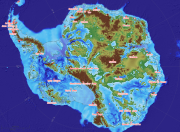
Geographical information systems
Geographical information systems (GIS) and the broader Spatial Data Infrastructure (SDI) are central to many activities at the British Antarctic Survey. The BAS SDI makes it possible to process, store, and share geospatial data reliably.
GIS allows the creation of detailed maps, supports scientific analysis, and helps with environmental mapping. Ongoing improvements to our GIS capabilities enhance planning and maintenance of station infrastructure, as well as operational air and field seasons.
BAS scientists rely on GIS for spatial analysis, mapping, and online projects. In addition, GIS training is provided for staff, with some materials freely available.
MAGIC people
- Andrew Fleming, head of MAGIC
- Andreas Cziferszky, geospatial systems architect
- Jonathan Dawe, geospatial developer
- Felix Fennell, geospatial developer
- Nathan Fenney, geomatics lead
- Elena Field, GIS mapping specialist
- Peter Fretwell, GIS scientist
- Laura Gerrish, GIS and mapping specialist
- Adrian Hughes, GIS and BIM specialist
- Louise Ireland, GIS lead
- Franco Ling, geomatics surveyor
- Nicole Logan-Park, estates asset engineer
- Aliaksandra Skachkova, EO specialist
- Tom Hughes, GIS and mapping specialist
MAGIC products and services
MAGIC provides the following products and services:
- Assets tracking service
- BAS map catalogue
- BAS spatial data infrastructure
- Field operations GIS and operations data store
- Geospatial training
- International Ice Charting Working Group (IICWG) Ice Logistics Portal
- Lifetime of Halley support
- Map sales
- Operational mapping
- Polar View & SIIS
- Rothera deployed support
- Rothera minimum snow cover
- Rothera ramp survey
- SCAGI UK representation and Co-Chair
- SCAR Air Operations Planning Maps
- SCAR Antarctic Digital Database
- UK Antarctic Place-names Committee Secretariat
- Wildlife from Space
-

-

Fontend Developer/Geospatail
-

Geospatial Developer
-

Geomatics Specialist
-
GIS and Web Mapping Specialist
-

Head of MAGIC
-

Geographic Information Officer
-
Geospatial Information Systems Lead
-
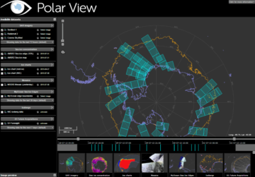
Polar View
Read more of: Polar ViewPolar View delivers information about sea ice direct to ships operating in the Southern Ocean.
-
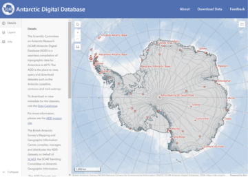
Antarctic Digital Database
Read more of: Antarctic Digital DatabaseThe SCAR ADD is a seamless compilation of topographic data for Antarctica to 60°S. It is the place to go to get data such as Antarctic coastline or contours for working in desktop GIS.
-
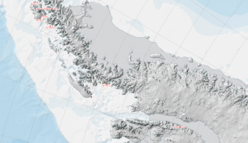
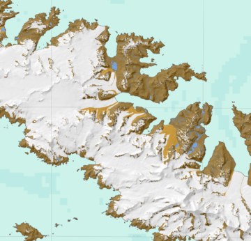
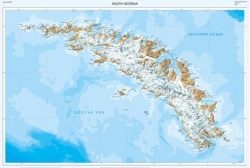
South Georgia GIS
Read more of: South Georgia GISVisualise and download topographic, management and scientific data for South Georgia.
-
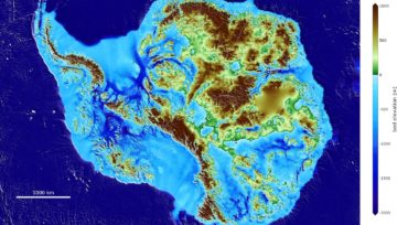
Bedmap3
Read more of: Bedmap3Bedmap3 is a collaborative community project with the aim to produce a new map and datasets of Antarctic ice thickness and bed topography.
-
Wildlife from Space
Read more of: Wildlife from SpaceMany populations of wildlife are remote, inaccessible or difficult to monitor. The advent of sub-metre, Very-High-Resolution (VHR) satellite imagery has enabled us study these animals in a much more efficient way.
-
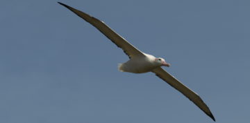
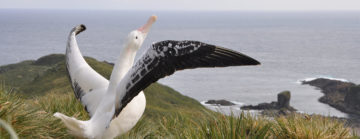
Albatrosses from Space
Read more of: Albatrosses from SpaceAlbatrosses face multiple threats to their long-term survival. Using very high-resolution satellites, we are able to estimate the number of breeding pairs in remote locations.

-
Higher Predators – Long-Term Science
Read more of: Higher Predators – Long-Term ScienceHigher Predators carries out long-term science to measure changes in Antarctic ecosystems. The aim is to understand the processes that drive these changes.
-
Assets Tracking Service
Read more of: Assets Tracking ServiceThe Assets Tracking Service shows where British Antarctic Survey ships, aircraft and vehicles are at any given time.

-
Embedded Maps Service
Read more of: Embedded Maps ServiceEmbeddable maps for visualising simple features on a suitable basemap.

-
Polar Thematic Exploitation Platform
Read more of: Polar Thematic Exploitation PlatformPolar TEP provides polar researchers with access to computing resources, earth observation and other data, and software tools in the cloud.
-
Improving shipping safety in the Arctic
Read more of: Improving shipping safety in the ArcticOptimising situational awareness in the Arctic through integrated space technologies

-
EC Copernicus Marine Environment Monitoring Service
Read more of: EC Copernicus Marine Environment Monitoring ServiceThe Copernicus marine environment monitoring service provides regular and systematic reference information on the state of the physical oceans and regional seas.
-
Bedmap
Read more of: BedmapBedmap is a collaborative community that has produced maps and datasets of Antarctic ice thickness and bed topography
-
Bedmap2
Read more of: Bedmap2Bedmap2 is a suite of gridded products describing surface elevation, ice-thickness and the sea floor and subglacial bed elevation of the Antarctic.
-
Hyperspectral imaging for Antarctic mapping
Read more of: Hyperspectral imaging for Antarctic mappingThe project has focused on exploiting information present in hyperspectral images, with a view to developing mapping tools to aid in the geological investigations.
-
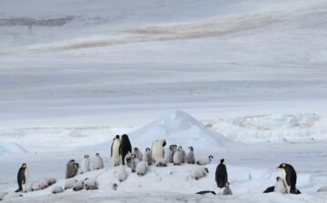
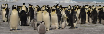
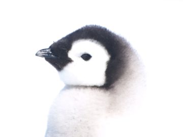
Accidental discovery reveals grim future for emperor penguins
Read more of: Accidental discovery reveals grim future for emperor penguinsScientists studying satellite images of Antarctica have stumbled upon a discovery that sheds new light on emperor penguins – and reveals a troubling threat to their survival.
-
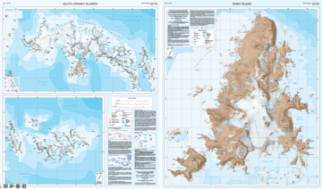
New map of South Orkney Islands published for the first time in 40 years
Read more of: New map of South Orkney Islands published for the first time in 40 yearsA new map of the South Orkney Islands has been released by British Antarctic Survey (BAS) – the first UK published, topographic map of the region in almost 40 years. The map offers a detailed topographic view of the entire South Orkney archipelago on one side, with a focused, high-resolution map of Signy Island on the reverse.
-
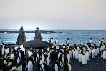
Drones and images from space count elephant seals
Read more of: Drones and images from space count elephant sealsA team of researchers are using drones and satellite images from space to count southern elephant seals on the sub-Antarctic Island of South Georgia.
-
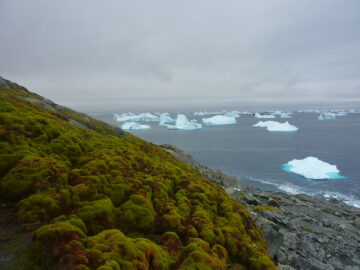
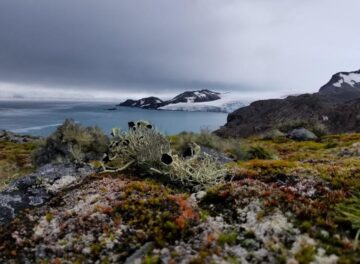
Satellite observations show accelerating greening of Antarctic Peninsula
Read more of: Satellite observations show accelerating greening of Antarctic PeninsulaNew research released today in Nature Geoscience reveals that vegetation cover on the Antarctic Peninsula has increased more than tenfold in the past four decades.
-
First Antarctic-wide survey of plant life to aid conservation efforts
Read more of: First Antarctic-wide survey of plant life to aid conservation effortsThe first continent-wide mapping study of plant life across Antarctica reveals growth in previously uncharted areas, and is set to inform conservation measures across the region.
-
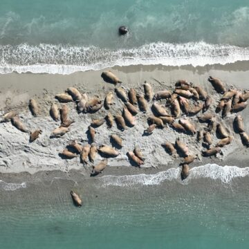
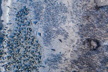
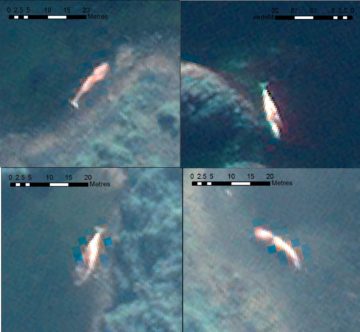
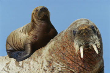
Drones validate walrus counts in satellite images from space
Read more of: Drones validate walrus counts in satellite images from spaceIn the first successful attempt to calibrate walrus counts from satellite imagery, scientists used drones to validate animal counts in Svalbard, Norway.
-
New interactive map of Antarctica available to all
Read more of: New interactive map of Antarctica available to allComprehensive digital maps of Antarctica are now available to all, following the latest update of the Antarctic Digital Database.
-
‘Penguin detectives’ required for new counting app
Read more of: ‘Penguin detectives’ required for new counting appBritish Antarctic Survey (BAS) is inviting the public to become ‘penguin detectives’ and spend five minutes counting emperor penguins to help with vital research into these iconic animals.
-
Emperor penguin colonies in Antarctica suffer as sea-ice diminishes
Read more of: Emperor penguin colonies in Antarctica suffer as sea-ice diminishesRecord low levels of Antarctic sea-ice in late 2023 resulted in breeding failures in a fifth of the continent’s emperor penguin colonies, according to a new study from British Antarctic Survey (BAS).
-
Four new emperor penguin colonies found by satellite
Read more of: Four new emperor penguin colonies found by satelliteScientists from British Antarctic Survey have discovered four previously unknown emperor penguin breeding sites.
-
New animation shows track of giant A23a iceberg
Read more of: New animation shows track of giant A23a icebergScientists at British Antarctic Survey are using satellite images to track the colossal iceberg A23a.
-
Using AI to track icebergs
Read more of: Using AI to track icebergsResearchers are using a new AI tool to detect icebergs in the Southern Ocean – the first step towards tracking the complete lifecycle of Antarctic icebergs from satellite data.
-
Loss of sea ice causes catastrophic breeding failure for emperor penguins
Read more of: Loss of sea ice causes catastrophic breeding failure for emperor penguinsEmperor penguin colonies experienced unprecedented breeding failure in a region of Antarctica where there was total sea ice loss in 2022.
-
New map reflects ice loss and name changes
Read more of: New map reflects ice loss and name changesDramatic changes in the Polar Regions are reflected in a new edition map of Antarctica and the Arctic produced by cartographers at the British Antarctic Survey (BAS). The flagship printed […]
-
‘Walrus detectives’ sought for conservation science
Read more of: ‘Walrus detectives’ sought for conservation scienceThis week (17 January) British Antarctic Survey and WWF are inviting the public to become ‘walrus detectives’ and get involved in the Walrus from Space project to help with vital […]
-
Calling for ‘Walrus Detectives’ on World Walrus Day
Read more of: Calling for ‘Walrus Detectives’ on World Walrus DayToday, 24 November 2022, marks World Walrus Day, and British Antarctic Survey (BAS) and WWF are inviting the British public to become ‘walrus detectives’ and get involved in their Walrus […]
-
Drones survey wildlife populations in remote Sub-Antarctic island
Read more of: Drones survey wildlife populations in remote Sub-Antarctic islandNext generation fixed-wing drones, capable of operating autonomously beyond the standard visual line of sight, are creating datasets of major wildlife populations around South Georgia for long-term monitoring to aid […]
-
Albatrosses from space: wildlife detectives needed!
Read more of: Albatrosses from space: wildlife detectives needed!British Antarctic Survey (BAS) and RSPB are recruiting albatross detectives to help to search for wandering albatrosses in satellite images taken from space. This is to help us learn more […]
-
BAS mapping data in global collection
Read more of: BAS mapping data in global collectionThe latest British Antarctic Survey (BAS) Antarctic Digital Database (ADD) data will be included in a world leading collection of geographic information.
-
‘Mega iceberg’ releases billions of tonnes of fresh water into ocean
Read more of: ‘Mega iceberg’ releases billions of tonnes of fresh water into oceanScientists monitoring the giant A68a iceberg from space reveal that a huge amount of fresh water was released as it melted around the sub-Antarctic island of South Georgia. An […]
-
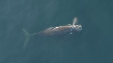
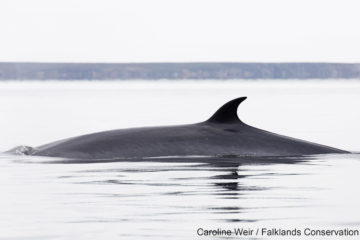
Space technology and artificial intelligence to monitor whale mass stranding events
Read more of: Space technology and artificial intelligence to monitor whale mass stranding eventsAn international team of scientists led by British Antarctic Survey have published research today on using new technology to study mass stranding of whales from space and how the technology […]
-
WALRUS FROM SPACE: Animal spotters wanted to join mass survey!
Read more of: WALRUS FROM SPACE: Animal spotters wanted to join mass survey!British Antarctic Survey (BAS) and WWF are seeking the public’s help to search for walrus in thousands of satellite images taken from space, with the aim of learning more about […]
-
Climate change risk to emperor penguins
Read more of: Climate change risk to emperor penguinsBritish Antarctic Survey scientists have contributed to a new study published today (3 August) which provides valuable new data highlighting how emperor penguins extinction risk is increased due to rapid […]
-
Using AI to track whales from space
Read more of: Using AI to track whales from spaceBritish Antarctic Survey (BAS) scientists will work with an Artificial Intelligence company after being awarded a contract from the Canadian Space Agency (CSA) to support the protection of an endangered […]
-
Giant iceberg mission begins
Read more of: Giant iceberg mission beginsA research mission to determine the impact of the giant A-68a iceberg on one of the world’s most important ecosystems departs from Stanley in the Falkland Islands today (2 February […]
-
Polar scientists and staff awarded place names in Antarctica
Read more of: Polar scientists and staff awarded place names in AntarcticaThe Government of the British Antarctic Territory today (Thursday 3 December) announces 28 new place names in the Territory
-
A68 iceberg heads towards South Georgia
Read more of: A68 iceberg heads towards South GeorgiaAn iceberg is heading towards the sub-Antarctic island of South Georgia. A68a – the size of the UK county of Somerset – broke off from the Larsen C ice shelf […]
-
Scientists discover new penguin colonies from space
Read more of: Scientists discover new penguin colonies from spaceA new study using satellite mapping technology reveals there are nearly 20% more emperor penguin colonies in Antarctica than was previously thought. The results provide an important benchmark for monitoring […]
-
Updated Mapping Datasets for Antarctica
Read more of: Updated Mapping Datasets for AntarcticaA newly updated Antarctic Digital Database is released today (12 May 2020). Aimed at the science and logistics communities, the maps include updates to the ice shelf front around Thwaites […]
-
New high-precision map of Antarctica’s bed topography
Read more of: New high-precision map of Antarctica’s bed topographyA team of glaciologists has unveiled the most accurate portrait yet of the contours of the land beneath Antarctica’s ice sheet – and, by doing so, has helped identify which […]
-
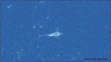
Stranded whales detected from space
Read more of: Stranded whales detected from spaceA new technique for analysing satellite images may help scientists detect and count stranded whales from space. Researchers tested a new detection method using Very High Resolution (VHR) satellite images […]
-
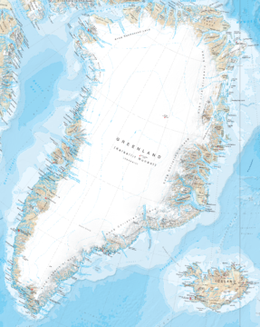
New map of Greenland reveals fast-changing environment
Read more of: New map of Greenland reveals fast-changing environmentCartographers at British Antarctic Survey (BAS) has produced the most detailed and up-to-date published map of Greenland available.
-
“Catastrophic” breeding failure at one of world’s largest emperor penguin colonies
Read more of: “Catastrophic” breeding failure at one of world’s largest emperor penguin coloniesResearchers at British Antarctic Survey have discovered “catastrophic” breeding failure at one of world’s largest emperor penguin colonies.
-
Watching whales from space
Read more of: Watching whales from spaceScientists have used detailed high-resolution satellite images provided by Maxar Technologies’ DigitalGlobe, to detect, count and describe four different species of whales. Reported this week in the journal Marine Mammal […]
-
New map of South Georgia wins award
Read more of: New map of South Georgia wins awardBritish Antarctic Survey’s detailed map of the sub-Antarctic island of South Georgia featuring the epic “Shackleton Crossing” has won an award at the 2018 British Cartography Society Awards. The map, […]
-
New satellite imagery reveals new highest Antarctic Peninsula Mountain
Read more of: New satellite imagery reveals new highest Antarctic Peninsula MountainCartographers surveying Antarctica have discovered Mt Hope is the tallest mountain in the British Antarctic Territory (BAT) at 3,239 m (10,654 ft) above sea level. Until now, maps showed Mt […]
-
New map of South Georgia unveiled
Read more of: New map of South Georgia unveiledA team of cartographers at British Antarctic Survey (BAS) has re-produced a high-resolution updated map of the sub-antarctic island of South Georgia. The island, situated at 37°W 54°10’S is a […]
-
Penguin colony repeatedly decimated by volcanic eruptions
Read more of: Penguin colony repeatedly decimated by volcanic eruptionsOne of Antarctica’s biggest gentoo penguin colonies was repeatedly decimated by eruptions of the Deception Island volcano in recent millennia.
-
Giant iceberg set to calve from Larsen C Ice Shelf
Read more of: Giant iceberg set to calve from Larsen C Ice ShelfA huge iceberg, roughly the size of Norfolk, looks set to break away from the Larsen C ice shelf on the Antarctic Peninsula. Larsen C is more than twice the size […]
-
Penguin colonies at risk from erupting volcano
Read more of: Penguin colonies at risk from erupting volcanoA volcano erupting on a small island in the Sub Antarctic is depositing ash over one of the world’s largest penguin colonies.
-
On the ice opportunity for PhD students and Early Career Researchers
Read more of: On the ice opportunity for PhD students and Early Career Researchers16 PhD students and Early Career Researchers have a unique opportunity to gain practical skills for working safely and effectively in the polar regions.
-
NEWS STORY: New maps show unseen world
Read more of: NEWS STORY: New maps show unseen worldNew maps of the polar regions reveal unseen world beneath the ice and highlight dramatic decline in Arctic sea ice cover New maps of the sub-ice features in Antarctica and […]

-
NEWS STORY: Emperor Penguins’ adaptation skills
Read more of: NEWS STORY: Emperor Penguins’ adaptation skillsNew research using satellite images reveals that emperor penguins are more willing to relocate than previously thought A new study led by the University of Minnesota offers new insights on […]
-
NEWS STORY: Award for innovative map
Read more of: NEWS STORY: Award for innovative mapMap makers rewarded for stunning recreation of Antarctic without ice A colourful British Antarctic Survey map has won a coveted award. The map, created by the institution’s MAGIC (Mapping and […]
-
NEWS STORY: Bedmap opens up Antarctica
Read more of: NEWS STORY: Bedmap opens up AntarcticaBedmap2 gives scientists a more detailed view of Antarctica”s landmass Scientists at the British Antarctic Survey have been working with a host of international collaborators to present the most detailed […]
-
NEWS STORY: Queen Elizabeth land
Read more of: NEWS STORY: Queen Elizabeth landUK names part of Antarctica in honour of the Queen The Foreign Secretary, William Hague, has announced that the southern part of British Antarctic Territory has been named Queen Elizabeth […]
-
International ice experts caution that ‘Open’ Arctic shipping routes does not mean ice-free waters
Read more of: International ice experts caution that ‘Open’ Arctic shipping routes does not mean ice-free watersIce experts from agencies from nine countries this week issued a statement urging marine and shipping companies operating in the region of the Northwest Passage and the Northern Sea Route […]
-
Polar View in the Antarctic
Read more of: Polar View in the AntarcticAs the Antarctic field season continues with the usual mix of exciting research programmes new enhancements to the online satellite image system that improves ship safety and efficiency are launched. […]
-
PRESS RELEASE: Interactive map highlights diversity
Read more of: PRESS RELEASE: Interactive map highlights diversityNew visualisation of South Georgia A new visualisation tool for exploring the subantarctic islands of South Georgia is unveiled today (22 October 2008). The South Georgia Geographic Information System (SGGIS) […]
-
Giant iceberg breaks off from Antarctic glacier
Read more of: Giant iceberg breaks off from Antarctic glacierGiant iceberg breaks off from Antarctic glacier British Antarctic Survey (BAS) scientists have spotted a huge iceberg, which has broken off from Pine Island Glacier in West Antarctica. The iceberg, […]
-
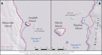
Antarctic Digital Database – December 2024 update
Read more of: Antarctic Digital Database – December 2024 updateContinuous mapping of Antarctica reveals new topographic features In November, we released version 7.10 of the SCAR ADD which included updated coastlines for the Alexander Island region, and new lakes, […]
-
How many penguins are in Antarctica?
Read more of: How many penguins are in Antarctica?No, it’s not a Penguin joke! This World Penguin Day (25 April 2023) we spoke to some of our resident experts, Mike Dunn and Peter Fretwell, to find out more […]
-
Last Post from the burning decks of a melting iceberg
Read more of: Last Post from the burning decks of a melting icebergComposer Ewan Campbell has written a piece of music for trumpet inspired by the 21-year journey of the A22a iceberg. The new composition was also illustrated onto a British Antarctic […]
-
Antarctic Digital Database – May 2021 update
Read more of: Antarctic Digital Database – May 2021 updateWelcome to the new Antarctic Digital Database (ADD) blog series, updating our users about each update of the datasets in the ADD and about other pieces of work happening in […]
-
PODCAST – Iceworld, Episode 5 – Seals from Space
Read more of: PODCAST – Iceworld, Episode 5 – Seals from SpaceEpisode 5: Seals from Space In Episode 5 of Iceworld, Rob Taylor is joined by Prem Gill who has just completed two weeks of fieldwork as part of his PhD […]

-
PODCAST – Iceworld, Episode 1 – Maps
Read more of: PODCAST – Iceworld, Episode 1 – MapsMapping in Antarctica – podcast