
Comprehensive digital maps of Antarctica are now available to all, following the latest update of the Antarctic Digital Database. A new map viewer brings together all of the Antarctic Digital Database datasets, alongside further useful information, and displays them together in an open-access interactive website.
Antarctica is a fast-changing environment, and it is the job of the Mapping and Geographic Information Centre (MAGIC) at British Antarctic Survey (BAS) to keep maps and data up to date, to aid safe travel and work on the continent. As part of this work, MAGIC compiles, manages and distributes data that makes up the Antarctic Digital Database – a SCAR (Scientific Committee on Antarctic Research) project that provides a seamless compilation of topographic data, including coastline and contours.
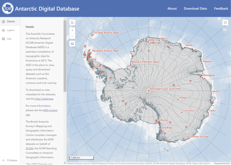
The new Antarctic Digital Database interactive map viewer
The release of the open-access digital viewer coincides with the latest release of data updates, which record physical changes in Antarctica. New extents for some of the ice shelves have been drawn, where icebergs have calved away from the continent, and in other areas where the ice shelves have grown by flowing forwards away from the land.
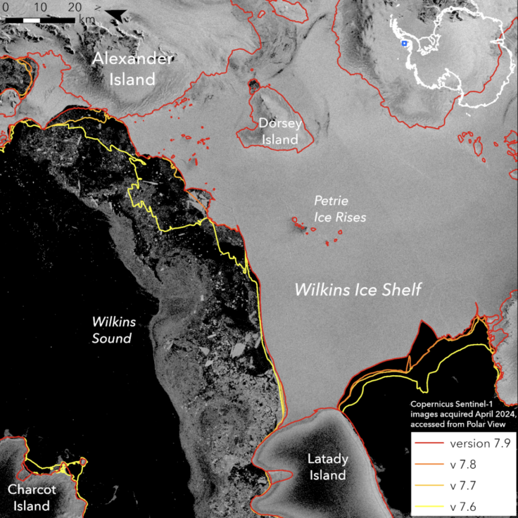
A map showing the last 4 versions of ice shelf extents for the Wilkins Ice Shelf on the Antarctic Peninsula
The coastline was also updated for the South Orkney Islands, the northernmost group of islands in Antarctica. Ice has been lost in these islands meaning that the glaciers are smaller than previously shown, and new islands have also been identified where glaciers have retreated to reveal islands underneath.
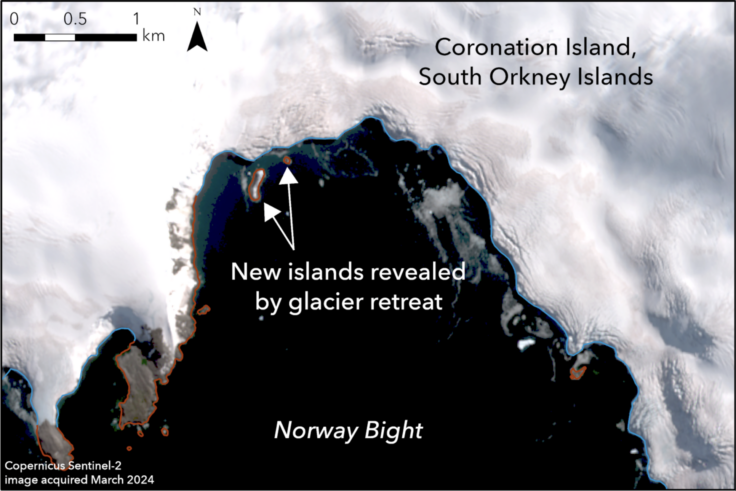
Image showing newly revealed islands in a bay off Coronation Island in the South Orkney Islands. These islands have been exposed by the retreat of the glacier on land.
The location of certain offshore rocks and islands has also been improved, as we have access to improved imagery, allowing us to locate small islands which previously might have been shown in the wrong location on a map, or not at all.
It is possible to view and query the data, as well as read full metadata records and download the data from our data catalogue.
Laura Gerrish, a GIS and Mapping Specialist from British Antarctic Survey, said:
Free and open access to reliable data is extremely important in all areas of Antarctic work – for science, and all of the logistical work that underpins it.
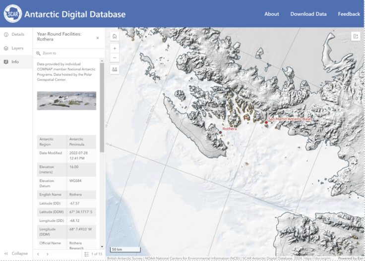
The new Antarctic Digital Database map viewer, focussed around Rothera Research Station
The new Antarctic Digital Database map viewer is now live at https://add.scar.org/