In the first successful attempt to calibrate walrus counts from satellite imagery, scientists used drones to validate animal counts in Svalbard, Norway. This International Day for Biological Diversity, the researchers describe how this study is a big step towards using satellite imagery as a non-invasive method to monitor walruses in the Arctic.
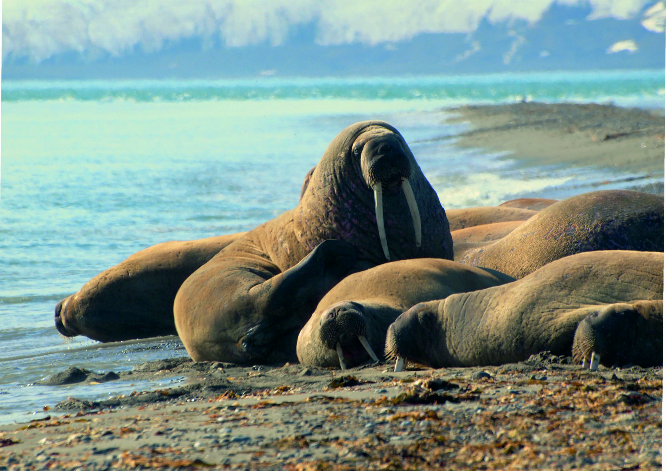
Scientists from the British Antarctic Survey (BAS), the Norwegian Polar Institute (NPI), and WWF visited Sarstangen, a sandspit on the western shores of Spitsbergen in the Svalbard Archipelago, Norway in the summer of 2022. Walruses are known to congregate on this shore during the summer months.
The whole field team monitor a walrus haul-out in Svalbard, Norway, using a drone to observe the animals from above. From left to right: Rod Downie (WWF-UK), Peter Fretwell (BAS), Hannah Cubaynes (BAS), Ingrid Kjerstad (NPI), Jaume Forcada (BAS). Emmanuel Rondeau_WWF
The team collected drone imagery of walruses hauled out on the shores, almost simultaneously with a Maxar Intelligence WorldView-3 satellite image that was obtained at three different spatial resolutions: 50 cm, 30 cm and 15 cm HD. The 15-minute gap between the drone and satellite images, alongside visual confirmation from the team on the ground, enabled scientists to validate the walrus counts in the satellite imagery. The results are published this week in the journal Remote Sensing in Ecology and Conservation. The drones were flown at a safe distance from the walruses, both on the ground and in the sky, to avoid disturbing the iconic animals.
Walrus experts and citizen scientists counted the number of walruses in the satellite image at each of the three spatial resolutions, and in the drone image where the walruses are much clearer and easier to identify. The numbers of walruses counted was then compared. Researchers found that both experts and citizen scientists slightly undercounted the walruses in the satellite images, and that the image at 30cm spatial resolution provided the most accurate results from the three satellite images. By comparing the citizen scientist and expert counts, the results can be calibrated and we can now begin to build a better understanding of walrus numbers.
During Walrus From Space field work in Svalbard, Norway, Peter Fretwell and Hannah Cubaynes (both BAS) operate a drone, whilst Rod Downie (WWF-UK) can be seen in the background. Whilst Peter uses the drone to monitor walrus from the air, Hannah notes key information like timings. Emmanuel Rondeau, WWF
Walruses are facing the reality of the climate crisis: their Arctic home is warming nearly four times faster than the global average and about 12% of summer sea ice is disappearing per decade.
To help safeguard the future of the walruses, BAS, WWF and their regional Arctic science partners are working to better understand these Arctic animals, using space satellites to capture thousands of high-resolution images of walruses congregated on the Arctic coastline of Canada, Greenland and Norway. The imagery is provided by Maxar Intelligence, a trusted source of secure, precise, geospatial intelligence. Launched in 2020, the Walrus from Space research project seeks the public’s help to search for walruses in thousands of Maxar satellite images taken from space, with the aim of learning more about how walruses will be impacted by the climate crisis.
Very high-resolution satellite imagery offers a non-invasive approach to monitor walruses across their whole distribution range in the Arctic, with more frequent, and regular surveys than what is currently achievable if using boats or aircrafts. Furthermore, walruses tend to be spooked by noises coming from these two platforms. Therefore, there is a strong rationale to develop non-invasive method to monitor walruses, such as satellite imagery.
Satellite view of the walrus colony and survey team. Maxar Technologies
Lead author Dr Hannah Cubaynes, a wildlife from space scientist at BAS, said:
“Counting walruses from space could revolutionise the way we currently monitor them. It can increase the extent and frequency of current surveys, helping us gain a better insight into how walruses are faring in a changing world. But we need to know how accurate walrus counts from satellite imagery are.
Thanks to the team’s perseverance, we were able to get an on-the-ground drone image within minutes of a satellite image taken from space. This was totally unprecedented and the best result we could have hoped for. This is a really exciting development for the project – giving us almost like-for-like satellite and drone images that we can use to calibrate walrus counts from both experts and citizen scientists.”
Kit Kovacs & Christian Lydersen, senior research scientists at the Norwegian Polar Institute/Norsk Polarinstitutt said:
“All Arctic endemic marine mammal species are being negatively impacted by global warming through losses in their sea ice habitats. This increases the need to monitor populations more closely to provide data to management authorities for mitigation and conservation actions. However, these animals are spread over large areas and are thus logistically challenging and very costly to count using ships or aircraft. Being able to monitor walruses (and other Arctic wildlife) using satellite imagery would be a giant step forward.”
Very high-resolution satellite imagery offers a non-invasive approach to monitor walruses across their whole distribution range in the Arctic. Peter Fretwell, BAS
Rod Downie, Chief Polar Advisor at WWF-UK, said:
“Walruses are an iconic species, of immense cultural significance to Arctic people. They are big, powerful animals, yet they are also increasingly vulnerable to the effects of climate change as the sea ice is literally melting out from underneath them. What we are trying to do is better understand walruses, how they are responding to the climate crisis now and how they might respond in a climate altered future. We are doing this to provide evidence to support the conservation of the species across its range.”
Anders Linder, GM of Maxar Intelligence’s International Government business said:
“British Antarctic Survey scientists leverage our industry-leading satellite imagery to accurately monitor the walruses in the Arctic without disturbing them. This remote sensing data gives a greater understanding of the effects of climate change on their icy habitats, supporting the conservation of the species.”
“Walruses from space: walrus counts in simultaneous remotely piloted aircraft system versus very high-resolution satellite imagery” by Cubaynes, H., et al is published today in Remote Sensing in Ecology and Conservation.