Scientists have used detailed high-resolution satellite images provided by Maxar Technologies’ DigitalGlobe, to detect, count and describe four different species of whales. Reported this week in the journal Marine Mammal Science, this study is a big step towards developing a cost-effective method to study whales in remote and inaccessible places, that will help scientists to monitor population changes and understand their behaviour.
Each species was observed in one of their known aggregation areas, where individuals come together to congregate: southern right whales off Argentina, humpback whales off Hawaii, fin whales in the Pelagos Sanctuary in the Mediterranean and grey whales off the coast of Mexico. Already it has helped whale conservation bodies to identify 10 key inaccessible whale populations that would benefit most from the application of satellite imagery in studies.
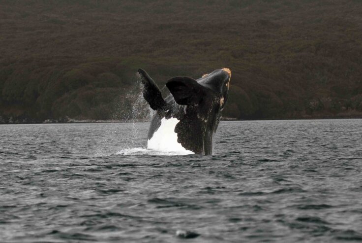
Southern Right Whale captured around the sub-Antarctic island of South Georgia. Photo credit: Carlos Olavarria
Lead author Hannah Cubaynes, a whale ecologist at British Antarctic Survey (BAS) and University of Cambridge explains:
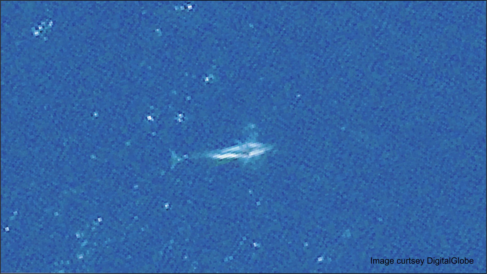
“This is the most detailed imagery of whales captured by satellites to date. It’s exciting that the improved resolution (now at 30 cm) reveals characteristic features, such as flippers and flukes, which can be seen in the images for the first time.
“Whales live in all oceans. Many areas are difficult to access by boats or planes, the traditional means of monitoring whales. The ability to track whales without travelling to these remote and inaccessible areas, in a cost-effective way, will be of great benefit to conservation efforts for whales.”
The study also shows some species are easier to identify by satellite. Fin and grey whales are the easiest to identify due to their body colouration, which contrasts with surrounding water. Humpback whales and southern right whales are more difficult to detect as they are a similar colour to their environment. In particular, the acrobatic behaviour of humpback whales makes them harder to see as they splash about so much and so their body shape is often obscured.
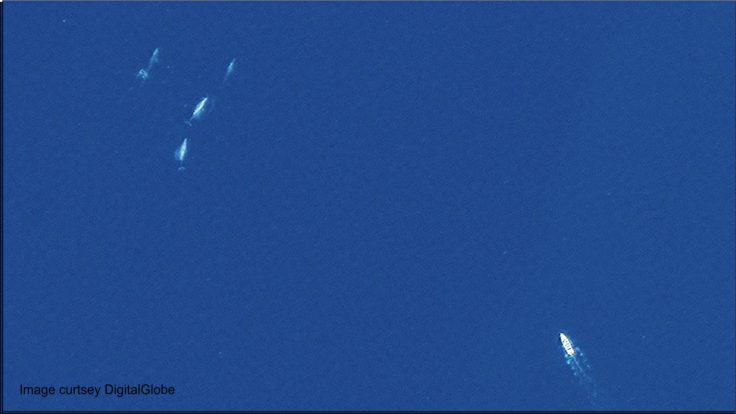
Grey whales spotted off the coast of Mexico. Credit: DigitalGlobe.
The team studied seven huge images of the open ocean taken by DigitalGlobe’s WorldView-3 satellite, covering over 5000 km2 – an area the size of the UK county of Norfolk or the U.S. state of Delaware.
Whale ecologist Dr Jennifer Jackson at BAS, an author on the paper, is due to embark on an expedition to the sub-Antarctic island of South Georgia in December to study southern right whales. She says:
“This new technology could be a game-changer in helping us to find whales remotely. Critically endangered whale populations like the Chile-Peru right whale (thought to winter in Patagonia) could really benefit from this approach.
“My project, looking at southern right whales around South Georgia, will examine if the species has made a recovery following the end of whaling. In recent years, many deaths have been seen on their nursery grounds at Peninsula Valdes. Satellite-based technology could prove very useful for measuring trends in whale populations such as these southern right whales, in future.”
This work was funded by the MAVA Foundation and the UK Natural Environment Research Council. DigitalGlobe provided imagery for this study.
Whales from space: four mysticete species described using new VHR satellite imagery by Hannah C. Cubaynes1, 2, Peter T. Fretwell1, Connor Bamford1, 3, Laura Gerrish1, Jennifer A. Jackson is published in the journal Marine Mammal Science on 27 October. Read the paper here: https://onlinelibrary.wiley.com/doi/full/10.1111/mms.12544
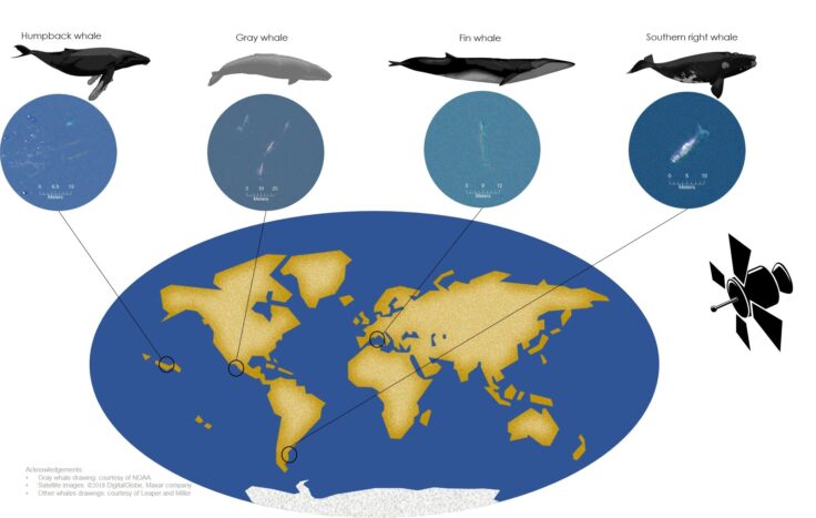
Infographic shows where different whale species congregate around the world. Credit: Hannah Cubaynes
About DigitalGlobe
DigitalGlobe is the global leader in commercial high-resolution satellite imagery used by decision makers to better understand our changing planet in order to save lives, resources and time. Sourced from the world’s leading constellation, our imagery solutions deliver unmatched coverage and capacity to meet our customers’ most demanding mission requirements. Each day customers in defense and intelligence, public safety, civil agencies, map making and analysis, environmental monitoring, oil and gas exploration, infrastructure management, navigation technology, and providers of location-based services depend on DigitalGlobe data, information, technology and expertise to gain actionable insight. DigitalGlobe is a Maxar Technologies company (NYSE: MAXR; TSX: MAXR). For more information visit www.DigitalGlobe.com.
About Maxar Technologies
As a global leader of advanced space technology solutions, Maxar Technologies (formerly MacDonald, Dettwiler and Associates) is at the nexus of the new space economy, developing and sustaining the infrastructure and delivering the information, services, systems that unlock the promise of space for commercial and government markets. As a trusted partner, Maxar Technologies provides vertically integrated capabilities and expertise including satellites, Earth imagery, robotics, geospatial data and analytics to help customers anticipate and address their most complex mission-critical challenges with confidence. With more than 6,500 employees in over 30 global locations, the Maxar Technologies portfolio of commercial space brands includes MDA, SSL, DigitalGlobe and Radiant Solutions. Every day, billions of people rely on Maxar to communicate, share information and data, and deliver insights that Build a Better World. Maxar trades on the Toronto Stock Exchange and New York Stock Exchange as MAXR. For more information, visit www.maxar.com.