New animation shows track of giant A23a iceberg
Scientists at British Antarctic Survey are using satellite images to track the colossal iceberg A23a.
This new animation shows the recent trajectory of the A23a iceberg as it moves north out of the Weddell Sea. Among the clouds and sea ice, the iceberg is shown alongside the tracks of previous large icebergs A68 and A76a. The animation has been compiled from Copernicus Sentinel-3 satellite imagery.
Andrew Fleming, Head of Mapping and GIS at British Antarctic Survey, says:
“The iceberg is following a very similar path and we’ll be interested to see if it also gets caught in the same place as the previous bergs, which span in circles for several weeks before moving on.”
A23a hit the headlines in November last year after it moved out of the Weddell Sea sector into the Southern Ocean. It calved from the Filchner Ice Shelf in 1986, before being grounded on the seabed nearby.
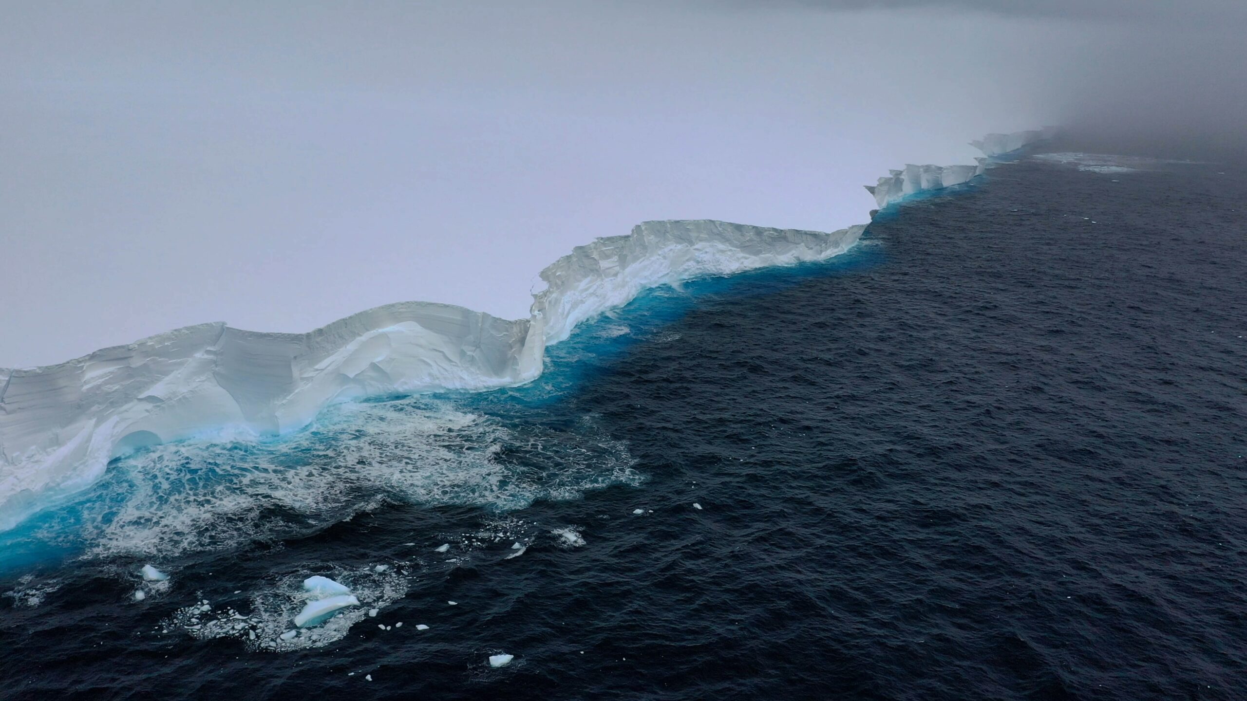
Scientists on board RRS Sir David Attenborough sailed past the mega iceberg as part of the BIOPOLE cruise in December last year, and collected samples of seawater from the area. Footage captured on board shows the enormous iceberg, 3,900 square kilometres stretching out into the distance beyond the research vessel.
Dr Andrew Meijers, Chief Scientist aboard the RRS Sir David Attenborough and Polar Oceans Science Leader at British Antarctic Survey (BAS), says:
“It is incredibly lucky that the iceberg’s route out of the Weddell Sea sat directly across our planned path, and that we had the right team aboard to take advantage of this opportunity. We’re fortunate that navigating A23a hasn’t had an impact on the tight timings for our science mission, and it is amazing to see this huge berg in person – it stretches as far as the eye can see.”
Footage was captured by Theresa Gossman, Matthew Gascoyne and Christopher Grey, with additions from Roseanne Smith.