International ice experts caution that ‘Open’ Arctic shipping routes does not mean ice-free waters
Ice experts from agencies from nine countries this week issued a statement urging marine and shipping companies operating in the region of the Northwest Passage and the Northern Sea Route to be cautious that the term ‘Open’ does not mean ice-free waters. At a meeting of the International Ice Charting Working Group (IICWG), hosted by the British Antarctic Survey (BAS), experts expressed concern that recent reports of reducing sea-ice opening up these seaways could be misinterpreted.
During the meeting British Antarctic Survey signed the International Ice Charting Working Group Charter. This formalizes BAS involvement with the group and emphasizes its co-ordination of the Polar View Antarctic sea ice service which provides easy access to real time information about ice conditions. Users of this service range from science vessels to tour ships to those coordinating rescue efforts.
Andrew Fleming, who leads on Polar View said,
‘This has been a successful meeting and draws attention to the value and importance of using scientific research to underpin safe marine operations.’
The IICWG statement is:
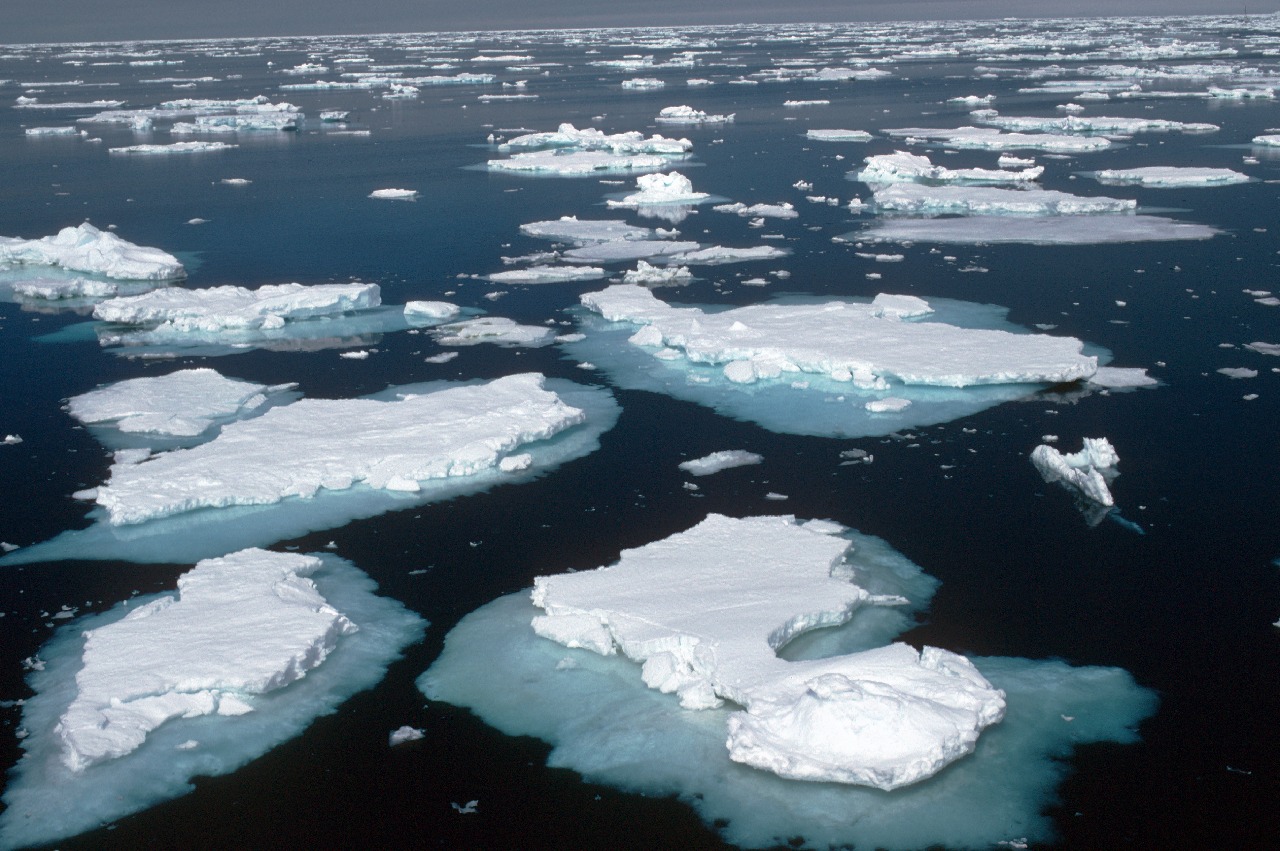
‘While it was widely reported in 2011 that both the Northwest Passage and the Northern Sea Route were “open” or even “ice free”, the participants in the International Ice Charting Working Group caution against misinterpreting these statements. Waters that appear “open” in satellite images can often have ice covering 15% of their surface. In fog, darkness or high waves, ice and icebergs are difficult to detect from the bridge of a ship and present a significant hazard to navigation and other maritime activities. The IICWG notes that paying careful attention to current and forecast ice conditions is essential for marine safety. The national ice services are working together to ensure that vessels operating in ice laden waters have the best ice information possible.’
Background:
- The sea ice pack in the Arctic Ocean shrank to the 2nd lowest extent on record, based on the National Snow and Ice Data Center analysis. At 4.33 million square kilometres, it was only slightly larger than the record minimum extent set in 2007.
- Significant year-to-year variability continues. For example, in 2011 sea ice persisted around Southern Greenland three weeks longer than normal.
- In February 2011, the ice in the Baltic Sea reached an extent of 309,000 square kilometers, about 3/4 of the total area of the Baltic Sea. This was the greatest extent since 1987 when it was almost completely ice covered.
- The southern hemisphere sea ice extent continued its slight increasing trend in 2011.
- Summer shipping through Russia’s Northern Sea Route (NSR) is rapidly becoming more common. In 2011, the Vladimir Tikhonov was the first supertanker to use the NSR to transit from Europe to Asia. For the first time, the receding Arctic ice pack allowed such vessels to travel north of the New Siberian Islands, a deeper and more direct route than the traditional one to the south of the islands.
- In the Canadian Arctic, sealift operations to resupply Northern communities have increased over the last ten years. However, international transit by commercial cargo through the Northwest Passage is almost non-existent as sea ice, icebergs and meteorological conditions continue to pose significant risks to mariners.
- The 280 square kilometer ice island that calved from Northern Greenland’s Petermann Glacier in 2010 broke into many fragments that are now strung along the entire east coast of Canada. The most southerly fragments are melting in the waters around Newfoundland.
The IICWG is pleased to note an increasing awareness of the hazards of polar navigation. The Arctic Search and Rescue Agreement signed by the member states of the Arctic Council, and new rules adopted by the International Maritime Organization (IMO) that will restrict large cruise ships from venturing to Antarctic waters, are important steps toward improved safety of navigation in ice laden waters.
April 15, 2012, marks the centennial of the sinking of the RMS Titanic after striking an iceberg in the North Atlantic. The IICWG joins the IMO in paying tribute to the memory of those who perished in that tragedy and to those who, over the past century, have contributed to improvements in maritime safety.
The IICWG was formed in 1999 to promote cooperation between the world’s ice services on all matters concerning sea ice and icebergs and brings together the operational ice services of Canada, Denmark (Greenland), Finland, Germany, Iceland, Norway, Russian Federation, Sweden, United States, as well as the British Antarctic Survey (BAS) and the International Ice Patrol.
For more information, please see regional contacts on the IICWG web site
For more information on the IICWG, please contact:
Mr. John Falkingham
IICWG Secretariat
Ottawa, Canada
- Tel: +1 613-355-4552
- John.Falkingham@rogers.com