Drilling Engineer/Marine Tech
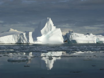
Filchner Ice Shelf System, Antarctica
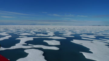
Ice shelves in a warming world
- Start date:
- 1 April, 2015
- End date:
- 1 April, 2020
Understanding the contribution that polar ice sheets make to global sea-level rise is recognised internationally as urgent. The mission of this five-year project is to capture new observations and data to assess the future stability of Antarctica’s Filchner Ice Shelf so that credible sea-level projections for the next 50-years can be produced.
Experts from leading UK research institutions (British Antarctic Survey, National Oceanography Centre the Met Office Hadley Centre, University College London, the University of Exeter and Oxford University) are working together with European partner the Alfred Wegener Institute, to investigate how the Filchner Ice Shelf might respond to a warmer world, and what the impact of sea-level rise could be by the middle of this century.
A research outcome from this project includes the acquisition of new knowledge and the modelling of data that are critical to the development of the Hadley Centre’s Global Earth Model. These enhanced projections are essential to inform UK and world-wide policy and business decisions relating to coastal and flood defence planning and investment.
The Guardian newspaper online feature about our project
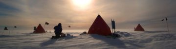
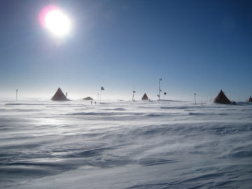
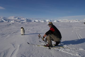
Polar fieldwork plans
Location: Filchner Ice Shelf, West Antarctica
Timing: October 2015-February 2018
Key to the attainment of the project is the success of a carefully designed field campaign that will collect data both to improve the way the models work, and also to validate their results.
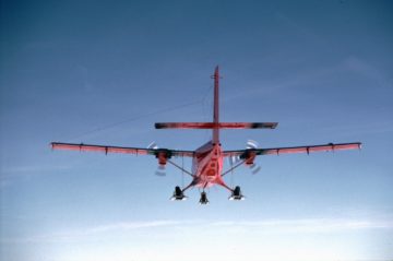
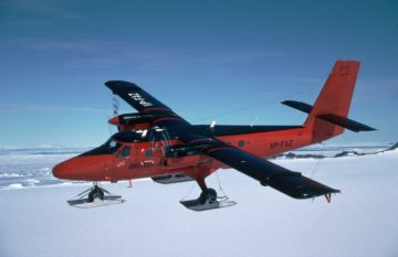
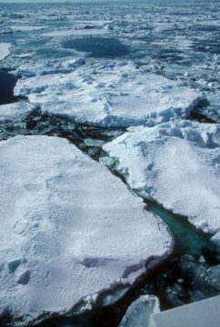
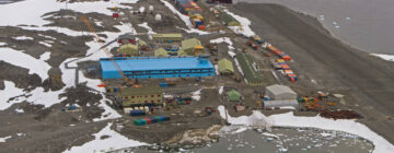
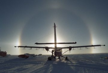
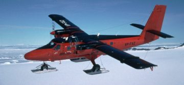
Fieldwork spans three years and comprises a suite of observation and data collection technologies including hot water drilling through the ice shelf to make measurements of ocean properties beneath the ice shelf; sediment coring to investigate past changes in the ice sheet; radar and seismic measurements taken on the ice and from the air to measure ice thickness and basal topography. Science field parties are supported from Rothera Research Station, by the airborne geophysics facility and by tractor train traverse system.
Marine sediment cores and instrumented buoys, deployed from the RV Polarstern (Alfred Wegener Institute), will capture vital information from the Antarctic continental shelf and slope.
2015/16 Field campaign
Filchner Ice Shelf, Recovery Ice Stream, Antarctic Continental Shelf and slope
Hot water drilling; Sediment coring; ApRES radar; Oversnow seismics; GPS measurements of tidal forcing; Airborne survey; Static GPS ; Ground Radar measurements (pRES and snow-accumulation); Deployment of instrumented buoys; Marine sediment-cores
2016/17 Field campaign
There are seven primary activities between November 2016 and January 2017
- Oceanographic observations through hot water drilled access holes
- Bathymetry beneath Filchner Ice Shelf
- Servicing of established ApRES sites
- Ground Radar measurements (pRES and snow-accumulation)
- Static GPS on Recovery Ice Stream
- GPS measurements of tidal forcing
- Airborne survey
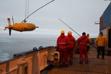
2018 Field campaign
The focus of this season’s work is the deployment of the ALR submersible beneath the Filchner-Ronne Ice Shelf.
- Research and technology teams from British Antarctic Survey, the National Oceanography Centre and the Alfred Wegener Institute work collaboratively onboard the RV Polarstern
- The aim is to record the water temperature and salinity, as well as vertical current profiles extending up to 90 m above and below the track. These observations will help us to understand how the 450-m-deep inverted step created by the ice front affects the ocean currents beneath it. Currents must cross this step in order to carry heat beneath, and meltwater away from, the ice shelf.
Maximising the impact of our research outcomes include:
- Informing the work of national and international bodies such as the Environment Agency, the Scientific Committee on Antarctic Research, and the Council of Managers of National Antarctic Programmes.
- Establishing knowledge exchange and dialogue with policy officials from UK Government departments such as the Department of Energy and Climate Change (DECC), the Department for the Environment and Rural Affairs (DEFRA); and the Department for Business, Innovation and Skills (BIS)
- Disseminating new knowledge to UK and international business leaders
The prime aim of the project is to determine how a large sector of Antarctica will respond in a warmer world. The sector to be studied, which spans one fifth of Antarctica, is the Filchner Ice Shelf and its five tributary ice streams. Projections will be made, for the middle of this century, of the amount of global sea-level rise from this sector. To achieve this aim the following three objectives need to be met:
Objective 1
Determine the dynamics of the coupled Filchner Ice Shelf and its tributary ice streams with the present southern Weddell Sea atmospheric and continental shelf oceanographic regimes. This will entail the capture of new observations and data required to understand and numerically describe the present system.
Objective 2
Determine how the oceanographic regime would respond to the likely future change in atmospheric forcing and how a modified sub-ice shelf circulation would change the pattern and intensity of basal melting. Then, determine the reduction in buttressing offered by the ice shelf when thinned and finally, quantify the response of the ice sheet through the five tributary ice-streams.
Objective 3
Use what was learned to evaluate the processes within the next generation of Hadley Centre predictive earth-system models.
Project deliverables:
1. New datasets from the Filchner region, and validated simulations of the present-day system and its variability
Determine the geometry of the model domain (ice-bed elevation, ice thickness and sub-ice shelf bathymetry) in several key areas that lack data coverage. Collect datasets designed to supply a physical understanding of Filchner Ice Shelf, its tributary ice streams and the sub-ice shelf ocean, in the present atmospheric and oceanographic regime. Numerical simulation of the complete system will demonstrate the various interconnected physical processes and importantly, their sensitivities to a change in climatic forcing.
2. Reliable projections on how the Filchner region will contribute to sea-level rise over the 21st century
3. An assessment of the uncertainties in the projections, and a broadening of the study to encompass all of Antarctica
Key to the attainment of the project is the success of a carefully designed field campaign that will collect data both to improve the way the models work, and also to validate their results. There is an urgent need to get and use the field observations. However, a substantial legacy of the project will be the observational datasets: long after the end of this five-year project the precious, hard-won data will be referred to time and time again.
Field research includes:
Oceanographic observations through hot water drilled access holes
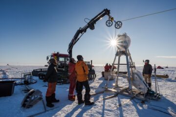
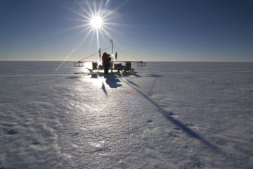
The cavity beneath an ice shelf is probably the least observed part of the World Ocean, as a result, models of the sub-ice shelf circulation lack an observational basis for validation. A hot-water drill will make three access holes through the Northern Filcher Ice Shelf and obtain oceanographic (CTD) profiles from the underlying water column. Deployed instrumented moorings in the water column at each site will obtain long-term records of water properties, including currents, temperature and salinity. Currents will be measured at 3 depths, and temperature and salinity at 7 depths. In addition, a thermistor cable will be frozen into the ice shelf at one of the sites to obtain time series of temperatures at 24 depths, with ~0.03°C accuracy in temperature. To drill through approximately 650 metres of ice shelf and gain access to the ocean below a hot water drill, pumping 90l of water per minute at around 90 °C is used. The resultant 0.5 MW of heating power makes a 30 cm diameter access hole through the ice. Whilst the hole is open (unfrozen) water samples will be taken at discrete heights in the water column Sediment cores from the ocean floor are planned to be recovered.
Bathymetry beneath Filchner Ice Shelf
The fieldwork has three components:
- Conventional spot depths for bathymetry at 104 locations
- The revisit of 13 pRES sites established by in 15/16
- A focused, high resolution seismic-study of the geomorphology of the ocean bed forms
To define the model domain refinement a two-person team will carry out seismics surveys to measure the bathymetry beneath Filchner Ice Shelf in regions where it is presently poorly known. A particular focus will be in the vicinity of ice stream grounding lines where, along the centre-line of the extension of the ice stream into the ice shelf, a spatial resolution on the order of one or two ice thicknesses will be sought. Using a power auger to install the explosive charge, with 24 Georods and a Geometrics Geode datalogger, we anticipate approximately 104 sites will be occupied during the season. An estimated traverse distance of 2,500 km is anticipated. The spot measurements of water depths and bed elevation will provide a dramatic and vital improvement to the available bathymetric coverage. The repeated pRES measurements will provide an average melt-rate of the ice shelf.
Ground radar measurements(pRES and snow accumulation)
In the 2015/16 season 14 phase-sensitive radars (ApRES) were established at carefully selected locations on both the Ronne and Filchner ice shelves. The ApRES instruments yield time series of ice shelf thickness change at precisions of ~1 mm, so that over a 10-day period a precision in derived melt rate of a few cm per annum is determined. The aim is not to quantify the total melt rate of the ice shelf, but to use its variability to improve the performance of the ocean models. By adjusting otherwise poorly constrained model parameters to obtain the best match between modelled and observed variability. The system is a low-power, light weight instrument developed in a collaboration between BAS and UCL. It is a 200-400 MHz FMCW radar, with a 1-second chirp, run by controller: housed within its characteristic yellow box the radar and a 100 AH battery is buried in a shallow hole. The radar’s transmit aerial and receive aerial are spaced 5 meters each side of the yellow box and are also buried. Each system will record for a nominal 12 months and has the ability to process and send, via satellite link, melt-rate data.
Static GPS on Recovery Ice Stream
The two person party will work along an area of the Filchner Ice Shelf between the grounding-line of Support Force Ice Stream and the southern drill sites using a pRES instrument to provide an average melt rate for the area. During the previous season (15/16) a total of 132 pRES sites were established. Each site is required to be reoccupied and the change in ice thickness recorded. Then by accounting for any spreading of the ice shelf the average melt rate can be determined. A high frequency radar will also be used in profile mode, this wideband system will provide intricate detail of the spatial variation in accumulation and strain by tracking the internal reflection horizons. The distanced to be travelled is estimated to be 1,000 km. In addition the team will service an automatic weather station (AWS) and in the latter part of the season joint forces with Sledge Victor to support the high resolution seismics.
-

-
Sedimentologist
-

Senior Climatologist
-

Oceanographer
-

E Fellow
-
Sedimentologist
Project Partners
| |
see above | |
| National Oceanography Centre | ||
| Met Office Hadley Centre | ||
| University College London | ||
| University of Exeter | ||
| University of Oxford | ||
| Alfred Wegener Institute | B Stocker |
-
ANTARCTIC BLOG: Polar guide tackles the long wait #6
Read more of: ANTARCTIC BLOG: Polar guide tackles the long wait #6Life in Antarctica can be difficult but strangely the more difficult it is, the easier it becomes. Life starts to be simple. One only has to do whatever it takes. The […]
-
ANTARCTIC BLOG: Polar guide arrives on site #5
Read more of: ANTARCTIC BLOG: Polar guide arrives on site #5As we finally approached our input site I could see our future home in the distance, a little black dot on a frozen white ocean, slowly growing in size as […]
-
ANTARCTIC BLOG: Polar guide flies into the field – #4
Read more of: ANTARCTIC BLOG: Polar guide flies into the field – #4A week after iBeam departed, our aircraft arrived at Sky-Blu from Rothera to take us further into the field, to our winterised vehicles, to our start point. The call sign […]
-
ANTARCTIC BLOG: Polar guide reaches the ice – #3
Read more of: ANTARCTIC BLOG: Polar guide reaches the ice – #3The FISS project is huge on a logistical scale. Drilling through an eight hundred meter ice shelf and providing support and equipment for several seismic, radar and instrument inputs and […]
-
ANTARCTIC BLOG: The journey South is long – #2
Read more of: ANTARCTIC BLOG: The journey South is long – #2“Goodbyes” get harder each time so I avoid them by saying “See you later” as if I’m just going to the shop. The journey South is long and for me […]
-
ANTARCTIC BLOG: Tales from a polar guide – #1
Read more of: ANTARCTIC BLOG: Tales from a polar guide – #1It’s four AM and I’m wide awake, staring at the deep blue and black shadows on the ceiling of my bedroom. I allow myself just this once to indulge in […]
-
Antarctic ice explains dip in CO2 levels
Read more of: Antarctic ice explains dip in CO2 levelsSmall bubbles of air from ice in Antarctica resolve a long-standing debate about why there was a decline in atmospheric carbon dioxide (CO2) during the 16th and 17th centuries.
-
Discovery of life beneath Antarctica’s ice shelves
Read more of: Discovery of life beneath Antarctica’s ice shelvesFar underneath the ice shelves of the Antarctic, there’s more life than expected, finds a recent study in the journal Frontiers in Marine Science, published this week (15 February 2021). […]

-
Boaty returns from first mission under the ice
Read more of: Boaty returns from first mission under the iceThe yellow high-tech autonomous underwater vehicle (AUV), affectionately known as Boaty McBoatface, has successfully returned from an ambitious science expedition deep below half a kilometre of ice. It is the […]
-
New field season begins
Read more of: New field season beginsAs spring returns to the southern hemisphere British Antarctic Survey (BAS) has started another research season which will take them over land, sea and ice in search of answers to […]
-
New interactive game ‘Ice Flows’ launches today
Read more of: New interactive game ‘Ice Flows’ launches todayResearchers and games developers have joined forces to explain how climate change is affecting Antarctica. A new game called ‘Ice Flows’ launches today (Tuesday 23 August) at an international science meeting in Malaysia.
Datasets
List of airborne geophysics datasets available for this project includes:
Aeromagnetic data:
- Jordan, T., Corr, H., & Robinson, C. (2021). Processed line aeromagnetic data from the FISS 2015 survey covering the Foundation Ice Stream (2015/2016) (Version 1.0) [Data set]. NERC EDS UK Polar Data Centre. https://doi.org/10.5285/367435D1-B2FD-4692-9570-852F9A21EC02
- Jordan, T., Corr, H., & Robinson, C. (2021). Processed line aeromagnetic data from the FISS 2016 surveys covering the Filchner and Halley Ice Shelves, and the English Coast (western Palmer Land), West Antarctica (2016/2017) (Version 1.0) [Data set]. NERC EDS UK Polar Data Centre. https://doi.org/10.5285/83C4F40E-ABD4-4F76-A7DB-D7307BD56B55
Gravity data:
- Becker, D., Jordan, T., Robinson, C., & Corr, H. (2021). Processed line aerogravity data from the FISS 2016 surveys covering the Filchner and Halley Ice Shelves, and the English Coast (western Palmer Land), West Antarctica (2016/2017) (Version 1.0) [Data set]. NERC EDS UK Polar Data Centre. https://doi.org/10.5285/B3E51C6E-20FD-4E3A-BE47-0ED2EFCAA0AB
Bed and surface elevation picks data:
- Corr, H., & Robinson, C. (2020). Airborne radio-echo sounding of the English Coast, western Palmer Land, Antarctic Peninsula (2016/17 season) (Version 1.0) [Data set]. UK Polar Data Centre, Natural Environment Research Council, UK Research & Innovation. https://doi.org/10.5285/E07D62BF-D58C-4187-A019-59BE998939CC
- Nicholls, K.W., Corr, H., Robinson, C., & Jordan, T.A. (2021). Processed bed elevation picks from airborne radar depth sounding from the FISS 2015 survey covering the Foundation Ice Stream and the Filchner Ice Shelf system (2015/2016) [Data set]. UK Polar Data Centre, Natural Environment Research Council, UK Research & Innovation. https://doi.org/10.5285/144ceb0d-9d76-4a39-aa01-7b94ac80fac9
Radar data:
- Nicholls, K.W., Corr, H., Robinson, C., & Jordan, T.A. (2021). Processed airborne radio-echo sounding data from the FISS 2015 survey covering the Foundation Ice Stream, Bungenstock Ice Rise, and the Filchner Ice Shelf system, West Antarctica (2015/2016) (Version 1.0) [Data set]. UK Polar Data Centre, Natural Environment Research Council, UK Research & Innovation. https://doi.org/10.5285/3507901f-d03e-45a6-8d9b-59cf98a03e1d
- Corr, H., Robinson, C. Jordan T., & Nichols K. (2021). Processed airborne radio-echo sounding data from the FISS 2016 surveys covering the Filchner and Halley Ice Shelves, and the English Coast (western Palmer Land), West Antarctica (2016/2017) (Version 1.0) [Data set]. UK Polar Data Centre, Natural Environment Research Council, UK Research & Innovation. https://doi.org/10.5285/0cb61583-3985-4875-b141-5743e68abe35
Data Portal
Airborne Geophysics data can also be accessed through the new Airborne Geophysics Data Portal.
More information about the Portal can be found here: https://www.bas.ac.uk/project/nagdp/#about
-
Rothera Research Station
Read more of: Rothera Research StationThe largest British Antarctic facility is a centre for biological research and a hub for supporting deep-field science.
-
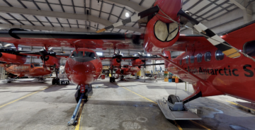
Rothera Air Facility
Read more of: Rothera Air FacilityWith its runway Rothera Research Station is the polar operations hub that supports British Antarctic Survey’s airborne capability
-
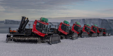
Tractor train traverse system
Read more of: Tractor train traverse systemOur tractor train traverse system is an innovative way to support deep-field science across Antarctica.
-
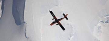
Airborne science and technology
Read more of: Airborne science and technologyDiscover the UK’s national capability to support science from the air
-
-
Instrument: Phase-sensitive radar (ApRES)
Read more of: Instrument: Phase-sensitive radar (ApRES)Research teams use phase-sensitive radars for determining ice shelf basal melt rates. Data is used to enhance climate models.
-
-
Aerogravity system
Read more of: Aerogravity systemBAS has developed aerogravity systems that can be mounted in its geophysical survey aircraft, or in a UAV. Over 100,000 km of gravity data has been collected since such systems were first deployed in 1993.
-
Polarimetric Radar
Read more of: Polarimetric RadarThe radar system is composed of a complex waveform generator, signal processor, data handler and data store.