Aerogroup Gravity
Airborne Geophysics

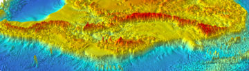
Airborne Geophysics, Antarctica
Expertise and capability
The British Antarctic Survey has many decades of experience collecting processing and distributing a wide range of aerogeophysical data from across Antarctica. It operates a Twin Otter aircraft with a certified fit of airborne geophysics instrumentation that support our programme of sustained observations. In addition we are developing our capability to deploy geophysical and other remote sensing instruments from Uncrewed Aerial Vehicles (UAVs).
The instruments
The core geophysical instrument suite includes gravimeter, magnetometers and polametric ice-penetrating radar (PASIN-2). This suite can be flown with LIDAR, camera, hyperspectral or other radar systems in support. The instrument suite has been widely employed on NERC and other grants.
Airborne platforms
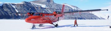
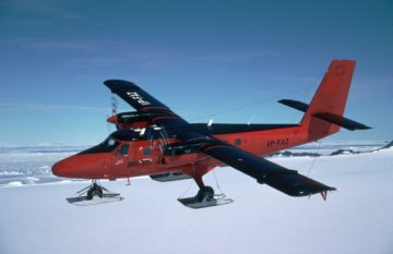
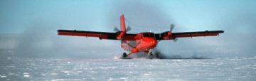
Twin Otter survey aircraft
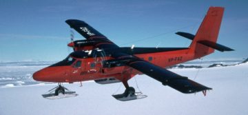
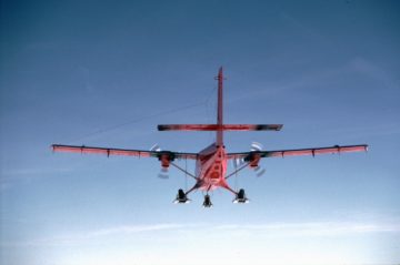
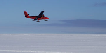
The primary geophysical survey platform is a Twin Otter aircraft. This very adaptable and robust platform is used the world over as a ‘bush’ aircraft. Its twin turbo-prop engines and ‘Short Take off and Landing’ (STOL) capability allow it to be operated from small, remote unpaved airfields. The addition of skis or tundra tyres also allows operation on snow from remote camps. The aircraft can be operated single pilot and a long range fuel tank is also available. In general the aircraft works in the Antarctic from October through to March each year. Outside the Antarctic season the aircraft is available in the Northern hemisphere.
Installations are flexible allowing for tailored missions for gravity, radar, magnetics or hyperspectral data collection or any combinations of the systems. Hard points in the wings allow for mounting of 8 radar antennas, while a belly antenna housing can add an additional four receive elements to the PASIN radar antenna array, or support other radar systems. Pods can be fitted at the wing tips for the magnetometer installation.
The camera bay, beneath a central floor hatch, can accommodate a scanning laser used for measuring ice surface elevation. A digital SLR camera can also be fitted to provide visual references for the data sets. A hyperspectral suite of imaging equipment can be utilised in the camera bay for a wide range of survey applications such as geology or vegetation studies. Alternatively a higher frequency accumulation radar can be fitted within the camera bay, giving higher resolution images of the internal structure of the ice sheet, but with shallower penetration of the ice. The required GPS and attitude measurements to support survey operations are fed data from up to three antennas mounted on the roof of the aircraft, with data typically logged to a Javad GNSS receiver.
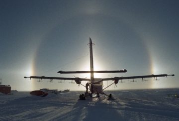
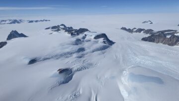
Aerogeophysical survey aircraft at Theron Mountains
UAV survey platform
Large UAVs, such as the Windracers Ultra, can carry many of the geophysical and other Earth observation instruments noted above. In some cases such platforms have distinct advantages over traditional aircraft, for example for smaller survey areas, where slow flight is required, or where fuel is at an extreme premium. Supported by Innovate UK BAS have successfully deployed magnetic, gravity, hyperspectral and visual camera systems from the Windracers Ultra platform in Antarctica on survey missions up to 260 km long and will continue to develop this capability. For UAV operations science equipment is pre-installed on a bespoke ‘floor’ which simply slots into the UAV payload bay. Science equipment either collects data across the entire duration of the mission, or is switched on/off automatically when specific mission waypoints are achieved. Due to weight restrictions the UAV surveys are currently limited to a sub-set of the instruments at any specific time, but future advances will reduce this limitation.
Technical information
- More information about the sensors can be found under the Facilities tab
Data
View the BAS Polar Airborne Geophysics Data Portal to access datasets and metadata. Individual datasets can also be accessed from the Project pages.
-
Aerogravity system
Read more of: Aerogravity systemBAS has developed aerogravity systems that can be mounted in its geophysical survey aircraft, or in a UAV. Over 100,000 km of gravity data has been collected since such systems were first deployed in 1993.
-
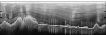
Polarimetric Radar
Read more of: Polarimetric RadarThe radar system is composed of a complex waveform generator, signal processor, data handler and data store.
-
Aerial survey of Pine Island Glacier
Read more of: Aerial survey of Pine Island GlacierBBAS-AGASEA used airborne surveys to map the landscape beneath Pine Island Glacier and assess its potential instability due to climate change.
-
Aerogeophysical survey of the Wilkes Subglacial Basin
Read more of: Aerogeophysical survey of the Wilkes Subglacial BasinWISE-ISODYN was a joint UK-Italian project to provide new boundary conditions to input into ice-sheet and paleoclimate models predicting the past and future stability of the East Antarctic Ice Sheet.
-
Bedmap
Read more of: BedmapBedmap is a collaborative community that has produced maps and datasets of Antarctic ice thickness and bed topography
-
Bedmap3
Read more of: Bedmap3Bedmap3 is a collaborative community project with the aim to produce a new map and datasets of Antarctic ice thickness and bed topography.
-
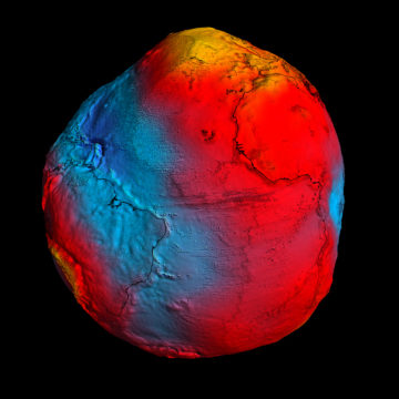
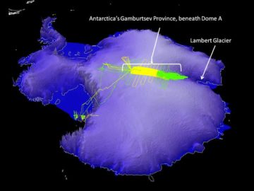
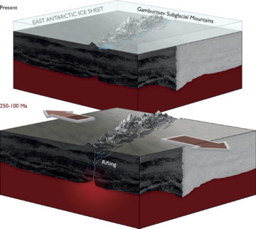
Exploring Antarctica’s Ghost Mountains
Read more of: Exploring Antarctica’s Ghost MountainsAGAP was an international effort to explore the Gamburtsev Subglacial Mountains in the center of East Antarctica.
-
Filchner Ice Shelf System, Antarctica
Read more of: Filchner Ice Shelf System, AntarcticaThis project investigated the stability of Antarctica’s Filchner Ice Shelf to produce sea-level projections using hot water drilling, ocean measurements beneath the ice shelf, sediment coring, radar surveys and autonomous submersibles.
-
GRADES-IMAGE
Read more of: GRADES-IMAGEThe aim of this programme was to image englacial layering and bedrock topography over this sensitive catchment of the West Antarctic Ice Sheet and Antarctic Peninsula.
-
ICEGRAV
Read more of: ICEGRAVThe primary aim of the project is to carry our airborne gravity observations across hitherto unexplored parts of Antarctica.
-
Polar Airborne Geophysics Data Portal
Read more of: Polar Airborne Geophysics Data PortalThe Polar Airborne Geophysics Data Portal provides direct access to airborne survey data.
-
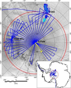
PolarGAP
Read more of: PolarGAPPolarGAP is an ambitious international mission to capture new and critical data about the Earth’s global gravity field.
-
PRESCIENT
Read more of: PRESCIENTPRESCIENT supports long-term, strategically important measurements and capabilities for the wider science community.
-
Surveying West Antarctica’s unstable ice streams
Read more of: Surveying West Antarctica’s unstable ice streamsThis project investigated the ice streams of West Antarctica’s Weddell Sea sector through airborne surveys.
-
ANTARCTIC BLOG: Science from the air #5
Read more of: ANTARCTIC BLOG: Science from the air #5Wrapping up I have started several of my blog posts saying I am writing in various odd/unusual/uncomfortable locations…the back of a Twin Otter, or in a mountain tent high on […]
-
ANTARCTIC BLOG: Science from the air #4
Read more of: ANTARCTIC BLOG: Science from the air #4Culture shock Just over two weeks ago I was writing this blog hunched up in a mountain tent, having not washed for a week, and with the company of just […]
-
ANTARCTIC BLOG: Science from the air #2
Read more of: ANTARCTIC BLOG: Science from the air #2The altimeter in the front of the Twin Otter aircraft is showing 8500 ft as we cruise due south from Rothera research station for the next leg in our PolarGAP […]

-
ANTARCTIC BLOG: Polar guide arrives on site #5
Read more of: ANTARCTIC BLOG: Polar guide arrives on site #5As we finally approached our input site I could see our future home in the distance, a little black dot on a frozen white ocean, slowly growing in size as […]
-
Ground beneath Thwaites Glacier mapped for first time
Read more of: Ground beneath Thwaites Glacier mapped for first timeThe ground beneath Antarctica’s most vulnerable glacier has been mapped for the first time, helping scientists to better understand how it is being affected by climate change. Analysis of the […]
-
“Thermal scar” from dinosaur era still warming base of Greenland Ice Sheet, new findings show
Read more of: “Thermal scar” from dinosaur era still warming base of Greenland Ice Sheet, new findings showA new ‘heat map’ shows, in unprecedented detail, how geothermal heat is escaping through the Earth’s surface beneath the Greenland Ice Sheet. This is critical information for enabling scientists to […]
-
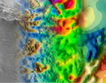
Subglacial valleys and mountain ranges discovered near South Pole
Read more of: Subglacial valleys and mountain ranges discovered near South PoleRevealing Antarctica’s hidden world
-
NEWS STORY: New gravity dataset
Read more of: NEWS STORY: New gravity datasetScientists now have a new tool to investigate the deep structure of the least understood continent on Earth
-
PRESS RELEASE: New season – ambitious science
Read more of: PRESS RELEASE: New season – ambitious scienceNew season tackles ambitious science and logistical challenges The British Antarctic Survey (BAS) 2015/16 field season is underway with dozens of scientists and support staff – together with planes and tonnes […]
-
NEWS STORY: Mountains frozen in time
Read more of: NEWS STORY: Mountains frozen in timeAntarctic “ghost mountains” preserved by ice sheet A new study reveals how the rugged ridgelines of East Antarctica’s ancient and mysterious ‘ghost mountains’ have been preserved for millions of years […]
-
NEWS STORY: Airborne geophysics in the Antarctic
Read more of: NEWS STORY: Airborne geophysics in the AntarcticIn this month’s International Innovation journal Dr Fausto Ferraccioli discusses how airborne geophysics can be used to uncover the geology of Antarctica and explore some of the Earth’s final frontiers. […]
-
PRESS RELEASE: Buried mountain range mapped
Read more of: PRESS RELEASE: Buried mountain range mappedGamburtsev Mountains enigma unraveled in interior East Antarctica The birth of the Gamburtsev Subglacial Mountains buried beneath the vast East Antarctic Ice Sheet — a puzzle mystifying scientists since their […]
-
PRESS RELEASE: New discovery from “ghost mountains”
Read more of: PRESS RELEASE: New discovery from “ghost mountains”Ice structures found among hidden Antarctic mountains The discovery of numerous large ice structures within Antarctica’s Dome A region, the site of the buried ‘ghost mountains’, reveals new understanding about […]
-
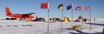
PRESS RELEASE: Mission to buried mountain range
Read more of: PRESS RELEASE: Mission to buried mountain rangeChallenge to discover Antarctica”s hidden world Later this month teams of scientists, engineers, pilots and support staff from British Antarctic Survey (BAS), USA, Germany, Australia, China and Japan will join […]