AI Team Lead
Artificial Intelligence (AI) Lab
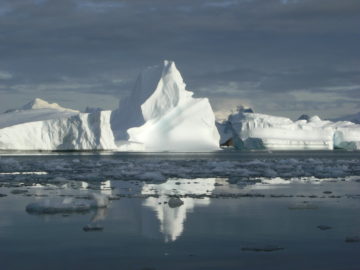
The AI lab applies artificial intelligence to tackle key polar challenges.
Our team analyses data from sources including sea ice, wildlife, and climate models. AI then helps us find patterns and insights in these complex datasets which would be otherwise impossible to detect.
We use AI to make polar research more efficient and sustainable.
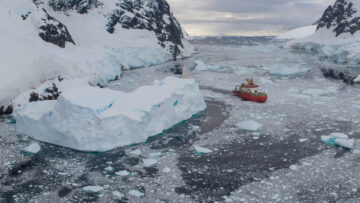
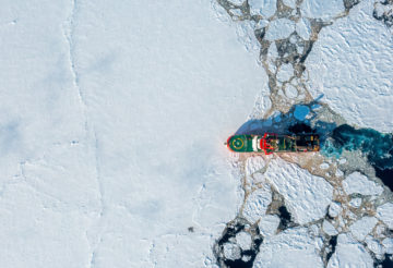
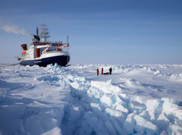
Our tools help reduce carbon emissions by optimising travel routes for research ships and autonomous vehicles, and by improving how we collect data in remote locations.
Team Priorities
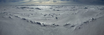
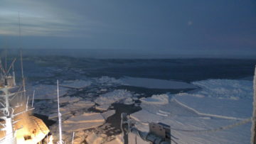
Monitoring polar regions
We use AI to track and understand changes in ice, oceans, and atmospheric conditions in real time.
Digital twins and models
We create virtual simulations of natural systems. These digital copies let us test different scenarios and predict future changes safely.
Automated mission planning
AI optimises expedition schedules and decides where to place scientific instruments. This saves time, money, and reduces environmental impact.
Faster climate models
We integrate data into models that provide more accurate climate predictions more quickly.
AI data pipelines
We build tools that transform large, complex datasets into formats that people can actually use.
Technology and training
We develop practical AI solutions for satellite observations, sensor networks, and polar logistics. Our PhD and student projects train the next generation of environmental AI scientists.
International collaboration
We partner with research organisations worldwide to develop AI methods for polar science.
Supporting decision-makers
Our AI tools provide actionable information to policymakers, satellite operators, and conservation organisations.
Public engagement
We share our research through media and public talks.
Featured Project
Machine Learning for Seasonal Sea Ice Forecasting
IceNet is a deep learning system that forecasts Arctic sea ice. The system is trained on climate simulations and observational data. It outperforms state-of-the-art dynamical models, especially for extreme sea ice events.
-

-

Machine Learning Research Scientist
-

AI Researcher in Optimisation and Planning
-

Machine Learning Research Scientist
-

Machine Learning Research Scientist
-

PhD Student
-

Machine Learning Research Scientist
Artificial Intelligence (AI) Lab, BAS Science Strategy Executive Group
-

Machine Learning Research Scientist
Artificial Intelligence (AI) Lab, Palaeo Environments, Ice Sheets and Climate Change team
-
Logist AI for environmentally aware decision support
Read more of: Logist AI for environmentally aware decision supportAMOP is developing Artificial Intelligence methods that aim to optimise the efficiency of Antarctic field operations, while maximising science delivery
-
Machine Learning for Sea Ice Forecasting
Read more of: Machine Learning for Sea Ice ForecastingIceNet is a deep learning system that forecasts Arctic sea ice. The system is trained on climate simulations and observational data. It outperforms state-of-the-art dynamical models, especially for extreme sea ice events.
-
AI for smart conservation
Read more of: AI for smart conservationThe AI for smart conservation project combines sea ice forecasts, satellite data, and GPS tracking to create early-warning systems for Arctic wildlife.
-
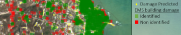
AI for Earth Observation
Read more of: AI for Earth ObservationThe AI for Earth Observation project develops machine learning tools to detect icebergs, sea ice, and wildlife from satellite imagery.
-
Digital Twins of the Polar Regions
Read more of: Digital Twins of the Polar RegionsThis project is developing digital twins of Antarctic and Arctic environments and resources. A digital twin makes it possible to test “what if” questions far more quickly than traditional computer models.
-
Top marks for UK science as world convenes for Antarctic conference
Read more of: Top marks for UK science as world convenes for Antarctic conferenceA major new analysis has confirmed British Antarctic Survey as the world’s leading centre for Antarctic and Southern Ocean research.

-
Using AI to track icebergs
Read more of: Using AI to track icebergsResearchers are using a new AI tool to detect icebergs in the Southern Ocean – the first step towards tracking the complete lifecycle of Antarctic icebergs from satellite data.
-
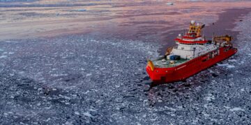
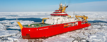
AI tool to revolutionise polar ship navigation
Read more of: AI tool to revolutionise polar ship navigationArtificial Intelligence (AI) will enable ships navigating in polar ocean conditions to be more efficient using a new route planning tool created by British Antarctic Survey (BAS) researchers. The tool […]
-
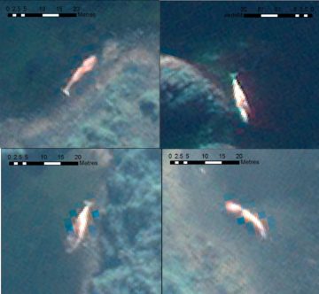
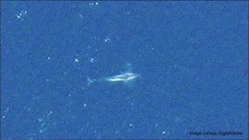
Space technology and artificial intelligence to monitor whale mass stranding events
Read more of: Space technology and artificial intelligence to monitor whale mass stranding eventsAn international team of scientists led by British Antarctic Survey have published research today on using new technology to study mass stranding of whales from space and how the technology […]
-
Artificial intelligence to help predict Arctic sea ice loss
Read more of: Artificial intelligence to help predict Arctic sea ice lossA new AI (artificial intelligence) tool is set to enable scientists to more accurately forecast Arctic sea ice conditions months into the future. The improved predictions could underpin new early-warning […]

-
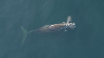
Using AI to track whales from space
Read more of: Using AI to track whales from spaceBritish Antarctic Survey (BAS) scientists will work with an Artificial Intelligence company after being awarded a contract from the Canadian Space Agency (CSA) to support the protection of an endangered […]
-
PhD centre will nurture new leaders in Earth observation
Read more of: PhD centre will nurture new leaders in Earth observationA new centre will enable 50 fully-funded PhD researchers to harness satellite data to tackle global environmental challenges. The Centre for Satellite Data in Environmental Science (SENSE) will bring together expertise in […]

-
Using AI to help tackle global environmental challenges
Read more of: Using AI to help tackle global environmental challengesA new Centre for Doctoral Training, involving researchers from British Antarctic Survey, will develop Artificial Intelligence (AI) techniques to address critical environmental challenges. Climate change and environmental hazards pose some […]
-
Watching whales from space
Read more of: Watching whales from spaceScientists have used detailed high-resolution satellite images provided by Maxar Technologies’ DigitalGlobe, to detect, count and describe four different species of whales. Reported this week in the journal Marine Mammal […]
-
Seeing double: Digital twins and net zero
Read more of: Seeing double: Digital twins and net zeroReaching net zero, as a country or a business, requires new measures, technology and innovations. Digital twins are an example of this; they can be a powerful tool to drive innovation and efficiency.
-
Predicting September 2021 Arctic sea ice using artificial intelligence
Read more of: Predicting September 2021 Arctic sea ice using artificial intelligenceTom Andersson, a data scientist at British Antarctic Survey Artificial Intelligence (AI) Lab, shares the latest predictions from a new Arctic sea ice forecasting AI tool as this year’s Arctic […]
-
Innovative Research Sprints Tackle Challenges in Biodiversity and Exposure
Read more of: Innovative Research Sprints Tackle Challenges in Biodiversity and ExposureOver the last decade, digital technologies, including Artificial Intelligence, developed rapidly as did our capability to monitor our home planet from space with Earth Observation satellites. How can we most […]
-
Earth Day 2020: A new age of Arctic science discovery – the AI way
Read more of: Earth Day 2020: A new age of Arctic science discovery – the AI wayWhen we see news reports on climate change on our TV, they are often accompanied by footage of a polar bear walking over the icy Arctic landscape. But the Arctic […]
-
Official launch of the BAS AI Lab!
Read more of: Official launch of the BAS AI Lab!Today we officially launched the BAS AI Lab – thank you everyone for coming!
-
AI Lab presents at the First Artificial Intelligence for Copernicus Workshop
Read more of: AI Lab presents at the First Artificial Intelligence for Copernicus WorkshopAndrew Fleming and Anita Faul present their research at the First Artificial Intelligence for Copernicus Workshop
-
Machine Learning for Environmental Sciences
Read more of: Machine Learning for Environmental SciencesRachel Furner is a PhD student at British Antarctic Survey, which has recently opened up its new AI Lab, that aims to foster the application of various machine learning (and […]
-
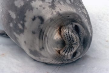
Data Study Group: Automated monitoring of seals via high-resolution satellite imagery
Read more of: Data Study Group: Automated monitoring of seals via high-resolution satellite imageryPrem hosted at Data Study Group at the Alan Turing Institute Seals from space: automated Antarctic ecosystem monitoring via high-resolution satellite imagery Antarctic seal populations are potential indicators for the […]
-
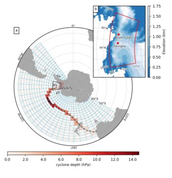
Automated clustering of storm tracks for interpreting ice core records
Read more of: Automated clustering of storm tracks for interpreting ice core recordsAccumulation in coastal West Antarctic ice core records and the role of cyclone activity Cyclones are an important component of Antarctic climate variability, yet quantifying their impact on the polar […]