
Tom Andersson, a data scientist at British Antarctic Survey Artificial Intelligence (AI) Lab, shares the latest predictions from a new Arctic sea ice forecasting AI tool as this year’s Arctic sea ice minimum is announced by the National Snow and Ice Data Center. This year is the 12th lowest on record. The last 15 are the lowest 15 on record.
Every September in the Arctic, as darkness replaces 24-hour summer daylight, the retreat of sea ice slowly grinds to a halt, marking the beginning of the sea ice freezing season that will last until March. This turning point for 2021 has just passed, with the area of ocean covered by more than 15% sea ice — the ‘sea ice extent’ — reaching 4.72 million km2 on September 16th according to the National Snow and Ice Data Centre (NSIDC). This is the 12th lowest in the four-decade satellite record, coming slightly higher than recent ultra-low years that have been driven by unprecedented anthropogenic warming in the region.
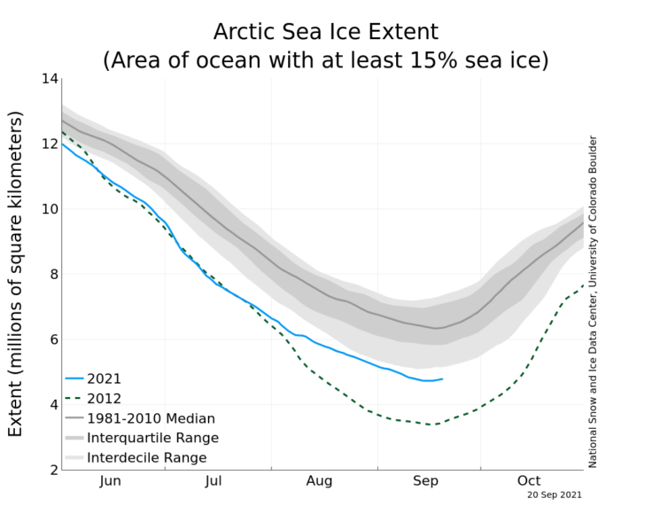
Figure 1: Sea ice extent this year was closely tracking the lowest-extent year of 2012, but slower melting over August meant we did not reach another record low last week. Source: NSIDC.
Predicting the shape and size of the ice pack in September is a notoriously challenging task that sees a range of teams carefully monitoring Arctic conditions and submitting forecasts over the course of the melting season.
Last year, through a collaboration between the BAS AI Lab, The Alan Turing Institute and several other research centres, I led the development of a new artificial intelligence (AI) system that predicts how Arctic sea ice will change over time. We gave this AI system the pet name ‘IceNet’ and introduced it to the world last month in the journal Nature Communications. Unlike previous methods that attempt to model the laws of physics directly, IceNet learned from scratch how to forecast sea ice based on observations and simulations of the Earth system.
Against expectations, IceNet outperformed even the best physics-based model in seasonal forecasts of Arctic sea ice in September. It’s possible that IceNet has spotted physical processes governing sea ice from patterns in the data which the leading physics-based models do not capture well.
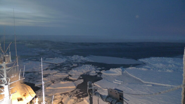
Moving through Arctic sea ice on a ship in 2015. Credit: Markus Frey.
For the past three months, I’ve fired up IceNet and made it predict the monthly-averaged distribution of sea ice for this September. I say ‘monthly-averaged’ because the current version of IceNet predicts on a month-wise timescale. For example, an IceNet forecast initialised on July 1st uses environmental data averaged over June to predict the mean sea ice conditions over July, August, September, and so on up to 6 months ahead.

Figure 2: IceNet’s predictions for the September-average Arctic ice edge for forecasts initialised on July 1st, August 1st, and September 1st.
The retreat of sea ice this year was one of surprises and stark regional differences. For most of the melting season, alarm bells were ringing as Arctic sea ice extent closely followed the lowest-extent year of 2012. A heatwave scorched Siberia (as in 2020) amidst record-early break-up of ice in the Laptev Sea for the second year running. However, a large low pressure system sat over the Beaufort Sea for most of August, bringing cold and windy conditions that reduced ice melt and increased ice dispersion, slowing the retreat of the ice edge north of Alaska.
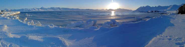
The icy Arctic landscape. Credit: BAS.
This complex picture is reflected in IceNet’s September ice edge forecasts shown in Figure 2. Since July 1st, IceNet consistently predicted less ice than usual on the Siberian side of the Arctic, possibly owing to the early break-up observed there. On August 1st, it started predicting less sea ice in the Greenland Sea, which reached record-low levels over July. On September 1st, after melting slowed north of Alaska, IceNet updated its forecast to increase the amount of sea ice predicted in the Beaufort and Chukchi Seas, bringing the sea ice extent prediction of its September-average forecast up to 5.16 million km2. IceNet also started to predict a large blob of sea ice to the west of the Siberian archipelago Severnaya Zemlya. We will find out after September how accurate these predictions were.
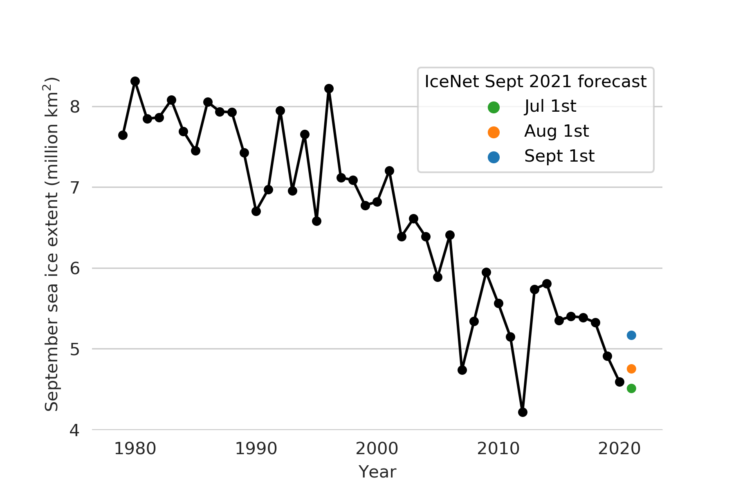
Figure 3: Observed extent of September-average sea ice from 1979-2020 (black) and IceNet’s predictions for the September 2021 sea ice extent at various initialisation dates (coloured crosses).
This September highlights the ‘natural variability’ inherent within the Arctic system — the reason behind the wiggles in Figure 3. Despite occasional bounce backs in extent, Arctic sea ice is still on a substantial downward trajectory, and the current amount of thick multi-year ice is one of the lowest ever recorded. Given the dramatic rates of warming in the Arctic, future years will certainly see further record-lows in September sea ice levels, with ice-free summers anticipated by the middle of the century.
Read our paper on IceNet in full in Nature Communications: https://www.nature.com/articles/s41467-021-25257-4