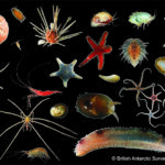
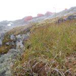
Larsen-C Benthos
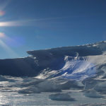
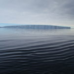
On 12 July 2017, the Larsen-C Ice Shelf calved one of the largest iceberg originating from the Antarctic Peninsula ever recorded. As iceberg A68 moves north, it leaves behind an …
Satellite technologies help scientists tackle some of the biggest environmental questions facing society. Innovative use of atmospheric, climate, ice and oceanographic data provides decision-makers in government and business with vital evidence to help them meet major environmental challenges. State-of-the art systems, capable of mapping the geology, monitoring sea-ice conditions, changes in surface temperature and concentrations of greenhouse gases reveal the changes in the Antarctic and Arctic.
On 12 July 2017, the Larsen-C Ice Shelf calved one of the largest iceberg originating from the Antarctic Peninsula ever recorded. As iceberg A68 moves north, it leaves behind an …
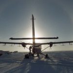
Project MIDAS (Impact of Melt on Ice Shelf Dynamics And Stability) is a UK-based Antarctic research project, investigating the effects of a warming climate on the Larsen C ice shelf …

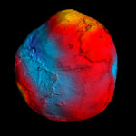
GOCE+Antarctica- Dynamic Antarctic Lithosphere -is an international project supported by the European Space Agency (ESA) that is using GOCE satellite gravity gradient data, GPS data and innovative 3D modelling to …
The polar regions have the capacity to amaze and astound, but despite the considerable progress of recent decades we still know far less about them than less remote parts of …

Situational awareness in the Arctic
The Copernicus marine environment monitoring service provides regular and systematic reference information on the state of the physical oceans and regional seas. The observations and forecasts produced by the service …
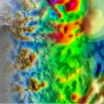
Exploring Antarctica’s ‘ghost mountains’
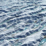
West Antarctic ‘rivers’ of ice
Understanding the contribution that polar ice sheets make to global sea-level rise is recognised internationally as urgent. The mission of this five-year project is to capture new observations and data …
1 November, 2019
2 October, 2019
17 October, 2019
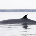
A new technique for analysing satellite images may help scientists detect and count stranded whales from space. Researchers tested a new detection method using Very High Resolution (VHR) satellite images …
3 July, 2019
A team of scientists has discovered a rare lava lake on a remote and inaccessible sub-Antarctic island. This volcano in the South Sandwich Islands is only the 8th to be identified worldwide to have a persistent lava lake.
13 June, 2019
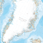
Cartographers at British Antarctic Survey (BAS) has produced the most detailed and up-to-date published map of Greenland available.

25 April, 2019
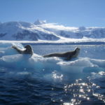
Researchers at British Antarctic Survey have discovered “catastrophic” breeding failure at one of world’s largest emperor penguin colonies.
7 September, 2018
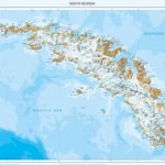
British Antarctic Survey’s detailed map of the sub-Antarctic island of South Georgia featuring the epic “Shackleton Crossing” has won an award at the 2018 British Cartography Society Awards. The map, …
24 May, 2018
Revealing Antarctica’s hidden world
11 December, 2017
Cartographers surveying Antarctica have discovered Mt Hope is the tallest mountain in the British Antarctic Territory (BAT) at 3,239 m (10,654 ft) above sea level. Until now, maps showed Mt …
29 November, 2017
An animation of the giant iceberg that calved off the Pine Island Glacier in West Antarctica just over two months ago shows an unexpected break up. Satellite images revealed a …
12 July, 2017
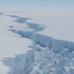
After months of ‘hanging by a thread’ a vast iceberg the size of Norfolk has finally broken off Antarctica’s Larsen C Ice Shelf. Around 30 metres of this 190m thick …
23 January, 2016
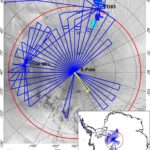
Scientists now have a new tool to investigate the deep structure of the least understood continent on Earth