Dep Science Leader of Palaeo Environments IMP 3
BAS Science Strategy Executive Group, Palaeo Environments, Ice Sheets and Climate Change team
A major theme of geological and geophysical research in Antarctica is determining how the ice sheet responded to natural climate changes in the past, in order to reduce uncertainty in predictions of future climate and sea level change. This information is important for informing Government strategy for mitigating against these risks. The RRS Sir David Attenborough is equipped with a range of instruments for geology and geophysics.
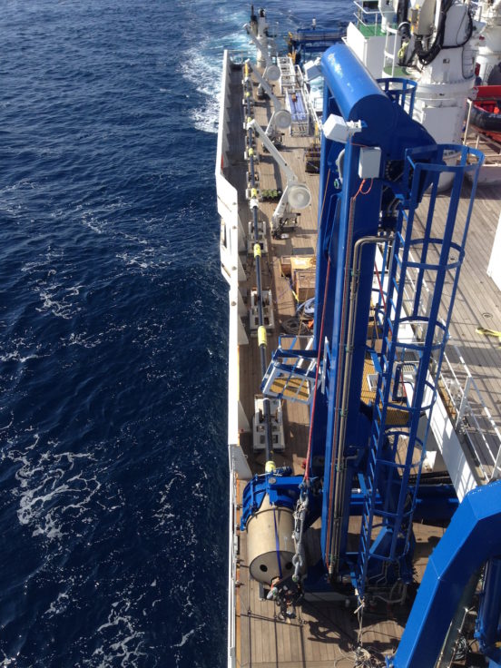
Using its dynamic positioning system, RRS Sir David Attenborough is able to hold its position accurately – even during rough seas – allowing effective geological and geophysical sampling to take place.
Undisturbed sea-floor sediments can reveal the history of the Antarctic continent. Sampled from the ocean floor or from beneath ice shelves, these sediments can be taken back to the lab to analyse and aid investigations into ice-shelf thinning and retreat, sedimentary processes and oceanic circulation.
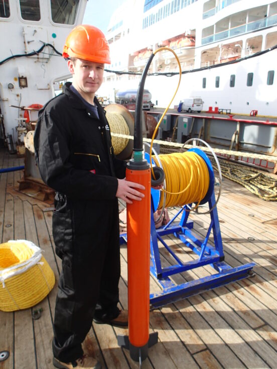
Collecting and analysing sediment cores gathered from ships and through the ice helps to provide a more complete picture of past ice sheet behaviour. The RRS Sir David Attenborough has a variety of instruments that allow researchers to do this.
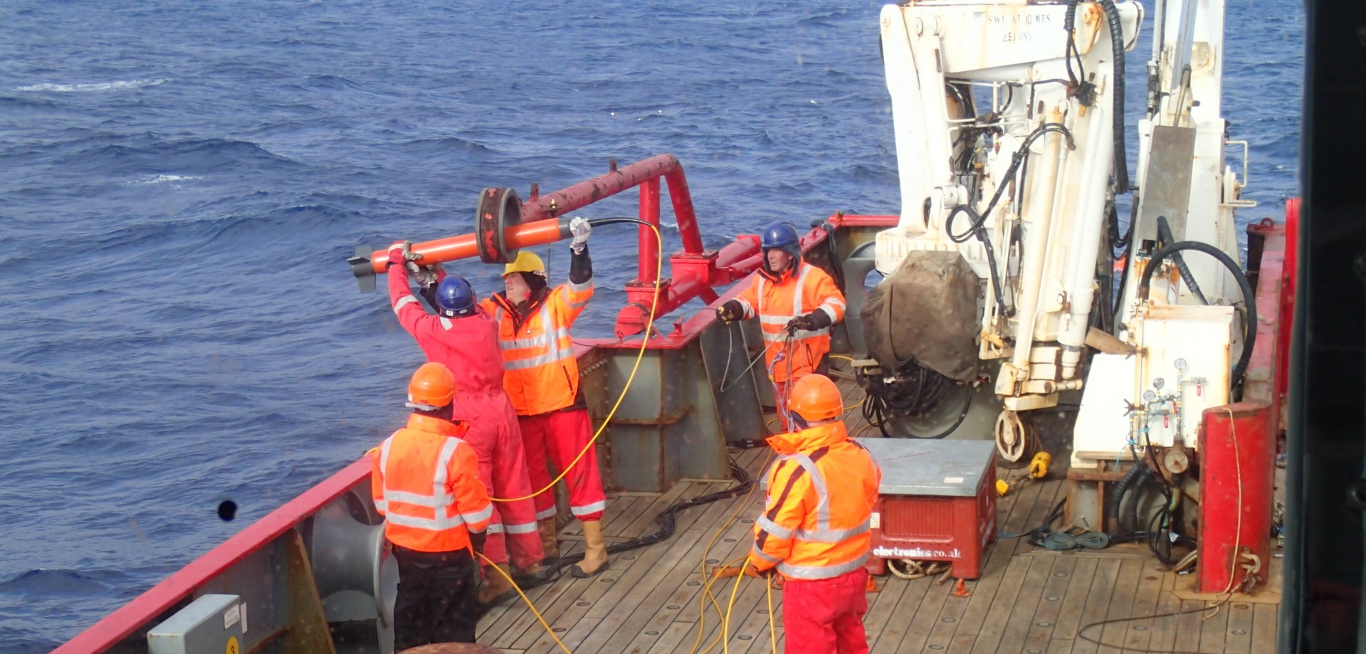
Piston corers are a vital tool for palaeoceanographers to reconstruct past climates. They’re used to collect sediment from the seabed; usually, the longer the corer, the greater the time period represented in the sediments recovered.
The RRS Sir David Attenborough is equipped with a 40m giant piston corer. Although piston coring is a routine activity for research ships, corers of this size are at the leading edge of technology because of the space needed on the ship and the complex procedure to deploy and recover them.
With this corer, palaeoceanographers can get long sediment cores from the sea floor containing high-resolution records of past climates through several glacial-interglacial cycles. In places where sea floor sediments have accumulated more slowly, they will be able to collect records that go back around three million years. This means scientists can go back in time to when atmospheric CO2 levels last exceeded 400 parts per million – an important analogue for the environmental conditions we’re experiencing now.
A UK science community workshop (hybrid format) was held at BAS on the 27th of March 2024 with the aim to (i) inform on the availability of the giant piston corer (GPC) aboard the RRS Sir David Attenborough, (ii) identify priorities for GPC expeditions for addressing globally significant science topics, and (iii) develop a strategy to trial and deploy this new research capability. The workshop report is available here:
OSIL Giant Piston Corer aboard R/V Kaimei. Image courtesy of JAMSTEC.
The RRS Sir David Attenborough also features a multi-corer. The multi-corer collects the first 60 cm of sediment below the sea floor, which contains records of the most recent environmental changes. Collecting samples in this way means they have an undisturbed surface, enabling marine geologists to study those changes in detail without concern about possible sampling disturbance or loss of the uppermost sediments.
A multi-sensor core logging scientific container can be placed on board to open directly into the ship’s wet lab. This means that non-destructive analyses of the cores can be conducted onboard the ship before they are sampled.
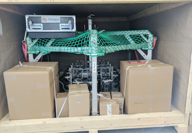
Oktopus Mega Multi Corer packed away
The RRS Sir David Attenborough has a state-of-the-art magnetometer to collect high-resolution magnetic data – the main way to determine the age of large areas of ocean crust.
Towed magnetometers are frequently deployed in the ocean during geoscience research cruises and are central to many geophysical studies. They are used to produce a map of magnetic lineations, which contain a record of the rates and directions of sea-floor spreading.
Magnetometer data is the most important type of data for reconstructing the motions of tectonic plates – they played an important role in the widespread acceptance of plate tectonic theory in the 1960s.
BAS geophysicist Tom Jordan prepares a magnetometer for deployment on the RRS James Clark Ross
The gravity meter is installed close to the centre of motion of the vessel and operates continuously,. It detects small differences in the Earth’s gravity field that indicate variations in the geology beneath the sea floor. Gravity data are typically combined with seismic and magnetic observations to determine the locations and extent of igneous intrusions or the thickness of sediment accumulations.
Seismic profiling systems are an effective way of studying the structure and composition of the sediments and rocks below the sea floor.
Seismic surveys work by using airguns as a source of sound which travels through the sea bed and penetrates layers of sediment and bedrock. These signals are reflected to varying degrees by layers of different materials. They are then picked up by an array of sensitive hydrophones towed behind the ship. This data is used to produce a profile of the seabed rocks rather than just the surface.
RRS Sir David Attenborough is equipped with advanced generator-injected airguns as well as air compressors to facilitate research into the geology of the sea floor.

Air gun array being deployed on the RRS James Clark Ross
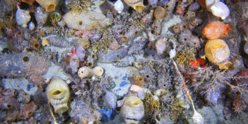
Seafloor sediments and the landforms on the Antarctic continental shelf contain records of past climate, ecosystems and physical processes. These records are essential for understanding the dynamics of ice flow and how this interacts with the ocean surrounding Antarctica. Polar research ships allow researchers to collect samples and data from remote locations using state-of-the-art sonar tools and specialised drills and corers. The resulting data include detailed maps of the seafloor that can shed light on past glacial processes and climatic changes.
The giant piston corer that can be deployed from RRS Sir David Attenborough will be able to recover sediment cores over 40m deep. This allows for high-resolution data going back roughly half a million years, or more coarse-resolution information going back as long as 2.7 million years.
Sediment cores collected from the seafloor can yield accurate records of past ecosystems and the way in which large-scale oceanic currents have changed over decades to millions of years. They also contain invaluable data about past climates. Reconstructing how the Antarctic ice sheet and ecosystems have changed in the past, particularly during periods of warming, is important for predicting future responses to climate change and its contribution to future sea-level rise. This data can also be used to test current models of future changes, by showing whether models can accurately reproduce what the sediment core records show.
Autonomous underwater vehicles and remotely operated vehicles (ROVs) allow researchers access to study sites that are too dangerous or difficult to reach for people, such as glacier calving faces and the undersides of ice shelves. These regions are key to understanding the changes taking place in the Antarctic ice sheet, which could have global climatic repercussions. These vehicles can carry high-resolution sonar system and some ROVs can also collect push cores and vibrocores.
Dep Science Leader of Palaeo Environments IMP 3
BAS Science Strategy Executive Group, Palaeo Environments, Ice Sheets and Climate Change team
Sedimentologist
Sedimentologist
Aerogroup Gravity
Marine Geophysicist
Antarctic seafloor ecosystems are both unique and fragile. Studying their past and present gives us valuable insights into how climate change may reshape them.