Aerogroup Gravity
ICEGRAV
ICEGRAV
- Start date:
- 1 September, 2012
- End date:
- 1 September, 2013
The ICEGRAV project is a major international collaboration between Danish, US, UK, Norwegian and Argentinian scientists. The primary aim of the project is to carry our airborne gravity observations across hitherto unexplored parts of Antarctica. Additional radar and aeromagnetic observations further contribute to filling major data voids.
The ICEGRAV 2013 season focused on exploring and understanding the Recovery Catchment, from the coast to the massive Recovery Subglacial Lakes ~750 km into the continental interior. This glacier catchment is potentially susceptible to significant change, due to variation in the Ronnie Filchner Ice shelf, yet before this project, the subglacial topography and underlying geology of this catchment remained un-resolved.
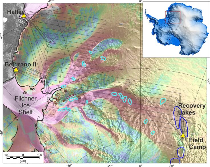
Ice velocity map and ICEGRAV 2013 survey lines. Yellow triangles mark operational bases and field camps. Dark blue outlines locate Recovery lakes, while pale blue outlines indicate dynamic lakes identified by satellite observations.
The overarching aim of the ICEGRAV 2013 survey was to collect high quality gravity, magnetic and radar data across the catchments of the Recovery, and adjacent Baily and Slesor glaciers. This data will contribute to work across a range of scientific disciplines.
For geophysics our goal is to better comprehend the nature of the tectonic features and deeper crustal architecture of one of the last geological frontiers on Earth, the East Antarctic shield. Little is known about the geology and tectonic architecture of our survey region, due to the lack of geophysical data and rock exposures. However, studies in West Antarctica show that the underlying geology plays a key role in determining the pattern of flow in the overlying ice sheet. When combined with preceding ICEGRAV surveys and major adjacent surveys performed by AWI, the ICEGRAV 2013 will provide unique new insights into sub-ice geology and crustal architecture of the East Antarctic Shield.
For glaciology the main scientific output will be new radar measurements of ice thickness, subglacial topography, basal hydrology, and internal layers in the ice. The survey region stands out as one of the major data gaps in BEDMAP II. In addition to the radar data, new laser data will be collected, giving ice sheet heights at an accuracy level of 5-10 cm. These data will help validate and augment satellite data and will also investigate subglacial lakes suggested by remotely sensed surface height changes.
For geodesy, the main focus will be to provide new high-resolution gravity data for global gravity field models and to supplement satellite missions (GOCE). DTU-Space has led a similar project in the Arctic, where gravity data were compiled from vast, formerly secret holdings of Russia and the US, as well as all available other data, under a working group “Arctic Gravity Project” of the International Association of Geodesy. It has for a long time been the goal of geodesy also to complete the southern gravity void in Antarctica. This is critical for supplementing the ESA gravity satellite GOCE (Global Ocean Circulation Explorer), which due to orbit inclination suffer from polar coverage gaps.
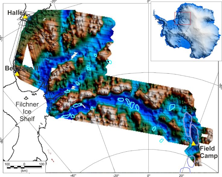
New subglacial topography of the Recovery Glacier catchment from the ICEGRAV 2013 survey.
ICEGRAV 2013 international partners include:


Rene Forsberg PI Technical University Denmark (DTU)

Arne Olesen Gravity specialist Technical University Denmark (DTU)
![]()
Instituto Antártico Argentino

Marta Ghidella PI Instituto Antártico Argentino (IAA)

Andrés Zakrajsek Geodetic specialist Instituto Antártico Argentino (IAA)

Norwegian Polar Institute
Kenny Matsuoka PI Norwegian Polar Institute (NPI)
Jack Kohler Norwegian Polar Institute (NPI)
Anja Diez Norwegian Polar Institute (NPI)
Publications:
Forsberg, R., Olesen, A. V., Ferraccioli, F., Jordan, T. A., Matsuoka, K., Zakrajsek, A., Greenbaum, J. S. (2017). Exploring the Recovery Lakes region and interior Dronning Maud Land, East Antarctica, with airborne gravity, magnetic and radar measurements. Geological Society, London, Special Publications, 461(1), 23-34. DOI: 10.1144/SP461.17
Diez, A., Matsuoka, K., Ferraccioli, F., Jordan, T.A., Corr, H.F., Kohler, J., Olesen, A.V., Forsberg, R., 2018. Basal settings control fast ice flow in the Recovery/Slessor/Bailey Region, East Antarctica. Geophysical Research Letters, DOI: 10.1002/2017GL076601
Paxman, G.J.G., Jamieson, S.S.R., Ferraccioli, F., Bentley, M.J., Forsberg, R., Ross, N., Watts, A.B., Corr, H.F.J., Jordan, T.A., 2017. Uplift and tilting of the Shackleton Range in East Antarctica driven by glacial erosion and normal faulting. Journal of Geophysical Research: Solid Earth 122, p2390–2408, DOI: 2310.1002/2016JB013841.
Data sets:
List of airborne geophysics datasets available for this project includes:
Aeromagnetic data:
- Ferraccioli, F., Forsberg, R., Olesen, A., Jordan, T., Matsuoka, K., Zakrajsek, A., & Ghidella, M. (2020). Processed line aeromagnetic data over the Recovery Lakes region and interior Dronning Maud Land, East Antarctica (2013) [Data set]. UK Polar Data Centre, Natural Environment Research Council, UK Research & Innovation. https://doi.org/10.5285/849E2215-95B0-4275-88B8-50E18E3F8D56
Gravity data:
- Olesen, A., Ferraccioli, F., Forsberg, R., Jordan, T., Matsuoka, K., Zakrajsek, A., & Ghidella, M. (2020). Processed line aerogravity data over the Recovery Lakes region and interior Dronning Maud Land, East Antarctica (2013) [Data set]. UK Polar Data Centre, Natural Environment Research Council, UK Research & Innovation. https://doi.org/10.5285/28E3B21F-BF4B-46A6-8559-F69D69C63A48
Bed and surface elevation picks data:
- Ferraccioli, F., Corr, H., Jordan, T., Forsberg, R., Matsuoka, K., Diez, A., Ghidella, M., Zakrajsek, A., Robinson, C., King, O. “Bed, surface elevation and ice thickness measurements derived from Radar acquired during the ICEGRAV-2013 airborne geophysics campaign” (2018) ]. UK Polar Data Centre, Natural Environment Research Council, UK Research & Innovation. https://doi.org/10.5285/6549203d-da8b-4a22-924b-a9e1471ea7f1
Radar data:
- Ferraccioli, F., Corr, H., Jordan, T., Forsberg, R., Matsuoka, K., Diez, A., Olesen, A., Ghidella, M., Zakrajsek, A., Robinson, C., & King, O. (2021). Processed airborne radio-echo sounding data from the ICEGRAV survey covering the Recovery Catchment and interior Dronning Maud Land, East Antarctica (2012/2013) (Version 1.0) [Data set]. NERC EDS UK Polar Data Centre. https://doi.org/10.5285/C6324118-94A2-4E03-8715-B24B82322A57
Data Portal
Airborne Geophysics data can also be accessed through the new Airborne Geophysics Data Portal.
More information about the Portal can be found here: https://www.bas.ac.uk/project/nagdp/#about
-
-
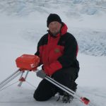
Aerogravity system
Read more of: Aerogravity systemBAS has developed aerogravity systems that can be mounted in its geophysical survey aircraft, or in a UAV. Over 100,000 km of gravity data has been collected since such systems were first deployed in 1993.
-
Polarimetric Radar
Read more of: Polarimetric RadarThe radar system is composed of a complex waveform generator, signal processor, data handler and data store.
-
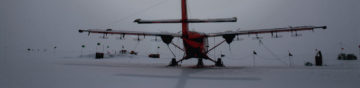
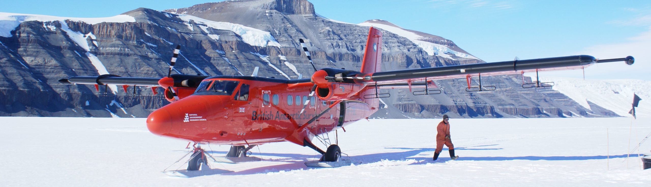
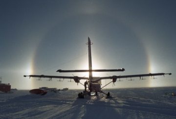
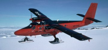
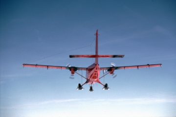
Twin Otter aircraft
Read more of: Twin Otter aircraftThe Twin Otter is a high-wing, twin-engine, turbo-prop aircraft. They are used all over the world and are known for their rugged construction, reliability and short take-off and landing performance.