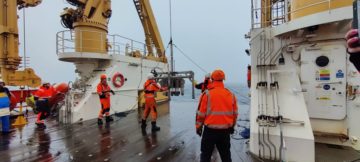
The science mission

Exploring the climate history of the East Antarctic Ice Sheet and the geological structure and evolution of the Gamburtsev Subglacial Mountains were the primary goals of this flagship International Polar Year (IPY) project. Buried by up to 4km ice, and surrounded by under-ice lakes, this enigmatic, virtually unexplored mountain chain, larger than the Alps may well be the birthplace of the vast East Antarctic Ice Sheet. During the mission science teams hunted for Antarctica’s oldest ice helping select possible sites for future ice core and bedrock drilling.

This multi-national, multi-disciplinary science venture brought together science teams from the UK, USA, Germany, Australia, China and Japan to take part in one of the most scientifically, technically and physically ambitious Antarctic projects yet to be undertaken.

To create a 3-dimensional map of what lies beneath the ice sheet two aircraft, one from British Antarctic Survey (BAS) and one from the US Antarctic Programme (USAP), completed the first aerogeophysical survey over the Gamburtsev Mountains and Dome A in East Antarctica. Results from this mission, combined with data from a suite of 26 seismic instruments on the ice, will unlock the secrets hidden beneath the ice.

AGAP airborne survey flights. Yellow lines flown by USAP Twin otter, Green lines flown by BAS Twin Otter.

The science mission addresses four fundamental questions:

  • How were the enigmatic Gamburtsev Subglacial Mountains formed?
  • What role does topography play in the birth of the East Antarctic Ice Sheet?
  • Where is the oldest climate record more likely to be found?
  • What are the tectonic controls on subglacial lakes?

Two strands of scientific operation, utilising several aircraft conducting between 80 and 100 survey flights, are required to build the picture of what lies beneath the ice:

  • The aerogeophysics teams, (GAMBIT) led by Lamont Doherty Earth Observatory (LDEO) and British Antarctic Survey scientists, involved two survey aircraft.
  • The seismic team, (GAMSEIS) led by the Washington University and Penn State scientists, used the USAP utility Twin Otter to deploy and service 26 seismometers on the ice.