Explore new polar maps online
18 September, 2025
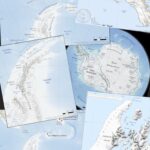
A new map catalogue with access to a large collection of freely available polar maps is now available online. Many of these maps were previously unavailable to the public and …
18 September, 2025
A new map catalogue with access to a large collection of freely available polar maps is now available online. Many of these maps were previously unavailable to the public and …
5 August, 2025
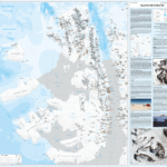
The Mapping and Geographic Information Centre (MAGIC) at the British Antarctic Survey have produced new maps of the topography (physical features) and geology of Alexander Island in Antarctica. These maps …
Read more on New maps published of Alexander Island, Antarctica
13 February, 2025
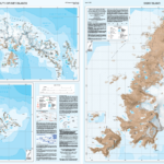
A new map of the South Orkney Islands has been released by British Antarctic Survey (BAS) – the first UK published, topographic map of the region in almost 40 years. …
Read more on New map of South Orkney Islands published for the first time in 40 years
18 May, 2024
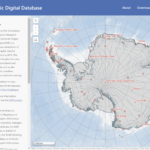
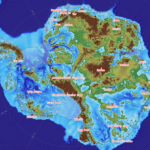
Comprehensive digital maps of Antarctica are now available to all, following the latest update of the Antarctic Digital Database. A new map viewer brings together all of the Antarctic Digital …
Read more on New interactive map of Antarctica available to all
12 May, 2020
A newly updated Antarctic Digital Database is released today (12 May 2020). Aimed at the science and logistics communities, the maps include updates to the ice shelf front around Thwaites …