Pine Island Glacier in West Antarctica is one of the fastest-flowing glaciers in Antarctica. Over the last eleven years, four major icebergs have broken off from its floating ice shelf. In February 2017, a team of researchers on board the German research icebreaker Polarstern successfully mapped an area of the seafloor previously covered by ice. A comparison of these new maps with satellite images of the glacier reveals why it suddenly retreated toward the coast: at important points, it had lost contact with the ground, as the team reports in a new study published in the online journal The Cryosphere this week (14 June).
With a flow speed of four kilometres per year, Pine Island Glacier is one of the fastest-flowing in Antarctica. Together with its neighbouring glaciers, every year the up to 50-kilometre-wide river of ice transports more than 300 gigatonnes of ice from its interior to the Amundsen Sea. It alone is responsible for between 5-10% of global sea-level rise. Scientists have already identified the cause of this rapid loss of ice. Since the 1940s, warm water masses, which branch off from the Antarctic Circumpolar Current, have found their way beneath the floating part of the glacier, melting what is referred to as its ice shelf from below. As a result, the ice shelf, which is currently ca. 55 kilometres long, has been losing roughly five metres of thickness per year over the last 25 years.
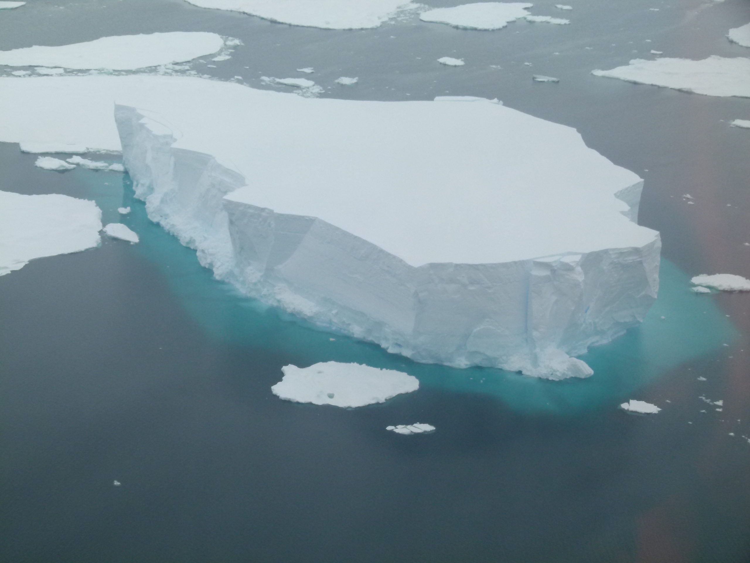
Grounded icebergs in Pine Island Bay in West Antarctica. Credit: Robert Larter @ British Antarctic Survey
What remained unclear was why, despite this sustained melting, the Pine Island Glacier’s calving front had barely retreated since the beginning of observations, which started in 1947. Then in 2015, a significant calving event shifted the edge of the ice shelf 20 kilometres nearer the coast and reduced the floating ice shelf’s total area to roughly 470 square kilometres.
“The direction and speed of a given glacier’s flow chiefly depends on the topography of the ground below it. But for most of the ice shelves in the Antarctic, we know very little about the features of the underlying seafloor. As such, our expedition was an unprecedented opportunity to map 370 square kilometres of an area that had previously largely been covered by the Pine Island Glacier’s ice shelf,” explains first author Dr Jan Erik Arndt from the Alfred Wegener Institute, Helmholtz Centre for Polar and Marine Research (AWI) in Bremerhaven.
With the aid of multibeam echosounders, the team was able to precisely map the seafloor.
Submarine mountains held back the ice
The new maps of the ocean floor in Pine Island Bay, which is up to 1,000 metres deep, reveal a previously unmapped submarine ridge and two mountains, the peaks of which reach up to a water depth of 370 metres. The Pine Island Glacier’s more than 400-metre thick ice shelf must have been grounded on the ridge for several decades, as the satellite images of the glacier gathered by the researchers – dating back to 2002 – confirm. In the older images, rises in the ice’s surface can be identified at precisely those points where the peaks of the ridge are directly under the ice shelf.
“But after 2006, these landmarks are nowhere to be seen. By that time, the ice shelf must have melted so extensively from below that it was either too light to produce any impression on the surface of the ice, or the ice sheet must have already lost contact with the mountains beneath it,” says co-author Dr Karsten Gohl from the AWI.
When an ice shelf loses contact with such obstacles – known as ‘pinning points’ – the glacier reacts as if someone had suddenly released a giant brake. With nothing left to stop them, the ice rapidly flows out to sea – at least that’s the theory. Using the time series of satellite images, the researchers were now able to test this thesis step by step. Much to their surprise, in the process they determined that submarine highs not only stabilise ice shelves like giant brakes; in some cases, these mountains can also set off calving events – for instance, when the calving front advances, causing it to crash into a mountain with full force.
That must be what happened during a calving event in 2007. As the satellite images show, back then the edge of the glacier’s ice shelf collided with one of the newly discovered mountains, hitting it so hard that rifts formed in the surface of the ice. When one of the rifts finally became too large, the entire face of the ice shelf broke off.
The story was similar, albeit less dramatic, with the iceberg that calved in 2015, breaking into several pieces just a few weeks later. The largest piece became caught on the submarine ridge for nearly a year, turning clockwise over and over again until the combination of ocean currents, wind and melting broke it loose. The researchers surmise that, just as in 2007, the ice shelf’s repeated contact with the ridge is what ultimately led to the calving event.
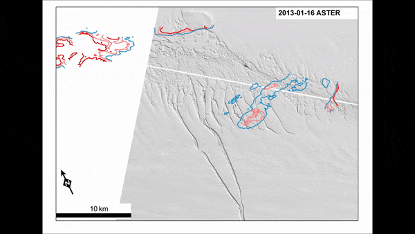
Stitched together satellite images of Pine Island Glacier show calving events of the ice tongue between 2013-17. Credit: European Copernicus Sentinel-1 satellite image
Dr Robert Larter from British Antarctic Survey, who took part in the 2017 research cruise and is a co-athor on the study says:
“By combining detailed bathymetry from an area the glacier’s ice shelf has retreated from with a sequence of satellite images, we have been able to show how some major iceberg calving events were triggered by the interaction of the ice with sea floor ridges. Our observations also show how the edge of the ice shelf retreated as its seaward part became unstable after progressive thinning caused it to lose contact with a ‘pinning point’ on one of the ridges.”
The ice shelf has now regained its footing
The bathymetric maps of the seafloor in Pine Island Bay and the results of the image analyses can now be fed into computer models of the West Antarctic Ice Sheet, helping produce more accurate simulations for future change and the glacier’s contribution to sea-level rise.
Researchers from the Alfred Wegener Institute, Helmholtz Centre for Polar and Marine Research, British Antarctic Survey and German Aerospace Center (DLR) took part in this study. Read it here