An ambitious flying campaign out of British Antarctic Survey’s Rothera Research Station over the Weddell Sea this month (December) aims to calibrate the data collected from two important satellites that monitor Antarctic sea ice. It’s the first time an aircraft has flown simultaneously beneath the CryoSat-2 and ICESat-2 satellites in the Antarctic.
ESA (European Space Agency) operates a radar-based altimeter system on CryoSat-2, while NASA (National Aeronautics and Space Administration) flies a laser-based altimeter system on ICESat-2. Altimeters are used to measure the altitude of an object above a fixed level. Both techniques have advantages, but until now, scientists have not been able to fully exploit coincident measurements recorded by each mission to monitor sea ice in the Southern Ocean.

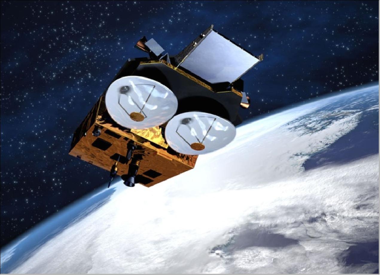
ESA’s CryoSat-2 satellite measures sea ice in the Polar Regions
In a bold move, ESA has manoeuvred the CryoSat-2 satellite to synchronise it with the IceSat-2 orbit, providing a unique window of opportunity for researchers to directly compare both sensors over the same sea ice. This month’s dedicated airborne campaign is flying beneath their orbits as an essential calibration step that will pave the way for future use of the satellite records alone.
The aircraft, British Antarctic Survey’s (BAS) DASH-7, is specially fitted with cutting-end sensors that mimic those flown on CryoSat-2 and IceSat-2 . This allows the team to survey the sea ice located under the satellite passes with finer detail, allowing the satellite measurements to be calibrated. This is the first time in 25 years that the BAS DASH-7 has been used for a science project, which is taking place from BAS’s Rothera Research Station.
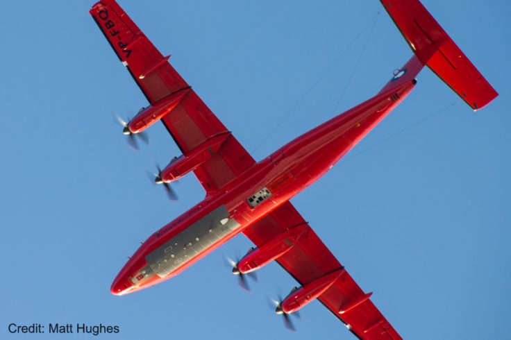
The DASH-7 is being used to calibrate the two satellites that are monitoring sea ice in Antarctica. Credit_Matt Hughes
Sea ice is considered as a key indicator of climate change, because it is extremely vulnerable to human-induced warming. However, measuring the thickness of Antarctic sea ice from space is a difficult and complex process.
Dr Gaelle Veyssiere, an expert on polar sea ice and one of the scientists flying on the DASH-7 , says:
“This project has been years in the planning and will enable us to fully understand the data that ESA and NASA are collecting from space. We know that sea ice is a key part of the jigsaw in understanding environmental change in Antarctica, and this project will answer important questions about what’s happening in places like the Weddell Sea.”

The on-board science laboratory. Photo credit_Carl Robinson
Dr Isobel Lawrence, from ESA, is in Antarctica and flying on the DASH-7. She says:
“This work is essential. It will future-proof sea ice thickness measurements from space.”
This is achieved by carrying an additional set of sensors that are similar to those to be installed by ESA’s next generation satellite radar altimeter, CRISTAL. Data from the air campaign will provide unique observations to align past and future altimeter-based satellite measurements, thus allowing us to bridge observations of Antarctic sea ice from the past and into the future.
Other key information is being collected on the three-dimensional surface topography of the sea ice, as well as the sea ice surface energy budget, measuring incoming and outgoing energy fluxes from changing sea ice conditions.
Observations made by the suite of sensors mounted on the DASH-7 will allow the team to develop more accurate algorithms to determine Antarctic sea ice thickness from space. By applying these algorithms to the historical satellite altimetry record such as CryoSat-2, they will provide a time series of Antarctic sea ice thickness stretching back decades and fill in a major gap in our knowledge of sea ice in the polar regions.
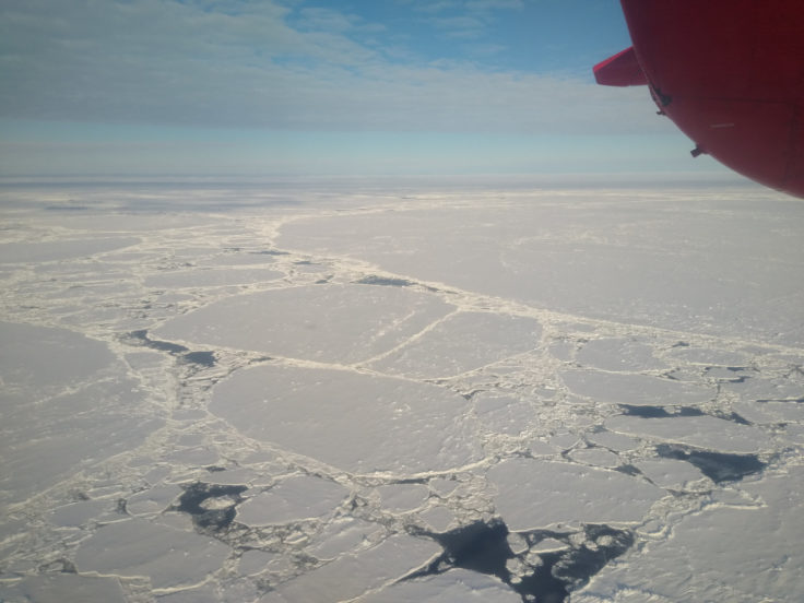
The DEFIANT team has been flying over the Weddell Sea. Photo credit_Carl Robinson
Professor Andy Shepherd, from the University of Leeds, is Principal Scientific Advisor to the CryoSat mission. He says:
“Flying the DASH-7 is an exciting opportunity as it shows that we can bridge the gap that will arise between CryoSat-2 and CRISTAL – Europe’s next polar satellite mission – which won’t launch until the late 2020’s.”
The airborne campaign is part of the DEFIANT and CryoVex projects.
DEFIANT is funded by NERC and aims to understand the drivers and climate implications of recent rapid loss of Antarctic sea ice and is led by Jeremy Wilkinson at British Antarctic Survey. CryoVex is funded by ESA and aims to further our understanding of radar and laser altimetry over land and sea ice and is led Andy Shepherd at the University of Leeds.