Maps

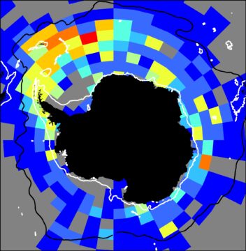
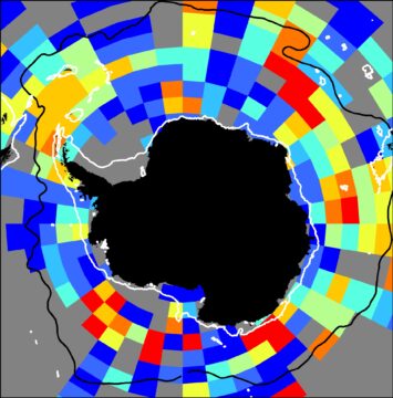
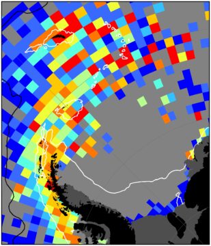
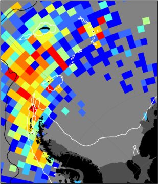
The KRILLBASE density data indicates the relative probability of occurrence for both Antarctic krill and salps at the circumpolar scale and at finer scales in well-sampled areas such as the west Atlantic sector and around Prydz  Bay. The maps on this page are preliminary summaries of these data. We will update these maps on publication of the data paper.


MAP 1: Preliminary unstandardised circumpolar Antarctic krill distribution.

figure9_circum_unstand_krill


MAP 2: Preliminary unstandardised circumpolar salp distribution.

figure9_circum_unstand_salps


MAP 3: Preliminary standardised Antarctic krill distribution in the west Atlantic sector.

figure10_zoom_standard_krill


MAP 4: Preliminary unstandardised salp distribution in the west Atlantic sector.

figure10_zoom_salps