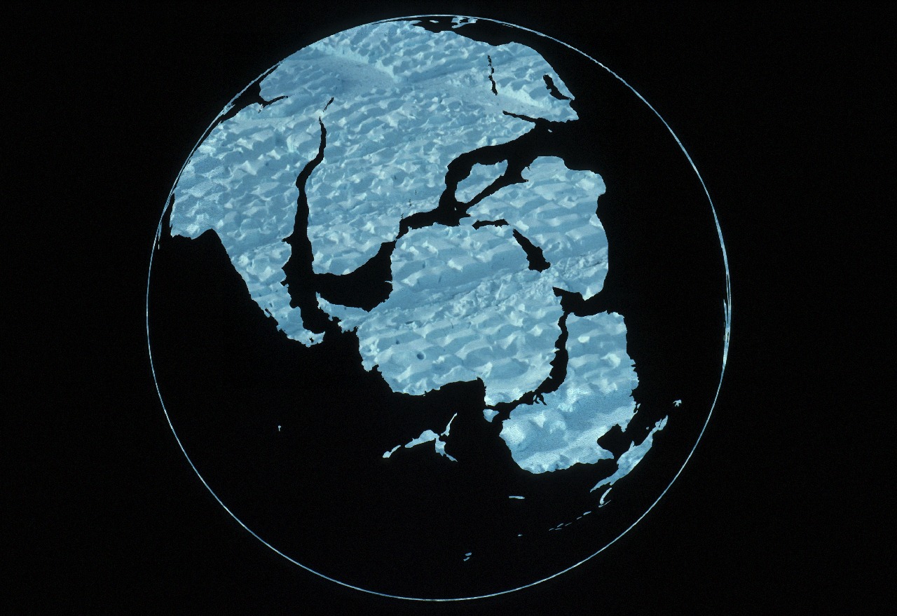
Gondwana, 150 Million Years Ago
An international research team has generated the first comprehensive map of geology beneath the East Antarctic Ice Sheet that will help to understand long-term changes in the largest ice sheet on the planet.
The study, published in the journal Geophysical Research Letters, analyses five years of new geophysical data to provide an improved understanding of the tectonic evolution of the southern supercontinent of Gondwana. The results also help to understand the influence of geology on the evolution and dynamics of the East Antarctic Ice Sheet.
Wilkes Land is a large district in East Antarctica, which fronts the southern Indian Ocean. It was connected to the southern coast of Australia in Gondwana times with geological links to south-west Western Australia, the Great Australian Bight, the Eyre Peninsula and eastern South Australia. This new data confirms that “Australian” geology extends into Antarctica for several hundred kilometres, until it meets “Indian” geology, deep in the interior of Antarctica.
Co-author Dr Fausto Ferraccioli, aerogeophysics group leader at the British Antarctic Survey explains:
“Despite its importance, this remains one of the largest regions on Earth where we lack even a basic knowledge of geology. Through this international collaboration we are obtaining remarkable new views of what lies beneath the East Antarctic Ice Sheet.”
Lead author Dr Alan Aitken said that the data provides the first opportunity to understand geology in an extremely remote region that has immense significance for the East Antarctic Ice Sheet.
“This is a timely study, as recent studies indicate that parts of the East Antarctic Ice Sheet may be more vulnerable to change than previously thought. Our data show that the morphology and properties of the ice-sheet bed are intimately linked to tectonic faults and sedimentary basins that also exist in Australia, and can therefore be characterised,” Dr Aitken said.
“The nature of the ice-sheet bed has a major influence on ice-sheet dynamics and this new information provides us with a better understanding of the largest ice-catchments in East Antarctica. Further work is needed however to characterise the processes occurring at the ice sheet bed, and their overall influence on long-term ice-sheet dynamics, including past and potential future changes of the ice sheet.”
“This new work demonstrates the value of international collaboration in addressing these vast regions of previously unexplored continents,” said co-author Dr. Duncan Young at the University of Texas. “A diverse range of not only technical and logistical resources but scientific skills were required to bring these continental correlations to light.”
The data analysed was collected by the 2008 to 2013 US-UK-Aus ICECAP program that brought together researchers from The University of Texas Institute for Geophysics, the British Antarctic Survey, the Australian Antarctic Division, The University of Bristol, Monash University and The University of Western Australia. ICECAP was funded by the National Science Foundation (US) the National Environment Research Council (UK) The Australian Antarctic Division (Aus) and NASA NASA’s Operation IceBridge (US). Logistical support was provided by the Australian Antarctic Division’s Casey Station.