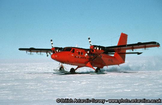
Radio-echo equipped twin otter ( VP-FBL ).
Ambitious science mission sets off for Antarctica
A team of British scientists is making final preparations for an ambitious Antarctic science mission. They aim to discover what’s causing the recent rapid ice loss from Pine Island Glacier on the West Antarctic Ice Sheet and whether this loss will continue to increase or slow down. The research is important for understanding the likely impact on future sea-level rise.
Dr Andy Smith, British Antarctic Survey (BAS) is the Science Programme Manager for the NERC-funded iSTAR programme. Speaking this week at the British Science Festival in Newcastle he said:
“We used to think that the volume of water flowing from Antarctica’s melting glaciers and icebergs into the ocean was equal to the amount of water falling as snow onto the ice sheet; and that this process was keeping the whole system in balance. But Pine Island and Thwaites glaciers on the West Antarctic Ice Sheet (WAIS) are losing ice at a faster rate than they are being replenished. This affects sea level all over the world. The speed of changes to this region has taken scientists by surprise and we need to find out what’s going on.”
Starting in November this year the iSTAR science programme will mount four projects focussed on finding out what’s causing the rapid changes observed in the Amundsen Sea region of the West Antarctic Ice Sheet. Using state-of-the-art technologies, science teams will measure changes to the flow and thickness of glaciers and investigate the role that the ocean plays in transporting warm water beneath ice shelves.
The first group of scientists depart the UK for Antarctica to spend 10 weeks travelling 600 miles (1000km) across the ice sheet by tractor-traverse. They will use ground-based radar and seismic technologies to map the bed beneath Pine Island Glacier. These will help reveal the influence that glacier bed conditions may have on varying the flow and thickness of ice all the way from the floating shelf up into its inland tributaries. Satellite remote sensing technology will allow the science team to measure the changing configuration of the glacier in areas that are inaccessible from the ground.
In January 2014 a team will sail into the Amundsen Sea onboard the RRS James Clark Ross to spend 30 days putting a range of instruments and devices into the ocean near Pine Island Glacier to discover when, where, and how warm ocean water gets close to the ice. Ocean measurements and observations are essential for improving a wide variety of computer models used by the international scientific community to forecast future climate and sea level.
A fleet of ocean robots known as Seagliders will measure the temperature, saltiness and current speeds at different depths in the water. Each time the Seaglider reaches the ocean surface it will send back data using satellite phone technology. The scientists will use the information from Seagliders to work out how the warm water is reaching the ice shelf and whether this is likely to continue in future.
To collect data during the Antarctic winter, when the ocean surface is covered by sea ice and inaccessible for research ships, the team is enlisting the help of 15 seals. Small sensors, temporarily glued to their fur, will capture information such as the temperature and the saltiness. Satellite technology will send information back to the scientists in their laboratories. This research also provides biologists with a better indication of how vulnerable seals might be to climate change. The sensors fall off when the seals moult their fur.
An unmanned submarine (Autosub¹), capable of diving beneath the ice, will make measurements along a pre-defined track then return to the ship with the data. To understand the rate at which the thickness of the ice changes four autonomous radar instruments, engineered to allow year-round operation, will monitor the gradual change of ice shelf thickness with time. This investigation will help the science team determine how heat is transported beneath the ice shelf by ocean currents and what impact changes in the climate will have on this part of Antarctica.
Professor Karen Heywood, University of East Anglia is Principal Investigator of one of the ocean investigations. She says:
“We are attempting to tackle this big science question from a number of different ice and ocean perspectives. Our observations and measurements will be a major contribution to the on-going, and urgent, international scientific effort to understand our changing world. We are confident that our results will bring many benefits to science, to policy and to economic decision-making — which will ultimately contribute to the well-being of our society.”
The iSTAR programme — investigating the stability of the West Antarctic Ice Sheet — is funded by the Natural Environment Research Council (NERC).
¹The Autosub unmanned submarine, designed and built by engineers at NERC’s National Oceanography Centre, has already proved itself on preliminary missions beneath Pine Island Glacier in 2009.
More information
- iSTAR project website
- iSTAR project page
- Follow iSTAR on twitter
Contacts
Press Office Contact:
- Paul Seagrove, Tel: +44 (0)1223 221414; +44 07736 921693 email: psea@bas.ac.uk
- Paul Holland, Tel: +44 (0)1223 221226; +44 07740 822229; email: pbmho@bas.ac.uk