In a significant milestone for Antarctic research, detailed and extensive information on ice thickness and bed topography is now available for the first time in a centralised and standardised format.
The comprehensive dataset, compiled over the last 60 years through ground-based and airborne surveys by more than 50 institutions, provides valuable information about the ice and rock that make up Antarctica and will be crucial in aiding our predictions of future ice loss and sea level rise.
Led by the Bedmap3 Action Group and supported by the Scientific Committee on Antarctic Research, Bedmap3 has significantly more data and coverage than the previous iteration, released a decade ago. 52 million new data points and 1.9 million kilometres of measurements have been added, more than doubling the amount of data available. 84 new surveys have filled in major gaps, particularly in East Antarctica – including the South Pole, and now covers glacier troughs and floating ice shelves, giving new insights into previously unsampled areas.
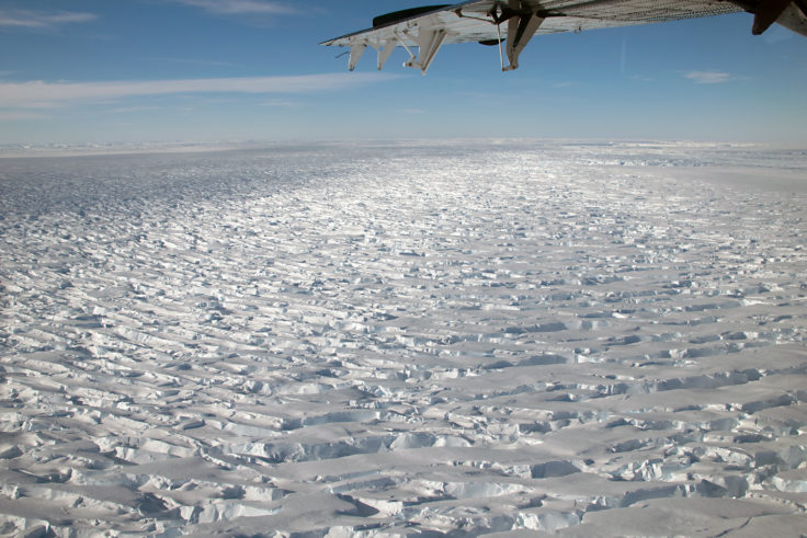
A plane flies over Thwaites Glacier. Photo credit_BAS.
Crucially, the underlying data has been made freely and easily accessible for all researchers. Using Fair data principles – Findable, Accessible, Interoperable and Reusable – and using internationally agreed, consistent formats of data, this dataset now paves the way for developing more accurate models of future ice loss and sea level rise.
Alice Frémand, Scientific Data Manager at British Antarctic Survey (BAS), and lead author of the paper, says:
“Up until now, it has been a slow, difficult process for researchers to use this data and means there is often a big time lag between data being collected and being used. Given how quickly parts of the Antarctic peninsula are changing, this is time we don’t have.
“The significance of this achievement cannot be overstated. For the first time, researchers around the world will have easy, open access to a wealth of comprehensive and reliable information on Antarctic ice thickness and bed topography.”
Bedmap data has primarily been collected through more than 270 ground-based and airborne radio-echo sounding and seismic surveys.
Peter Fretwell, Geographic Information Officer and co-author at BAS, says:
“This is a real community effort, with more than 80 international partners contributing. The success of this project highlights the importance of international collaboration and data sharing in advancing scientific research.”
This project represents a major step forward in future research and predictions regarding Antarctica’s contribution to sea level rise. This in turn will help policy makers develop climate change strategies and mitigate against rising oceans.
“Antarctic Bedmap data: Findable, Accessible, Interoperable and Reusable (FAIR) sharing of 60 years of ice bed, surface and thickness data”by Frémand, A.C. et al. is published in Earth System Science Data.
You can access the data through the SCAR Bedmap Data Portal.