Working in Antarctica often means making the best out of what you got. For the Rothera 2022 wintering team, this meant spending a winter without diving, which had to be suspended due to unforeseen circumstances.
Diving is a tool that allows marine scientists to access their underwater office and conduct a range of data collection such as the deployment of underwater experiments, species collection, surveys of the seabed, the use of specialised equipment to measure species responses and much more. In order to gain an accurate understanding of what is happening in Antarctic marine environments, divers need to be up close and personal with their subject. We call this type of work ‘in situ’ observations.
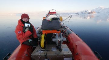
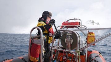
The Rothera Remote Operated Vehicle (ROV) being prepared by Boating Officer Louis Day
If diving isn’t possible, other tools can also be used to sample the marine environment and contribute towards maintaining long term time series to document changes over the years. Remotely Operated Vehicles (ROVs) are pilot operated underwater robots.
Our ROV is called DEBRA, short for deep environment benthic research apparatus. DEBRA can dive to depths way beyond our diving limit; our limit is 30 meters where our time permitted on the bottom is only 15 minutes. DEBRA can dive to 100 meters and can be fitted with a claw or a Go Pro and can stay at this depth for 3 hours! The claw is manoeuvrable in four axis so it can rotate, open and close.
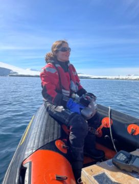
Marine biologist Nadia Frontier launching the ROV
A series of underwater deployments were deployed in 2017 by marine biologist Ben Robinson, as part of his PhD research. Rocks and Perspex settlement panels were set across three depths, 30, 60 and 100 m. The aim was to monitor the settlement of sessile (non-mobile) invertebrates and make a comparison across different depths as well as to compare species diversity between natural versus artificial substrate. Collecting samples which have been deployed for five years is exceptionally rare and presents its challenges.
First, the ever imposing threat of icebergs threaten the integrity of these deployments. Icebergs have a deep keel and have the ability to scour the seabed and take any existing structures along with it.
Second, DEBRA is deployed from a boat down to 100 meters on specific waypoints.
ROV operations must be conducted in calm conditions with little swell and wind below 10 knots. It is connected to the boat with a tether and controlled via a little video screen and joystick. Imagine playing super-reactive video games in wavy conditions, a delicate operation. Many hours are spent searching for these underwater deployments which are marked with a 1m length of rope and a subsurface buoy. Upon location, the pilot uses precise movements to open the claw, inch forwards and pinch the subsurface rope. This is all visible on the controller screen. The claw is closed and the sample is slowly hauled to the surface. Samples are then processed and analysed in the Bonner laboratory.
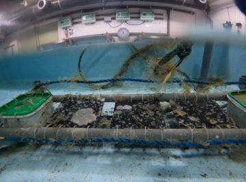
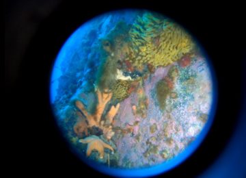
Settlement panels are used to understand colonization and succession in marine environments
In order to identify bryozoan species, the rocks and panels must be completely dry to distinguish between features. Multiple photos of the settlement panels are stitched together and allow the percentage cover of species to be assessed. Competition between species can be assessed between the panels across the depth transect.
We continued to conduct the weekly CTD and water sampling events over our winter, part of the Rothera Time Series (RaTS), an oceanographic data set which has been ongoing for the past 25 years. The CTD measures conductivity, temperature and depth. It also measures pigment levels in the water, which show how much phytoplankton there is, allowing an assessment of the water primary production. Productivity changes throughout the seasons with changing sunlight and sea ice.
Dive Officer Alice Clement deploying a plankton net on the boat winch
Collecting this data is extremely valuable to monitor long-term changes. The more phytoplankton in the water, the more food is available for larger organisms to feed, supporting complex food webs.
As we were not diving, the dive officer helped with the science side of the Bonner research. This included setting up a new project, conducting vertical plankton trawls in Ryder Bay. Different depths and times of year were sampled in order to assess any changes within the planktonic communities and populations.

Larvae captured in a pelagic plankton trawl
The data from this sampling showed a range of organisms in the water column and gives us more information of organism’s pelagic larval stages of their life cycle. Changes in organism abundance could potentially be linked back to the phytoplankton levels in the water, as a food source, which are measured by the water sampling and CTD.
In addition to water sampling, biological long term time series involve the monthly collection of eight dominant invertebrate species. This time series began in 1997 and aim to document the reproductive patterns of marine invertebrates in response to environmental factors. For examples, questions such as ‘in warming waters, will invertebrates be more or less efficient at producing the next generation?’ can be answered. The utility of multiyear data will permit the identification of long term signals associated with climate change. Usually, divers would collect these animals from two sites in Ryder Bay. This year, we have used a combination of Van Veen grabs, to collect bivalves that burrow into the sediment, and baited traps which attract brittle stars in particular. Furthermore, the subsurface rope that is used to mark deployments, collected using the ROV, provide an excellent settlement substrate for sea squirts and sea cucumbers. Species collected on theses ropes have also contributed towards the monthly species collection.
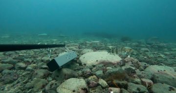
Using the ROV to monitor feeding activity of benthic invertebrates
The marine team also participate in a project to monitor marine invertebrate feeding activity. Ordinarily, divers would swim along a pre-defined transect and visually record feeding in suspension feeders. The aim is to establish the timing of periods of feeding and non-feeding to relate the timing of summer feeding activity to that of the seasonal phytoplankton bloom and dynamics of winter sea ice .The switch from feeding to non-feeding can occur in a matter of weeks where a whole colony of sessile invertebrates could transition from feeding to not feeding and vice versa. We used our ROV to replicate the dive surveys, which can give similar results.
Another fantastic tool that can be deployed from our boats are Baited Remote Underwater Video Systems (BRUVS for short). These rigs are deployed either on the sea bed or mid water to sample fish assemblages and gather data about species which are otherwise mostly illusive when diving due the disturbance caused by divers. Two cameras are positioned at a fixed distance on each rig.
An Antarctic ice fish filmed near the bait box.
Once a fish is identified during video playback, trigonometry can be used to calculate its length. This provides information about the structure of fish populations.
In conclusion, the Bonner team has been able to fulfil key research goals without diving and continue to collect environmental and biological data to understand how changes will affect polar diversity. The outcome of this work will provide an insight into the impacts environmental change will have on the natural world and contribute towards future conservation measures.
This is a great example of creativity, ingenuity and perseverance, traits that have defined the success of early polar explorers and are essential to working in Antarctica to this day.