A British Antarctic Survey team has just returned from a three-week science cruise with National Geographic on board the RRS James Clark Ross around Ascension Island’s seamounts. This five-part blog, today by marine biologist Ali Massey, provides an insight into the vital role of scientific research in informing conservation policy.
Sunday 21st May 2017
After 19 hours travel from the UK via Lisbon, we exit Recife airport into the humid 28oC air and take a short taxi-ride to the port where we join the BAS research ship RRS James Clark Ross. After months of planning and preparation the National Geographic Pristine Seas Ascension Island Charter is about to start and, as marine benthic ecologist Dave Barnes explains, the BAS team are playing an important role:
The National Geographic expedition should provide vital scientific underpinning for the huge planned Marine Protected Area (MPA) around Ascension Island. This MPA will be one of the world’s largest and a major component to the ‘blue belt’ conservation plans of the UK. Three seamounts (underwater mountains), Harris-Stewart, Grattan & an un-named are possibly some of the most important areas within this vast marine sanctuary, but very little is known about their biodiversity.
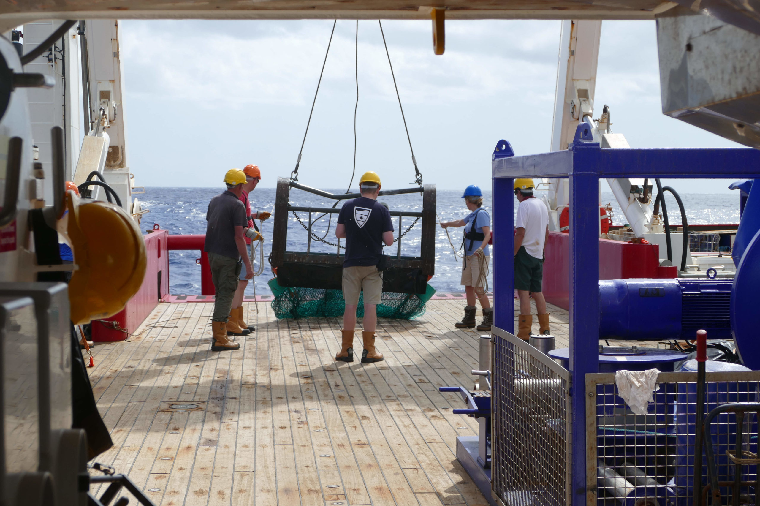
The BAS team will first map the physical nature of the seabed. They will then deploy a CTD (Conductivity, Temperature and Depth measurement device) that will measure the physical and chemical nature of the water above the seamounts. Plankton nets will be deployed by day and night to investigate bands of jellyfish near the surface, salps below these, and crustaceans below them both. Then they will explore the seabed with a camera lander to capture high definition photographs and video of the benthos, and finally a trawl will be towed to capture actual animal specimens to confirm identities using genetics and microstructure under the microscope.
This suite of activities will allow biologists to characterise the ecosystem structure and how it varies with the physical attributes of the seabed and water column. We should be able to see what makes the seamounts special in terms of animals which only occur there (endemics), regional and global rarities and yet others which are important indicator species (eg sentinels of climate change). All of this greatly helps in assessing what threats are present, what is vulnerable and how best to monitor the rich, and likely sensitive area in the middle of the Atlantic.

Matt and Rich demonstrating the correct donning of the immersion
As with any project health and safety is paramount, so one of the first jobs on board is to run through the emergency drills. This is a chance for us to try on our lifejackets and immersion suits and to familiarise ourselves with the routes to the life boats – training we hope never to need!
As the last items of equipment are loaded on board the crew and science teams gather on the dock for a team photo and there is a clear sense of excitement over our pending departure.
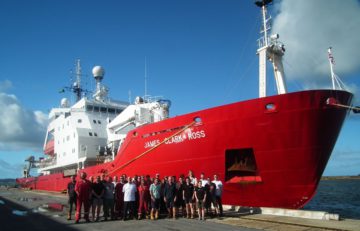
The team at Recife: National Geographic, BAS, Ascension Island Government and Exeter University
Thursday 25th May
It never ceases to amaze me just how vast our oceans are; it will take us three full days to travel the 2000 km from Recife to our first sampling location: the Harris seamount. In that time we frequently pass over areas of water that are several kilometres deep, as I write this blog entry the current water depth is 5456m!
On this expedition we will be surveying three seamounts in the region of Ascension Island- Harris-Stewart, Grattan and ‘un-named’. Seamounts are submarine mountains, different from islands as their tops do not break the sea surface and often lie 100’s or even 1000’s of metres below it. These underwater mountains, rising up from the deep ocean floor, provide a habitat for benthic marine life, which in turn offers food and shelter for the pelagic species. Seamounts can be thought of as the oceanic equivalents of desert oases and are teeming with life compared to the barren deep-sea floor below; they become mid-ocean feeding stations for the long-distance travellers and important breeding and nursery grounds for many species of fish. For this reason, seamounts are often targeted as prime fishing grounds and until recently very little was done to protect these fragile habitats.
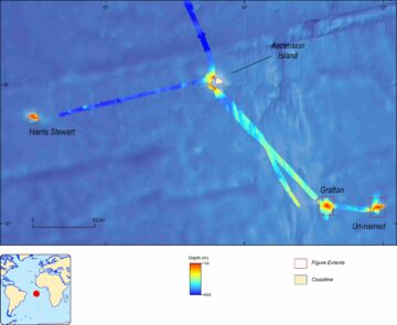
Map of seamount locations
The key to effective management is understanding. There are an estimated 100,000 seamounts in the world yet less than 0.5% of them have been studied. It is for this reason that the National Geographic Pristine Seas team and Ascension Island Government have highlighted these seamounts as a crucial part of the ocean to be mapped and surveyed; the BAS team have been invited to provide some of the essential science support required for such a trip.
With greater understanding comes the knowledge of how best to protect these highly productive yet fragile areas and, with careful management and allocation of marine protected areas, allow managed fishing grounds for decades to come; thus giving protection to the oceans and the fisheries, benefiting both the marine and human lives which depend on them.
As we draw nearer to Harris-Stewart there is a great sense of anticipation on board. The mind-boggling array of equipment is checked and re-checked and the whole team meet to make a plan of action. Like something out of a Bond movie Paul draws up plans on his whiteboard; Matt & Chris prepare their “spy-cams” specially designed to withstand the pressures the deep ocean will inflict on them; Seth fine tunes the CTD instrument which will take measurements of salinity, temperature and depth right down to 1000m; Floyd, Sam and Matt calculate the perfect lines for the swath bathymetry which will produce the first ever detailed maps of the seamount and surrounding seafloor; Nigel and Jude prepare to satellite-tag tuna and sharks; whilst Pete, Dave, Chester, Gabi and Will rig up their SUCS camera system for high resolution images of the sea floor and a variety of nets to sample plankton and benthic marine life. We will sneak up on Harris-Stewart tonight, under cover of darkness, and leave 24 hours later with an incredible view of this previously unexplored seamount.
I need to get some sleep in order to be ready for the day’s sampling tomorrow, but like the princess and the pea I’m not sure how I am going to sleep with the thought of waking up with a seamount effectively underneath my mattress!