The challenges of glacier travel
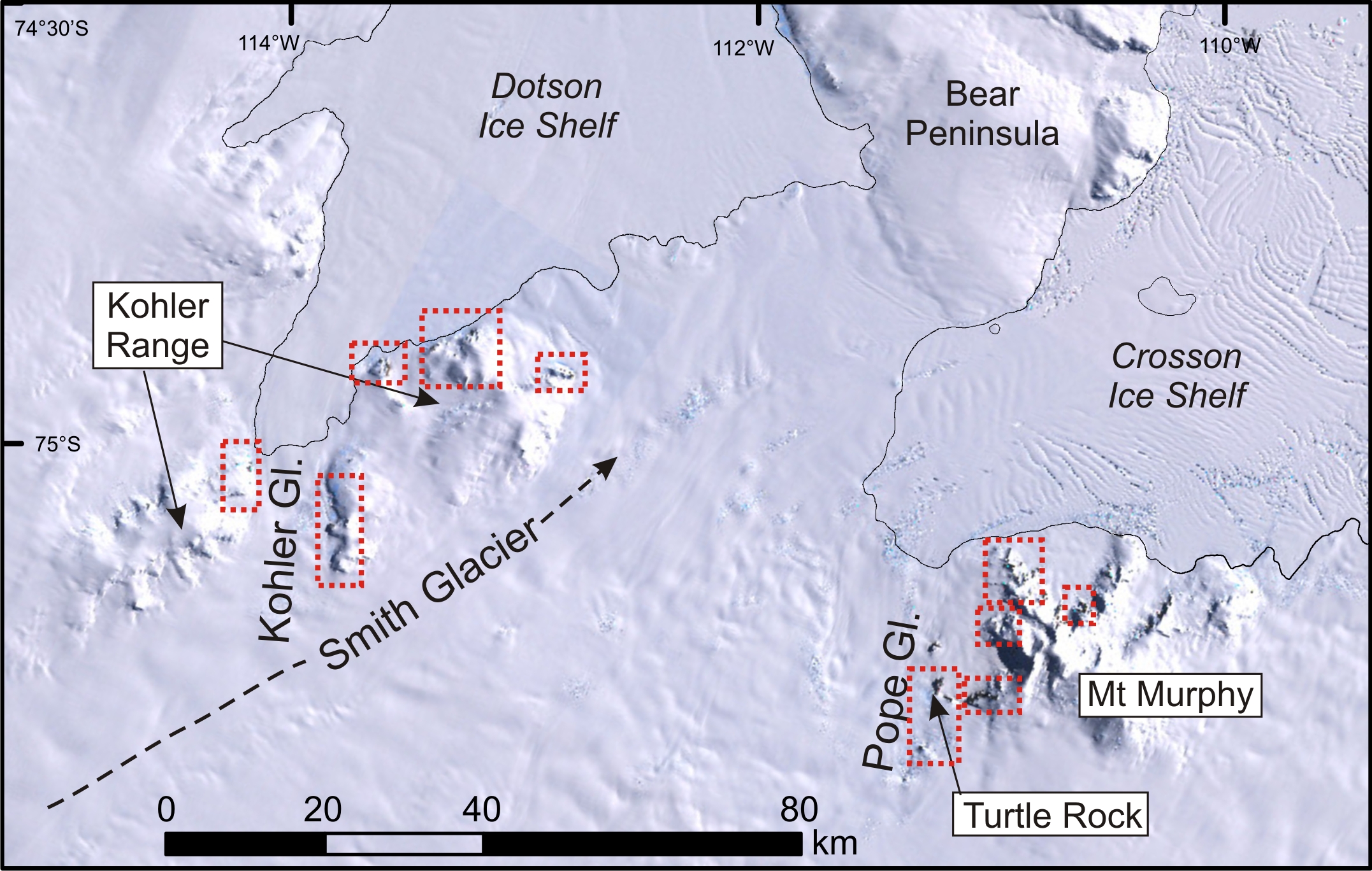
The ANiSEED project field area lies between two of the most rapidly changing glaciers in Antarctica, the Smith and Kohler Glaciers. These have thinned more than 9 metres per year over the past two decades. One of the aims of our project is to find out whether such dramatic thinning has happened in the past, and if so, when.
We are using the mountains here as dipsticks, collecting rock samples from different heights to tell us how the ice sheet thickness has changed through time. We are working close to the grounding line, the point at which a glacier is no longer resting on the underlying rock, but where it is floating on the ocean. Near this point, lots of fissures and cracks (crevasses) appear in the ice – sometimes wide and deep enough to fit several houses in – because it is under a lot of stress. Our field guides, Iain and Al, have the tricky task of getting us safely to our work sites, and moving camp with all our gear as well, in areas where we know (from satellite imagery and old aerial photos) there are many crevasses. They must consider the constantly changing environmental conditions and requirements of our scientific work. Here Iain tells us about travelling across this amazing landscape:
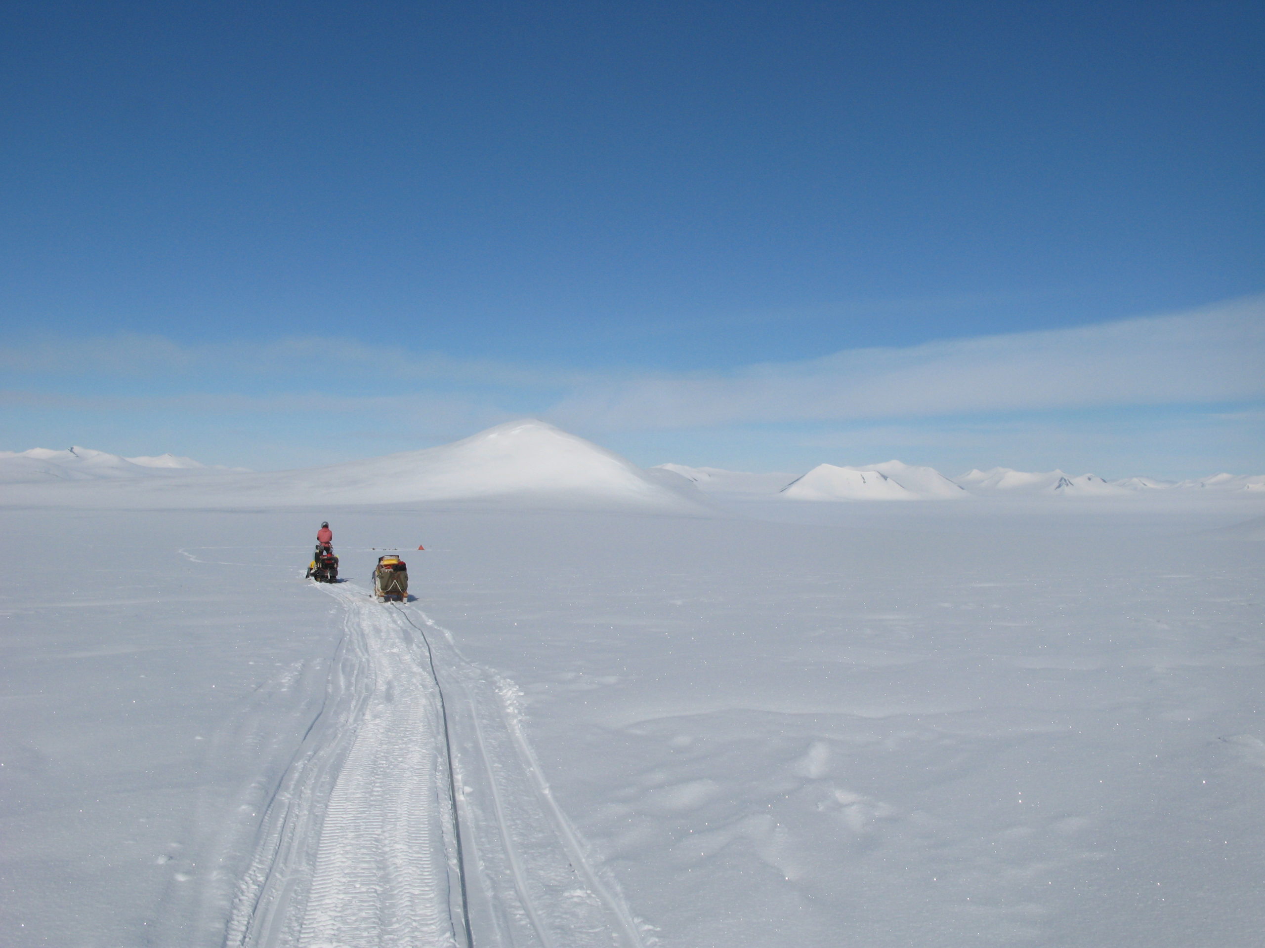
Map showing where the fieldwork is taking place
“The terrain through which we journey daily for Jo and Steve’s project is vertiginous and heavily crevassed. One of the logistical challenges for us as field guides is to find safe routes to access work sites and travel between camps. Ideally, one would opt for crevasse-free routes even though they may be much circuitous, as they offer a risk-free way of travelling between locations. The Mount Murphy area we are working in does not always allow for this option, such that on occasion, we have to weave our way through crevasse fields using standard navigational techniques and our knowledge of glaciers and their movements.
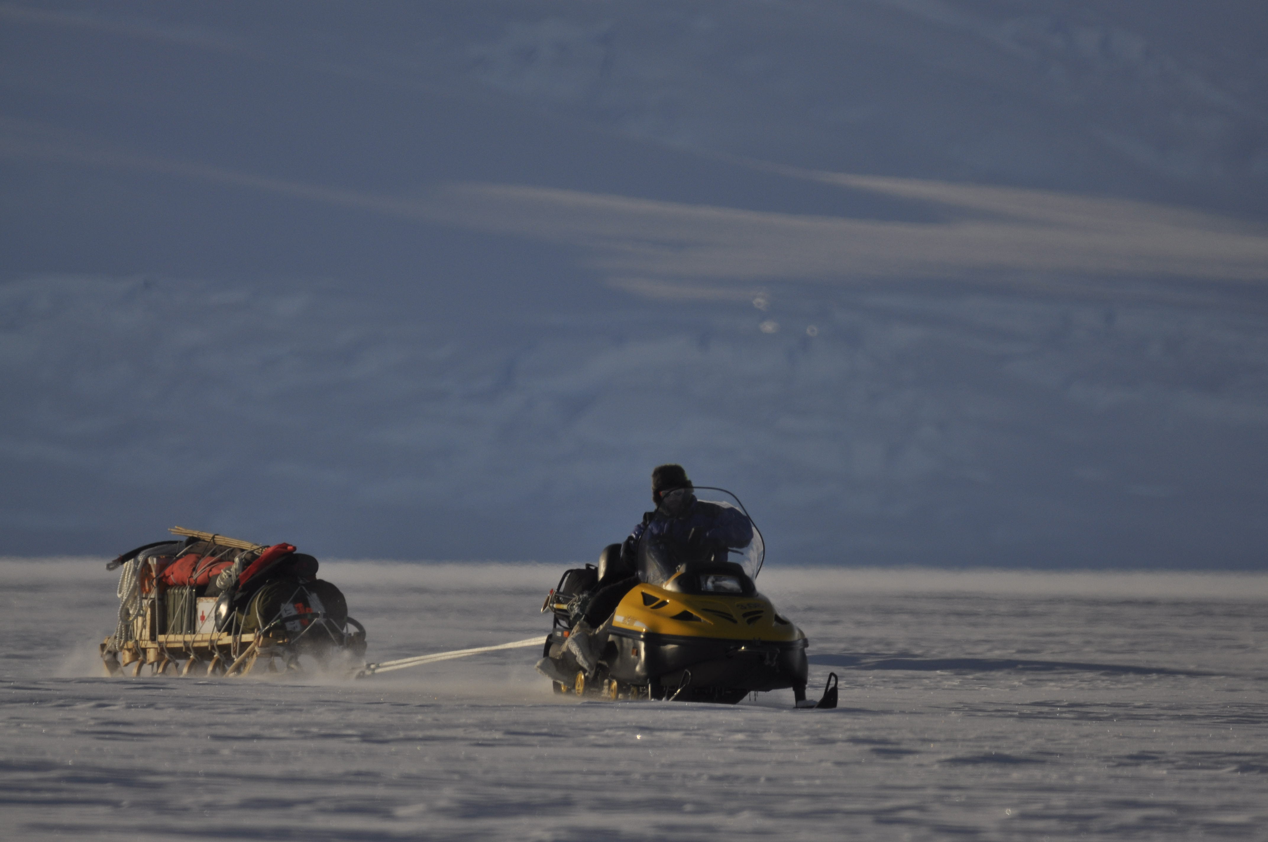
Travelling by ski-doo
Often we will first ski a route through a crevassed area prior to venturing over it with our train of skidoos and sledges; doing a U-turn is far simpler on skis should we see something we don’t like! Upon encountering an unavoidable hazard, we assess the bridge of snow covering the crevasse to ascertain its strength and stability. This is achieved by probing it to determine its thickness, then by walking over it (whilst safely roped) to discover its load-bearing limits. Once satisfied, we proceed to travel over the crevasse safe in the knowledge we can do so without incident.
A myriad of other factors have to be considered with crevasse travel, such as crossing during the coldest period of the day, to ensure the snow is at its most frozen or taking into account recent weather patterns like heavy snowfall. Ultimately though, however daunting, it is extremely satisfying to thread the eye of the proverbial needle and find a safe way through what initially looked impossible terrain, allowing the project to continue to achieve its goals.”
In November 2015 geologist Joanne Johnson and 3 colleagues set off to work at one of the most remote parts of Antarctica to find out what’s causing the changes to the West Antarctic Ice Sheet.