Operation Tabarin – first bases
Britian’s modern exploration of Antarctica began with Operation Tabarin, a secret World War II mission to establish bases.
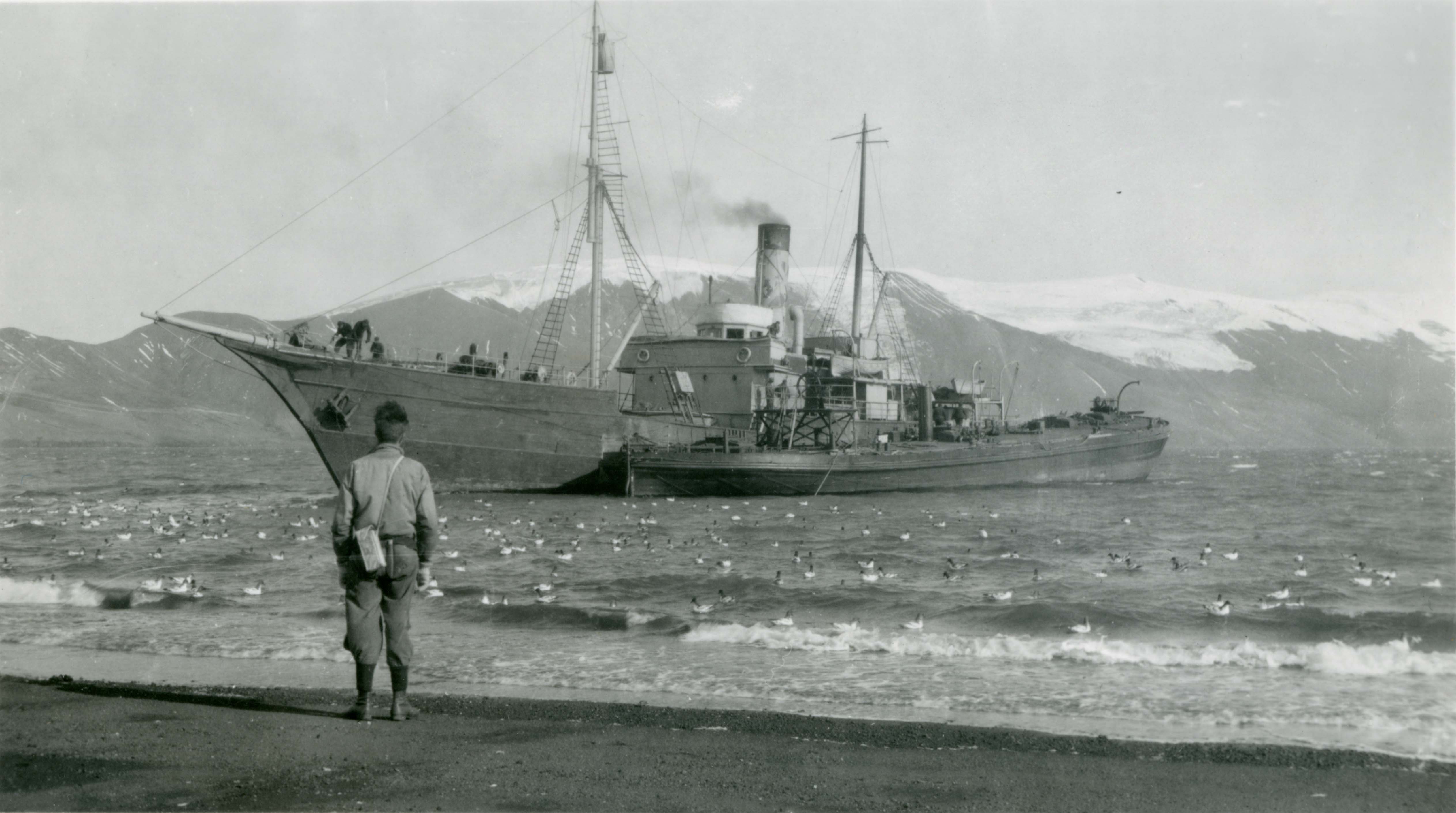
HMS Scoresby and SS Fitzroy arrived at Deception Island 3 February 1944. This was the site of Base B, the first to be established by Operation Tabarin.
The disused whaling station buildings were occupied by five explorers who were to stay over the winter, living off stores unloaded from the two ships.
Base B
Geologist and base leader at Deception Island William Flett recalled how the old whaling station was converted for use by the 1944/1945 wintering party:
“Immediately after landing it was thought advisable to settle the problem of accommodation for the party without delay. Two of the dormitories, erected by the former lessees of the whaling station, and both of which were in remarkably good state of repair, were surveyed [and the dormitory with the best view of the bay selected]…
“Before proceeding with alterations to the house, it was considered expedient to establish the identity of the building and its inhabitants for the benefit of casual visitors.
“So, on the 7th February, a white table-top was converted into a signboard, on which was stencilled the British Imperial monogram and the words Port Foster Post Office. Its claim to be the farthest South Post Office was quickly outmoded by the establishment of a Post Office, at Port Lockroy, by the Base “A” Party…
“The Base was singularly fortunate in having a large amount of salvage material and members of the party exercised their skill and ingenuity in several ways in contriving small additions to the furnishings of the house and Base equipment – a form of occupational recreation which has much to recommend it.”
Base A
Victor Marchesi, captain of the Scoresby, explains the decision:
The ships sailed on 11 February for Hope Bay, where the crew planned to set up Base A. But they had to select an alternate site, at Port Lockroy on Goudier Island, when pack ice in the bay prevented Fitzroy from entering.
There were no existing buildings at Port Lockroy, unlike Base B, where the expedition occupied the abandoned whaling station.
Tabarin’s medical officer, Eric Back, recalls the process:
The exhibition crew laboured to erect a prefabricated building supplied by the Boulton and Paul company in Britain. They slept in relative comfort on Fitzroy until the ship departed.
Tabarin’s commander, James Marr reported with pride on his team’s building efforts in his report to the Governor:
“This building, for it can hardly be described as a hut, had been named Bransfield House. It is strong and commodious and is possibly a more elaborate building than has hitherto been erected in Antarctica – at any rate by a British expedition.
“Of the whole structure only the… workroom, together with the kitchen, is the original Boulton and Paul hut we brought with us from England. The remainder, comprising mess room, cabins, store room, scullery and the rest, was put together from a motley collection of materials – corrugated iron, timber and lining paper from Deception, heavy beams dating from the whaling days dug up out of the ice on Wiencke Island, the woodwork and beaver board of the second Nissen hut which was not erected, packing cases and junk of every description, the whole eked out with a quantity of timber, sisalkraft and aluminium foil supplied as good measure by Boulton and Paul along with the original hut.
“We are indebted this fine residence to the energy, genius and craftsmanship of Lewis Ashton, the carpenter, who in a hundred other ways has proven himself to be a most valuable member of the expedition.”