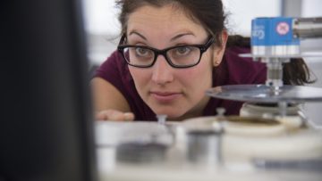
Aerogroup Gravity
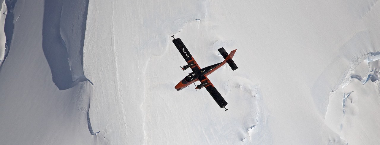
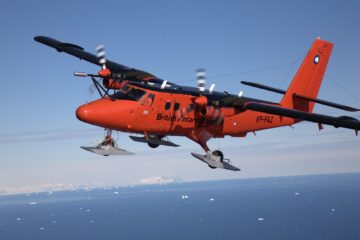
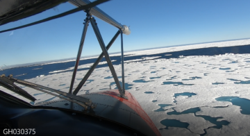
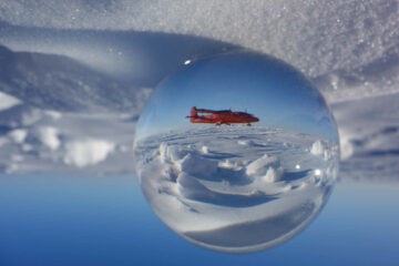
Airborne science and technology
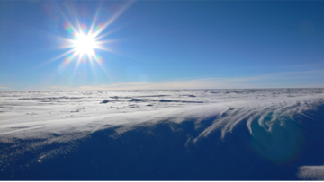
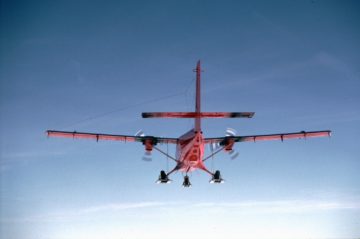
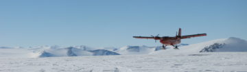
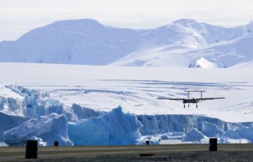
Airborne science and technology, Antarctica
Our airborne national capability
Our airborne science and technology services and facilities contribute to a National Capability programme that is supported by the UK Government and NERC.
Accessing our services
Scientific community access to Antarctic and Arctic infrastructure is coordinated and managed by BAS through the Collaborative Antarctic Science Scheme and opportunities for polar fieldwork for NERC-funded scientists. We encourage you to contact us as soon as possible to discuss your project requirements. Scientific instruments, sensors and equipment that will be deployed on Twin Otter aircraft require time for installation and certification. Depending on the instrumentation to be fitted it may be necessary that integration, installation and testing cost are paid.
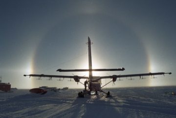
BAS Air Unit support services
- Provide the installation guidance and management of science survey equipment onto the BAS Twin Otters and Dash 7.
- Carry out the installation and certification of the science survey equipment
- Maintain the core BAS survey equipment
- Provide survey equipment engineering support during science campaigns
- Provide the guidance and oversight of UAS flying in Antarctica
- Provide the development of BAS UAV capability.
Focal point for UK polar science our aims are to:
- Sustain a UK national capability that delivers scientific understanding of environmental processes over large time and space scales, supports world-leading environmental science, and meets national needs
- Enable the most ambitious Earth-system science by facilitating long-term, global-scale programmes that integrate research across disciplines
- Reduce the long-term cost of our large research facilities and invest in new technologies that make far-reaching environmental research and observation more cost-effective
- Ensure that our research centre thrives as vibrant, innovative, sustainable organisation that attracts and retains the best scientists
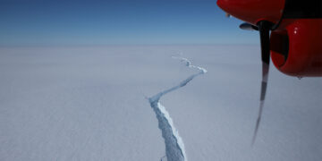
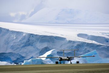
Airborne Geophysics
BAS will deliver an airborne geophysical capability deployed on low-cost piloted and autonomous aircraft. This instrument suite includes gravimeter, magnetometers and ice-penetrating radar, which can be flown with LIDAR in support. The suite has been widely employed on NERC and other grants. Details here
Airborne meteorological and atmospheric instrument suite (MASIN)
BAS will deliver an instrumented aircraft with suite of atmospheric instruments and scientific expertise ready-to-support grants, collaborations, and strategic programmes.
-
Aerial photography camera
Read more of: Aerial photography cameraBAS uses aerial photography taken with this camera for topographic, geological and vegetation mapping, interpreting satellite imagery and counting populations of penguins and seals.
-
-
-
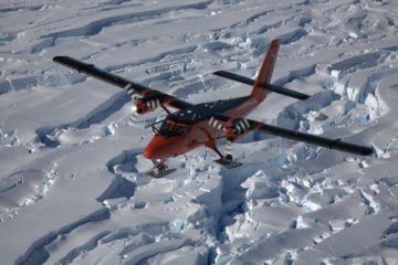
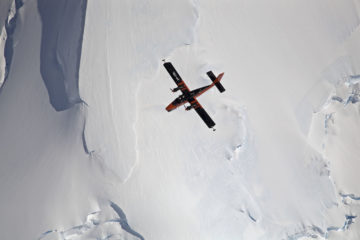
Airborne Remote Sensing
Read more of: Airborne Remote SensingTwo of the four BAS Twin Otters are equipped with a full remote sensing capability, providing scientists with data on land, ice and sea.
-
International Thwaites Glacier Collaboration
Read more of: International Thwaites Glacier CollaborationThe International Thwaites Glacier Collaboration unites global scientists to study Antarctica’s most vulnerable glacier, predict sea-level rise, and inform climate action worldwide.
-
Brunt Ice Shelf movement
Read more of: Brunt Ice Shelf movementBritish Antarctic Survey is monitoring glaciological changes on the Brunt Ice Shelf, home to Halley Research Station.
-
Arctic Summer-time Cyclones
Read more of: Arctic Summer-time CyclonesThe overarching goal of the project is to determine the role of sea-ice surface properties in Arctic cyclone dynamics and to characterise the interaction of Arctic cyclones with the summer-time Arctic environment.
-
BEAMISH: Basal Conditions on Rutford Ice Stream
Read more of: BEAMISH: Basal Conditions on Rutford Ice StreamBEAMISH drilled through over 2 km of ice on Rutford Ice Stream to discover when the West Antarctic Ice Sheet last collapsed and how water and soft sediments beneath it help the ice flow towards the sea.
-
Filchner Ice Shelf System, Antarctica
Read more of: Filchner Ice Shelf System, AntarcticaThis project investigated the stability of Antarctica’s Filchner Ice Shelf to produce sea-level projections using hot water drilling, ocean measurements beneath the ice shelf, sediment coring, radar surveys and autonomous submersibles.
-
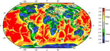
How the Earth’s crust influences ice sheets
Read more of: How the Earth’s crust influences ice sheetsGOCE+Antarctica- Dynamic Antarctic Lithosphere uses GOCE satellite gravity gradient data, GPS data and innovative 3D modelling to study the Antarctic lithosphere and its influence on the overlying ice sheets, including the process of glacio-isostatic adjustment (GIA).
-
National Capability for Global Challenges
Read more of: National Capability for Global ChallengesPolar Expertise – Supporting Development
-
PRESCIENT
Read more of: PRESCIENTPRESCIENT supports long-term, strategically important measurements and capabilities for the wider science community.
-
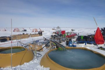
Drilling for success
Read more of: Drilling for successIn January 2019 a science and engineering team drilled over two kilometres through the ice sheet in West Antarctica using hot water. It was the first time they had done this […]
-
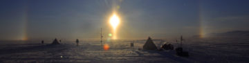
ANTARCTIC BLOG: Science from the air #5
Read more of: ANTARCTIC BLOG: Science from the air #5Wrapping up I have started several of my blog posts saying I am writing in various odd/unusual/uncomfortable locations…the back of a Twin Otter, or in a mountain tent high on […]
-
ANTARCTIC BLOG: Science from the air #4
Read more of: ANTARCTIC BLOG: Science from the air #4Culture shock Just over two weeks ago I was writing this blog hunched up in a mountain tent, having not washed for a week, and with the company of just […]
-
ANTARCTIC BLOG: Science from the air #3
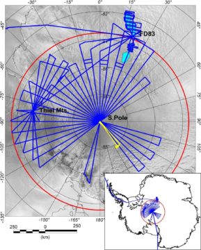
Read more of: ANTARCTIC BLOG: Science from the air #3One week on from departing Rothera into the field and the first leg of the PolarGAP survey at FD83 is almost over, I get to sit back, relax a bit […]
-
ANTARCTIC BLOG: Science from the air #2
Read more of: ANTARCTIC BLOG: Science from the air #2The altimeter in the front of the Twin Otter aircraft is showing 8500 ft as we cruise due south from Rothera research station for the next leg in our PolarGAP […]

-
ANTARCTIC BLOG: Science from the air #1
Read more of: ANTARCTIC BLOG: Science from the air #1Tom Jordan is part of the PolarGAP project, an ambitious international collaboration which will use airborne geophysics to explore one of the last known frontiers on our planet – the […]
-
Cloud scientists take to the skies to solve climate uncertainty
Read more of: Cloud scientists take to the skies to solve climate uncertaintyA project looking at how clouds affect climate change in Antarctica starts its second year of field research this month. The Southern Ocean Clouds (SOC) project, which is part of the CloudSense programme, will carry out research on the RRS Sir David Attenborough and at Rothera Research Station in Antarctica.
-
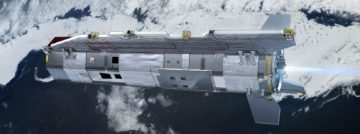
First flights of uncrewed aircraft in Antarctica
Read more of: First flights of uncrewed aircraft in AntarcticaA team testing the Windracers ULTRA drone in Antarctica has shared the first video footage of the aircraft flying autonomously over British Antarctic Survey’s (BAS) Rothera Research Station and its nearby islands.
-
Pilotless plane test crew arrives in Antarctica
Read more of: Pilotless plane test crew arrives in AntarcticaA team have arrived at Rothera Research Station, ready to start testing the new Windracers ULTRA autonomous drone in Antarctica. If successful, the new drone platform could represent a major addition to British Antarctic Survey’s scientific capability on the frozen continent.
-
Ground beneath Thwaites Glacier mapped for first time
Read more of: Ground beneath Thwaites Glacier mapped for first timeThe ground beneath Antarctica’s most vulnerable glacier has been mapped for the first time, helping scientists to better understand how it is being affected by climate change. Analysis of the […]
-
Flying campaign to improve climate modelling begins
Read more of: Flying campaign to improve climate modelling beginsA team of scientists are currently conducting a major experiment over the Southern Ocean that will help to improve climate modelling. The Southern Ocean Clouds project team are performing several […]
-
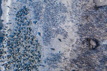
Drones survey wildlife populations in remote Sub-Antarctic island
Read more of: Drones survey wildlife populations in remote Sub-Antarctic islandNext generation fixed-wing drones, capable of operating autonomously beyond the standard visual line of sight, are creating datasets of major wildlife populations around South Georgia for long-term monitoring to aid […]
-
Antarctica’s magnetic link to ancient neighbours
Read more of: Antarctica’s magnetic link to ancient neighboursFor the first time, an international team of scientists has used satellite magnetic data from ESA’s Swarm mission, together with aeromagnetic data, to help reveal the mysteries of the geology […]
-
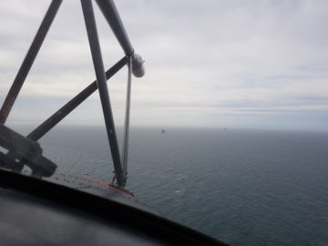
Scientists to study methane emissions in North Sea
Read more of: Scientists to study methane emissions in North SeaScientists embark on a three-week flying campaign today (23 April) to study methane emissions from gas fields in the southern North Sea. Using specialised scientific equipment, on board one of […]
-
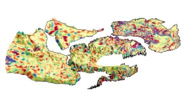
Enhanced views of Earth tectonics
Read more of: Enhanced views of Earth tectonicsUnveiling key geological features of the Earth’s lithosphere
-
Subglacial valleys and mountain ranges discovered near South Pole
Read more of: Subglacial valleys and mountain ranges discovered near South PoleRevealing Antarctica’s hidden world
-
Air unit awarded prestigious aviation award
Read more of: Air unit awarded prestigious aviation awardThe British Antarctic Survey Air Unit have been awarded the Johnston Memorial Trophy for 2017 by The Honourable Company of Air Pilots. This is a considerable acknowledgement of the regard held […]
-
New field season begins
Read more of: New field season beginsAs spring returns to the southern hemisphere British Antarctic Survey (BAS) has started another research season which will take them over land, sea and ice in search of answers to […]
-
Polar experts offer expertise to the developing world
Read more of: Polar experts offer expertise to the developing worldODA funds – expertise to address major challenges facing the developing world