
AI Team Lead

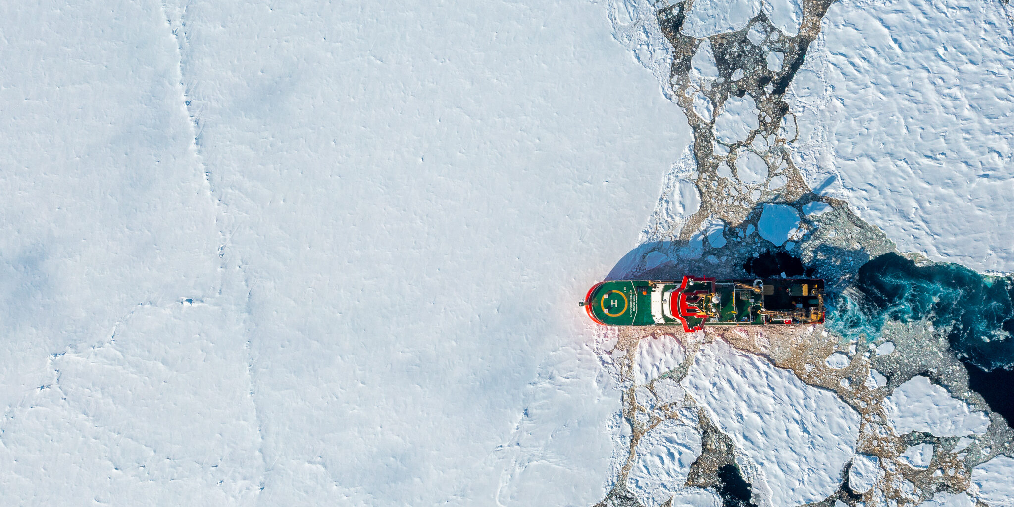
Logist develops decision support tools that use environmental data to help experts make the best routing and planning decisions. It brings together specialists in research software engineering, AI methods, sea ice forecasting and mapping to create tool sets ready to be used by crew on the on the RRS Sir David Attenborough and operations planners across British Antarctic Survey (BAS) and the Natural Environment Research Council (NERC). These tools could also be beneficial if used by other polar operators so, with support from the Government Office for Technology Transport, we are exploring how these tools could have the maximum societal and economic benefit. 
These tools create suggested routes and itineraries for ships and autonomous vehicles (such as Boaty McBoatface) that satisfy or optimise a range of conditions that a planner might want to specify – from obvious ones like avoiding getting stuck in sea ice to minimising carbon emissions and causing the least ecological impact in sensitive areas. Planners and crew then use their extensive experience of polar operations to choose the routes or itineraries that work the best for them in the real world. They also let planning experts try out ‘what if’ scenarios like ‘what if we used a fleet of autonomous vehicles instead of one large ship to do all these tasks?’ or ‘what if these autonomous vehicles had 10% more battery?’ This helps us to make the most effective decisions about what we do in the present and how we should operate in the future.
Logist tools provide crew and planners with a choice of routes and plans that save time, money and carbon emissions. This means that we can make as efficient use of our ships and vessels as possible – doing the most science with the least environmental harm. They also make us safer and more resilient. Polar conditions are very unpredictable so, by providing possible routes much more quickly than a person alone can, we can replan immediately if something changes. You can read more about why we need these tools in the Impact section of each tool. These tools don’t exist from commercial providers because they’re specific to the polar regions and the conditions we operate in – the weather, the wind, the waves, the sea ice and so on. By developing them ourselves, we bring together the deep environmental understanding we get from the science we do every day with the polar operational expertise we’ve gained over more than 80 years as the UK’s presence in Antarctica. We use our environmental expertise – both from our science and from our experience as an operator – for environmental stewardship. But that doesn’t mean that we’re the only people who would benefit from these tools. With the help of the Government Office for Technology Transfer and Innovate UK, we have been exploring commercialising these tools to have a real societal impact.
AI Team Lead

AI Researcher in Optimisation and Planning

Polar Scientific Innovation Lead

Innovation Community Officer

Research Software Engineering Lead
Senior Research Software Engineer

Fontend Developer/Geospatail

Head of MAGIC
Scientific Data Manager
Research Software Engineer

Research Software Engineer

Machine Learning Research Scientist
Polar Artificial Intelligence team, Palaeo Environments, Ice Sheets and Climate Change team

Machine Learning Research Scientist