Machine Learning Research Scientist


PolarSim is a digital facility at British Antarctic Survey. It brings together environmental computer science projects across the British Antarctic Survey to provide AI forecasting, modelling, downscaling and emulation tools for the polar regions. These tools originate from curiosity-driven research projects but, through our integration with polar operations, some are being developed into use for mapping and GIS, conservation warning systems and sea ice navigation.
We know that the polar regions are changing rapidly due to long-term climate change, but there’s still lots we don’t fully understand. Simulation and other machine learning techniques give us a better understanding of the polar regions, as well as the ability to answer specific questions. Simulations help transform physical understanding and science data into answers about what our environment will look like under a range of conditions. Whilst long-term simulation might help policy makers understand what the polar regions might look like decades later under different climate scenarios, short term simulations could help polar operators make plans for the next few days.
Different types of simulations work differently. Some PolarSim tools are direct forecasting models. These are trained on what has happened in the past and generate forecasts based on huge amounts of past data, rather than by making millions of calculations according to the rules of physics. This means that they run much more quickly and using less computing power than traditional physical models – what would require hours on a supercomputer with a physics-based model might be done in seconds on a laptop with a machine learning model.
Other simulations might be downscaling, where models which are trained on high resolution data can generate what the high-resolution version of a low-resolution image could look like. This lets us deal with sparse or missing data, which is especially important in the polar regions which are some of the most data-sparse areas on Earth. PolarSim also includes emulation tools which replicate existing models or methods for a specific condition. This might mean training a machine learning method to replicate a very computationally expensive physical model.
These simulation methods also let us do other things that conventional modelling struggles with, such as forecasting with uncertainty and retaining the fidelity of data alone. They also allow data sets to be combine – so, for example, very local but high resolution data gathered from a ship could be combined with a lower resolution regional model, something that is much more difficult with traditional gridded techniques.
Although machine learning methods don’t rely on physics alone, they can be informed by the science we do. Our tools are integrated into all the science we do at BAS, so the atmospheric or oceanographic science expertise can lead to subtle features and interconnections being present in our models. We have access to the brilliant scientists across BAS who bring their physical and biological understanding to improve our models – and so that our models can help their science. Our models also allow us to connect domain expertise, letting us slot together the puzzle-pieces from different science teams. We know that these interconnections are really important to long-term climate predictions – the Earth is a very complicated system and the oceans don’t exist separately from the atmosphere!
More specifically, polar expertise shapes these tools by shaping the kinds of outputs we want to generate as well as shaping how we develop the model. For instance, scientists might be able to tell us which factors are most important to a particular phenomenon, which guides what we concentrate on improving the most. Their absolute immersion in their domain can also help us find, understand and best use various data sources.
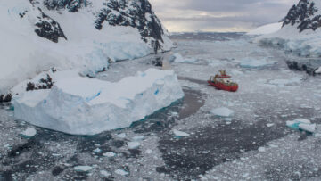
Our simulations are tied to specific problems, whether in science or in operations. We need simulations for our own operations – in particular sea ice forecasts. The people who will use these guide our development. This lets us make sure we’re providing operators the right structured format of data that they need, at useful resolutions and timescales and in a system that they already use. For example, we can integrate machine learning sea ice forecasts with ice mapping and navigational software already in use on the bridge of the RRS Sir David Attenborough.
Our tools have been developed as research projects with the Polar AI team working with science teams at BAS as well as with partners such as the Government of Nunavut, the University of Cambridge, the University of Bath and WWF. The Polar AI team develops tools into use with the Digital Innovation team, the Mapping and GIS team and the UK Polar Data Centre team.
Machine Learning Research Scientist
PhD Student

AI Team Lead

Research Software Engineer

Machine Learning Research Scientist
Polar Artificial Intelligence team, BAS Science Strategy Executive Group

Fontend Developer/Geospatail

Head of MAGIC
Nilas produces high resolution, physically realistic sea ice forecasts which outperform physical models for the 1 to 15 day range.
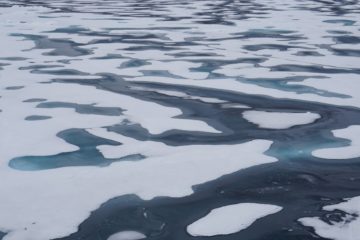
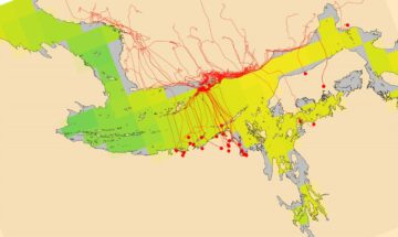
The AI for smart conservation project combines sea ice forecasts, satellite data, and GPS tracking to create early-warning systems for Arctic wildlife.
IceNet is a deep learning system that forecasts Arctic sea ice. The system is trained on climate simulations and observational data. It outperforms state-of-the-art dynamical models, especially for extreme sea ice events.
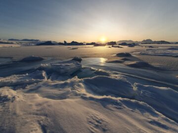
This project is developing digital twins of Antarctic and Arctic environments and resources. A digital twin makes it possible to test “what if” questions far more quickly than traditional computer models.