
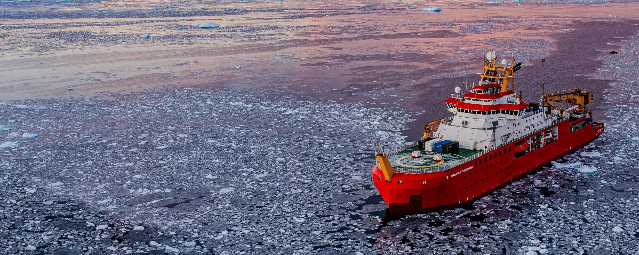
This weekend, the UK’s polar icebreaker RRS Sir David Attenborough departed the UK for Antarctica, and British Antarctic Survey’s (BAS) aircraft fleet began to touchdown at Rothera Research Station. The 2026/27 Antarctic science field season is officially underway!
The start of the season sees dozens of scientists and support staff, together with tonnes of equipment and fresh supplies, make their way to BAS’s five Antarctic research stations. BAS is the UK’s national operator in Antarctica, so our mission is to embark on another ambitious season of research across Antarctica and the Southern Ocean.
From investigations using cutting-edge technologies, to building on decades of data collection – this season’s science will help us understand how this frozen landscape is changing. Researchers, engineers and support staff will investigate the oceans, atmosphere, ice and ecosystems, using new tools to explore beneath ice shelves and monitor wildlife from the air and underwater.

Research projects take place aboard the RRS Sir David Attenborough (SDA) the UK’s most sophisticated floating laboratory that operates in the polar regions) across all five BAS research stations and at remote and extreme field sites across West Antarctica. As part of BAS’ work to decarbonise, the ship is making the journey using hydrotreated vegetable oil (HVO) – a biofuel helping to reduce the organisation’s carbon footprint.
A season of firsts
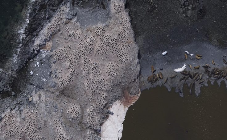
The Penguin Census Project will undertake the largest ever count of penguins in Antarctica. Following a successful trial in 2025/26, BAS will use a sophisticated aerial camera system aboard one of our Twin Otter aircraft to survey around 200 colonies of Adélie, chinstrap and gentoo penguins. The census will target the Antarctic Peninsula, South Shetland Islands, Elephant Island group and South Orkney Islands, with flights operating from both Rothera Research Station and Chile’s Marsh station. Monitoring these colonies will help scientists understand changes in penguin populations and the potential impacts of krill fishing, providing evidence for organisations including the Commission for the Conservation of Antarctic Marine Living Resources (CCAMLR) – the organisation that works to conserve Antarctic marine life while allowing sustainable harvesting of key marine resources like Antarctic krill.
The first drone-based monitoring system for humpback whale body condition and demography is being established at Rothera this year, as whale populations rebound post-whaling across the Southern Ocean. Alongside gathering vital data, the project will evaluate the feasibility of larger-scale drone surveys in the region. As well as watching whales from the sky, teams aboard the RRS Sir David Attenborough will studying the distribution of multiple whale species by listening for their calls using a hydrophone array, as well as investigating the chemicals in the water the whales may use to detect krill.
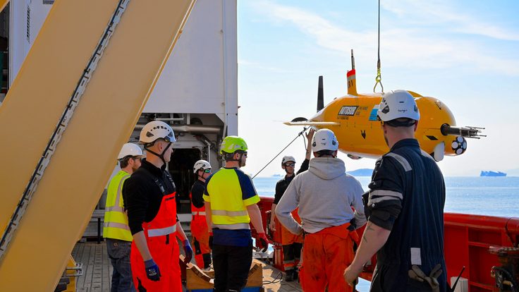
Autonomous underwater robots are an essential way for BAS to access hard to reach areas of an area inhospitable and remote region. The Autosub Long-range (aka Boaty McBoatface’s) is heading to West Antarctica. DECADES is a multinational and multi-institutional study investigating why the movement of warm ocean water to the Amundsen Sea – a major driver of ice loss from the West Antarctic Ice Sheet – varies between years and decades. During a 35-day science cruise, the DECADES team will combine ship-based observations with moorings, autonomous underwater measurements from Autosub Long Range (Boaty) operated by the National Oceanography Centre. Other research on the ship this season includes an annual survey of Antarctic krill distribution, an investigation into underwater tsunamis in the bays around Adelaide Island and collecting data about carbon in an open-ocean observatory in the northern Scotia Sea.
As part of a pilot project at Halley VI Research Station, researchers will launch around 15 weather balloons, each capable of flying for an average of 10 days. Unlike traditional weather balloons, which burst after just a few hours, this new generation of long-endurance balloons can remain airborne for days, collecting valuable atmospheric data as they travel. These balloons can change altitude to measure temperature, pressure, humidity and wind conditions at different heights. The data will contribute to the Antarctic InSync programme with successful trials potentially paving the way for wider use of this technology across Antarctica.
Antarctica’s ice and contribution to global sea-level rise
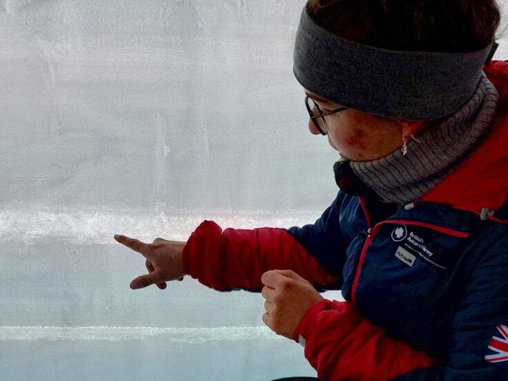
Antarctica’s ice shelves play a vital role in slowing the flow of glaciers into the ocean, helping to limit global sea-level rise. One of their natural defences is firn, a layer of compacted snow that acts like a sponge, absorbing meltwater and allowing it to refreeze before it can weaken the ice. But as temperatures rise and melting increases, this protective layer is losing its ability to absorb water. As part of the FIRN-CASSIO project, a collaboration between BAS and Netherlands NWO, researchers will sample the firn layer to understand how its role in buffering against melting of the ice sheets in a warming climate, and how this could affect the future stability of Antarctic ice shelves. By combining snow and ice samples collected from George VI Ice Shelf with satellite observations and climate models, the researchers will investigate how much meltwater firn can realistically store, including where layers of refrozen ice block water from reaching deeper snow.
The Filchner-Ronne Ice Shelf is around 780 metres thick, with another 300 metres of ocean beneath it. This enormous mass of floating ice helps slow the flow of ice from Antarctica’s interior into the ocean and so slowing the rate of sea level rise. This season, a multinational team from BAS, the NASA-Jet Propulsion Laboratory and Caltech will be deploying a new instrument, IceNode, through the shelf. It will measure currents, salinity and temperature just below the ice, sending data back to the surface. This will allow detailed study of the turbulent processes that cause the melting by delivering heat and salt to the base of the ice.
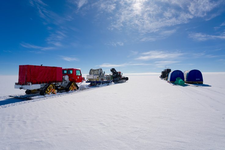
Ice streams are fast-flowing rivers of ice that carry around 90% of the West Antarctic Ice Sheet into the ocean. Water beneath the ice reduces friction, helping it flow faster and contributing to global sea-level rise. A team, led by University of Swansea, will use seismic and electromagnetic surveys beneath the Institute Ice Stream and Bungenstock Ice Rise to investigate whether deep groundwater reservoirs also influence ice flow. The project, called IGIS, is the largest supported by BAS this season and will work via a fixed field camp and via the traverse – a moving convoy led by large vehicles – to help researchers better understand how these hidden water systems could affect Antarctica’s contribution to rising sea levels.
Our long-term data has value
At King Edward Point (KEP) Research Station, the South Georgia Groundfish Survey will reach an important milestone: 40 years since surveys began in 1987. One of the Southern Ocean’s longest-running fisheries surveys, its four decades of data provide an exceptional record against which scientists can investigate the effects of ocean warming, marine heatwaves and other environmental changes on fish and the wider ecosystem. Our research enables sustainable fisheries that is important for our food security.
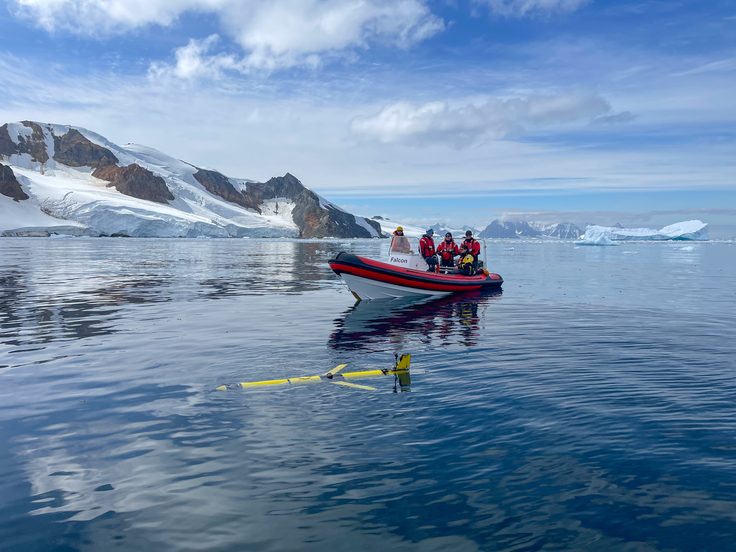
The Rothera Time Series (RaTS) has monitored the station’s adjacent Ryder Bay since 1998 and is unusual in maintaining observations throughout the year, including during the Antarctic winter. Scientists regularly deploy autonomous gliders to measure ocean temperature, salinity (or saltiness), chlorophyll and ocean mixing. As winter sea ice around the Antarctic Peninsula undergoes major changes, this continuous record is helping researchers understand how the ocean absorbs heat, and what the consequences of a warming climate are for ocean ecosystems. BAS has monitored the impact of icebergs on the shallow seabed around Rothera since 2002. The Iceberg Impact Study (IBIS) provides one of the longest continuously monitored records of this type anywhere in the global ocean, revealing how changing sea-ice conditions influence iceberg disturbance and the communities living on the Antarctic seabed.
Across Rothera, Signy, Bird Island and King Edward Point research stations, long-term monitoring of Adélie, chinstrap and gentoo penguins, albatross, skuas, giant petrels, shags and seals will continue, providing indicators of environmental change and information used by CCAMLR. At KEP, a team will use both GPS and depth loggers on King penguins to see how they use the ocean currents surrounding South Georgia to move between foraging areas.
Professor Dame Jane Francis, Director of British Antarctic Survey, said:
“Collaboration is at the heart of Antarctic science, highlighting the importance of research partnerships across institutions and nations. This year, our collaborations include researchers from across the world, including Chile, the Netherlands, the United States and Australia.
We’re also celebrating the value of long-term monitoring programmes, which provide vital insights into how Antarctica and the Southern Ocean are changing. Some of these programmes, including the South Georgia groundfish survey, are marking significant milestones this year, with 40 years since surveys began in 1987 – reflecting decades of scientific research.”