Geographic Information Officer
South Georgia seabirds from space

South Georgia seabirds from space
- Start date:
- 1 April, 2024
- End date:
- 30 March, 2026
What the project does
This project tests whether satellite imagery can be used to monitor breeding seabirds across the island group.
Traditional monitoring uses ground and boat-based surveys. These are expensive, time-consuming, and cannot cover remote or inaccessible areas.
South Georgia is home to globally important seabird populations. However, many species have declined due to human impacts.
Albatrosses and white-chinned petrels have suffered long-term declines, mainly because of bycatch in fisheries. South Georgia shags are declining due to climate change and reduced fish availability.
Many burrowing petrels disappeared from mainland sites because of invasive rodents and habitat damage from reindeer. These mammals were eradicated in the mid-2010s.
Now, monitoring is needed to track recovery and detect ongoing threats.
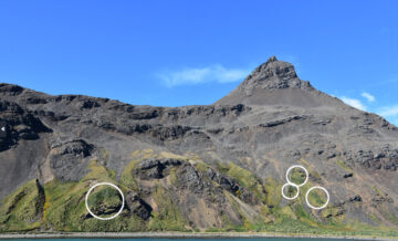
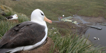
White-chinned petrel burrows on King Edward Point, shown in the white circles. The vegetation around these burrows are greener due to fertilisation. Photo credit Richard Phillips.
Why this matters
Satellite monitoring avoids disturbing wildlife. It is also a low-carbon alternative to field or aerial surveys.
This project will help track seabird recovery after invasive species removal. It will also provide new data on species affected by fishing, such as wandering, black-browed, and grey-headed albatrosses.
These species are listed as global priorities for conservation.
If successful, the project will show whether conservation actions — like rat eradication and efforts to reduce bycatch — are working.
It will help the UK and the Government of South Georgia and the South Sandwich Islands (GSGSSI) protect seabird populations and manage threats more effectively.
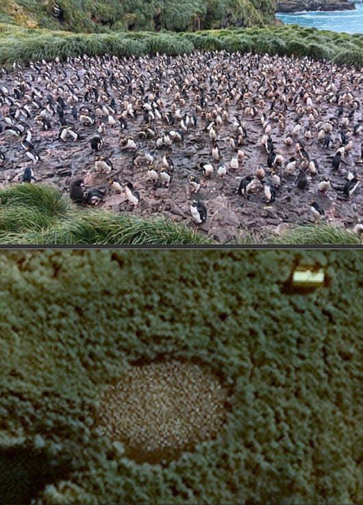
Macaroni penguin colony on Bird Island viewed from land (top image) and in a 30 cm resolution satellite image (bottom image) during the breeding season ©Maxar Technologies 2024.
Different satellite techniques will be used for different species:
- spectral classification to map vegetation enriched by burrowing petrels
- textural analysis to detect nesting mollymawks
- guano colour and colony density mapping to distinguish shags from penguins
Science objectives
- Create new baselines for burrowing petrels following rodent and reindeer eradication.
- Test methods that could replace costly surveys on remote islands worldwide.
- Potentially complete the first remote population surveys of selected species across all South Georgia.
Who is involved
This Darwin Plus funded project is led by BAS, working with GSGSSI and the Marine Biological Association (MBA).
Stakeholders include the UK government, South Georgia Heritage Trust (SGHT), Royal Society for the Project of Birds (RSPB) and BirdLife International.
The four aims of this project are:
- Determine whether burrowing petrels can be detected using satellite imagery based on spectral analysis of vegetation colour at Bird Island.
- Assess long-term changes in the distribution and densities of burrowing petrels across South Georgia using satellite imagery.
- Investigate whether very-high resolution satellite imagery can be used to count mollymawks (black-browed and grey-headed albatrosses) and South Georgia shags, and to identify colonies of differing species of burrowing petrels, including white-chinned petrels, using ground-truthing data from Bird Island and elsewhere at South Georgia.
- Complete an archipelago-wide very-high resolution satellite survey of wandering albatrosses, mollymawks and South Georgia shag breeding colonies on South Georgia.
-
-
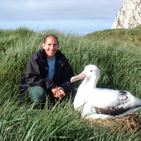
Seabird Ecologist Deputy Science Leader IMP 3
-

Machine Learning Research Scientist
-
-
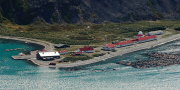
King Edward Point Research Station
Read more of: King Edward Point Research StationKing Edward Point Research Station on South Georgia has been a centre for marine and fisheries research for 25 years.
-
Bird Island Research Station
Read more of: Bird Island Research StationThe Bird Island Research Station focuses on the long-term study of seabirds and seals in one of the world’s richest wildlife sites.