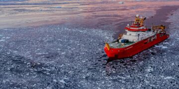
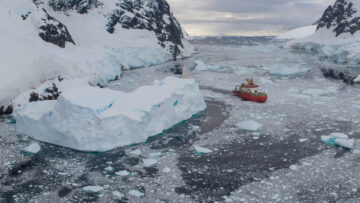
AI for Earth Observation
The AI for Earth Observation project develops machine learning tools to detect icebergs, sea ice, and wildlife from satellite imagery.
I’m a machine learning researcher based in the Artificial Intelligence (AI) lab at BAS. My research focuses on using machine learning to monitor and detect wildlife, particularly using satellite and drone imagery. I work closely with the Wildlife from Space research group, developing image algorithms to automatically count wildlife in very high resolution satellite imagery. For my PhD I developed a convolutional neural network to detect wandering albatrosses in 31-cm resolution WorldView-3 imagery – work which is being extended on in the Darwin Plus Albatrosses from Space project. Since joining BAS i have been involved with the Walrus from Space research, detecting walrus haulouts using lower resolution Sentinel-2 imagery. I am also involved with a WWF funded project using IceNet sea ice forecasts to predict risks to arctic wildlife. In this we are using GPS collar data to establish links between sea ice conditions and the timing and location of caribou migrations in the Coronation Gulf, to develop a Conservation Early Warning and Alert System which can inform local ecologists.
Cubaynes, Hannah C. ORCID record for Cubaynes, Hannah C.. Vergara-Pena, Alejandra. Bowler, Ellen ORCID record for Bowler, Ellen. Downie, Rod. Forcada, Jaume ORCID record for Forcada, Jaume. Garde, Eva. Heide-Jørgensen, Mads Peter. Higdon, Jeff W. Ida, Emina. Kovacs, Kit M. Lancaster, Melanie L. Lapointe St Pierre, Mathilde. Lydersen, Christian. Matthews, Cory J.D. Spencer, Matt. Fretwell, Peter T. ORCID record for Fretwell, Peter T.. (2026) A roadmap towards monitoring walruses from space.
Bowler, Ellen ORCID record for Bowler, Ellen. Byrne, James ORCID record for Byrne, James. Leclerc, Lisa-Marie. Roberto-Charron, Amélie. Rogers, Martin S.J. ORCID record for Rogers, Martin S.J.. Cavanagh, Rachel D. ORCID record for Cavanagh, Rachel D.. Harasimo, Jason. Lancaster, Melanie L. Chan, Ryan S.Y. Strickson, Oliver. Wilkinson, Jeremy ORCID record for Wilkinson, Jeremy. Downie, Rod. Hosking, J. Scott ORCID record for Hosking, J. Scott. Andersson, Tom R. ORCID record for Andersson, Tom R.. (2025) AI sea ice forecasts for Arctic conservation: A case study predicting the timing of caribou sea ice migrations.
Attard, Marie R.G. ORCID record for Attard, Marie R.G.. Phillips, Richard A. ORCID record for Phillips, Richard A.. Oppel, Steffen. Bowler, Ellen ORCID record for Bowler, Ellen. Fretwell, Peter T. ORCID record for Fretwell, Peter T.. (2025) Feasibility of using very high-resolution satellite imagery to monitor Tristan albatrosses Diomedea dabbenena on Gough Island.
Attard, Marie R.G. ORCID record for Attard, Marie R.G.. Phillips, Richard A. ORCID record for Phillips, Richard A.. Bowler, Ellen ORCID record for Bowler, Ellen. Clarke, Penny J. ORCID record for Clarke, Penny J.. Cubaynes, Hannah ORCID record for Cubaynes, Hannah. Johnston, David W. Fretwell, Peter T. ORCID record for Fretwell, Peter T.. (2024) Review of Satellite Remote Sensing and Unoccupied Aircraft Systems for Counting Wildlife on Land.
Bowler, E., Attard, M., Phillips, R., & Fretwell, P. (2026). WorldView-3 satellite image tiles of wandering albatross breeding sites on South Georgia with citizen science annotations of individual birds, 2015-2022 (Version 1.0) [Data set]. NERC EDS UK Polar Data Centre. https://doi.org/10.5285/fd82803b-6764-4b50-a8ef-0e8729c07870
Clarke, P., Cubaynes, H., Bowler, E., Jackson, J., Attard, M., Stockin, K., & Carlyon, K. (2025). Point annotation dataset of stranded whale and dolphin species identified in very high-resolution optical and SAR satellite imagery along offshore islands of New Zealand and Tasmania between 2018-2023 (Version 1.0) [Data set]. NERC EDS UK Polar Data Centre. https://doi.org/10.5285/b26c3a3d-73c8-4500-9a23-696011c20a45
Bowler, E., Byrne, J., Leclerc, L., Roberto-Charron, A., Rogers, M., Cavanagh, R., Harasimo, J., Lancaster, M., Chan, R., Strickson, O., Wilkinson, J., Downie, R., Hosking, J., & Andersson, T. (2025). Pan-Arctic 93-day sea ice concentration forecasts from the IceNet model and mappings between sea ice concentration and Dolphin and Union caribou sea ice crossing-start times (Version 1.0) [Data set]. NERC EDS UK Polar Data Centre. https://doi.org/10.5285/8738b3cb-52c7-4b36-aa6d-6e15c0b46ba4
Panigada, V., Bowler, E., & Fretwell, P. (2024). Annotated dataset of wandering albatrosses detected in Very High Resolution (VHR) satellite imagery of South Georgia, Crozet Islands and Kerguelen Islands, from 2015-2017. (Version 1.0) [Data set]. NERC EDS UK Polar Data Centre. https://doi.org/10.5285/276367fa-03dd-4c80-9f7b-7652eb1664d9
The AI for Earth Observation project develops machine learning tools to detect icebergs, sea ice, and wildlife from satellite imagery.
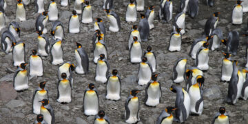
This project tests whether satellite imagery can be used to monitor breeding seabirds across the island group.
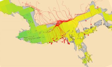
The AI for smart conservation project combines sea ice forecasts, satellite data, and GPS tracking to create early-warning systems for Arctic wildlife.
This project is developing digital twins of Antarctic and Arctic environments and resources. A digital twin makes it possible to test “what if” questions far more quickly than traditional computer models.
Albatrosses face multiple threats to their long-term survival. Using very high-resolution satellites, we are able to estimate the number of breeding pairs in remote locations.

IceNet is a deep learning system that forecasts Arctic sea ice. The system is trained on climate simulations and observational data. It outperforms state-of-the-art dynamical models, especially for extreme sea ice events.