Scientific Data Manager Geophysics
Bedmap
Bedmap (2001 – present): ice bed, surface and thickness datasets for Antarctica
- Start date:
- 1 January, 2001
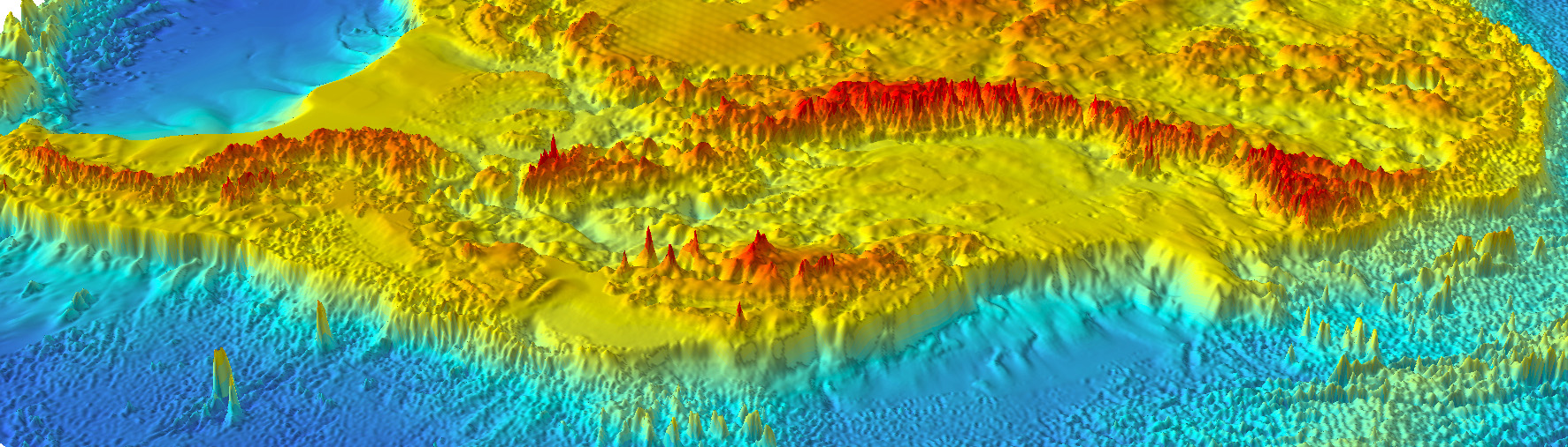
Bedmap is a collaborative community project with the aim to produce a new map and datasets of Antarctic ice thickness and bed topography for the international glaciology and geophysical community, using a variety of data (including ice-thickness, bathymetry, surface altitude and grounding lines).
The Bedmap Portal (bedmap.scar.org) provides a direct access to the ice thickness, bed and surface elevation datasets. An associated Geophysics Book gives the list of data available and provides interactive codes to help you use the data with Python.
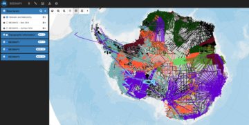
The Bedmap portal
For more information:
Pritchard, H.D., Fretwell, P.T., Fremand, A.C. et al. Bedmap3 updated ice bed, surface and thickness gridded datasets for Antarctica. Sci Data 12, 414 (2025). https://doi.org/10.1038/s41597-025-04672-y
Frémand, A. C., Fretwell, P., Bodart, J. A., Pritchard, H. D., . et al: Antarctic Bedmap data: Findable, Accessible, Interoperable, and Reusable (FAIR) sharing of 60 years of ice bed, surface, and thickness data, Earth Syst. Sci. Data, 15, 2695–2710, https://doi.org/10.5194/essd-15-2695-2023, 2023.
-

-

Geographic Information Officer
-

Glacial Processes Satellite
-
60 years of Antarctic ice sheet data released
Read more of: 60 years of Antarctic ice sheet data releasedIn a significant milestone for Antarctic research, detailed and extensive information on ice thickness and bed topography is now available for the first time in a centralised and standardised format. […]
All the data are now published at the UK Polar Data Centre.
Standardised CSV:
Standardised shapefiles and geopackages – Lines and statistically-summarised data points:
Gridding products:
-
-
Polarimetric Radar
Read more of: Polarimetric RadarThe radar system is composed of a complex waveform generator, signal processor, data handler and data store.