Improving how we measure Antarctic sea ice
QUASAR uses AI to improve Antarctic sea ice measurements from satellites, making climate data more reliable for scientists tracking changes in polar regions.
1 to 12 of 303 results
QUASAR uses AI to improve Antarctic sea ice measurements from satellites, making climate data more reliable for scientists tracking changes in polar regions.
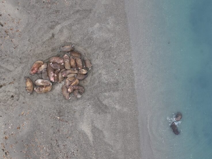
Despite their importance to Arctic ecosystems, we don’t know how many walruses exist. We’re using satellite images and citizen science to count walruses.
SEIEG is an independent committee of experts that provide support and advice to the UK Met Office and government departments.
ANTARCTICA INSYNC brings together researchers from around the world including British Antarctic Survey to study the continent and the Southern Ocean at the same time.
Artificial Intelligence for Stable Isotope Tracers (AISIT) creates a standardised, machine-readable database of Arctic freshwater tracers.
Counting whales in South Georgia.
Eco-ICE studies whether making Arctic sea ice thicker could harm ocean life and creates tools to help decision-makers work out if climate projects are safe.
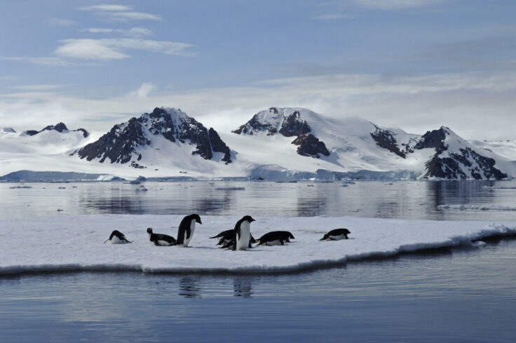
MACS looks at Antarctica’s rapidly changing seasonal sea ice. As the planet warms microalgae growing in ice and water are affected and this, in turn, affects our climate system.
Embeddable maps for visualising simple features on a suitable basemap.

The Assets Tracking Service shows where British Antarctic Survey ships, aircraft and vehicles are at any given time.

GIANT is a pioneering science project that will test the potential for early warning of a critical climate tipping point.