Science Leader
BAS Science Strategy Executive Group, Atmosphere, Ice and Climate team

MesoS2D uses powerful radars and satellites to study a little-understood layer of the atmosphere (the mesosphere), helping scientists predict how space weather and climate affect our atmosphere from weeks to decades ahead.
To predict how space weather and climate variability affect the whole atmosphere, we need accurate models of every layer.
The mesosphere (about 50–95 km altitude) is the least understood region. It sits at the boundary between the climate system and space weather, making it especially difficult to model.
The mesosphere both influences, and is influenced by, processes from above and below. Atmospheric waves and tides move upward from lower layers, while space weather effects drive changes downward. The mesosphere is tightly coupled with the ionosphere and other regions, so changes in one part can affect the whole system.
Until recently, there were too few observations to improve this. But in the past decade, new satellite missions have created a surge of middle atmosphere data. MesoS2D combines these observations with one of the world’s most advanced whole-atmosphere models to study variability and its drivers.
For climate models, we can already predict variability on short (around 2 weeks) and long (about decadal) scales. But we cannot yet do this in the mesosphere. Currently, prediction skill in the mesosphere is no better than using long-term averages.
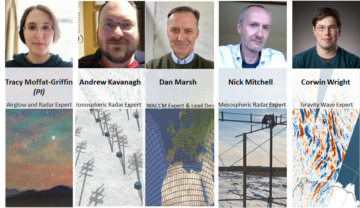
MesoS2D is led by UK researchers with international partners. The project brings together expertise in atmospheric science, space weather, and climate modelling.
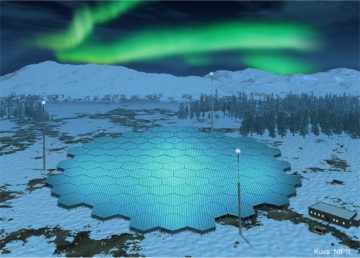
The team makes use of world-class facilities, including the £50 million EISCAT 3D radar, the most advanced ionospheric radar ever built.
The project combines modern observations and high-resolution models:
MesoS2D aims to:
These objectives are a crucial step towards accurate modelling of the mesosphere as part of a fully coupled climate–space weather system.
MesoS2D will use existing and new ground-based observational datasets over Scandinavia to study the atmosphere. Satellite observations add global coverage, while EISCAT 3D enables high-resolution radar measurements of the middle atmosphere.
Alongside this, advanced model simulations help link observations to underlying processes. Together, these activities will provide the first robust pathway to predictability of the mesosphere on sub-seasonal to decadal scales.
To quantify the physical drivers of mesosphere variability at all timescales, opening a
pathway to improved predictability of weather and climate processes in the Earth system.
Our project builds from regional observationally-driven studies to whole-atmospheric dynamical-
science advances via four closely-linked sub-objectives.
We will:
By the end of this three-year project, MesoS2D will have produced three key outputs:
Science Leader
BAS Science Strategy Executive Group, Atmosphere, Ice and Climate team
Middle Atmosphere Vertical Coupling Analys
Investigator team:
A new project to improve scientists understanding of the impact of space weather and climate change on the atmosphere starts this month (January 2022). A team from British Antarctic Survey, […]
This page will be populated once the project starts.