
British Antarctic Survey’s (BAS) Space Weather Observatory (SWO) uses over 50 scientific instruments to continuously watch the Sun–Earth system. It provides vital information about space weather events that can disrupt satellites, power grids, and other key infrastructure.
National Capability Science
SWO is maintained and operated by BAS with support from the Natural Environment Research Council (NERC). We are working to add new instruments and expand our coverage across Antarctica to fill gaps in our observations. Data is freely available to over seven global instrument networks and the wider research community, maximising scientific value.
Sustained Observations
We collect data all year round at Halley Research Station, Rothera Research Station, and deep field sites. This allows us to study Sun-to-Earth processes and assess the impact of severe space weather to develop ways to reduce its effects.
The Sun follows an 11-year cycle, moving from periods of low to high activity. Geomagnetic storms happen more often during periods of high activity. SWO has collected continuous observations throughout the 2025 solar maximum and into the quieter phase that follows, supporting computer models that inform the UK Risk Register on space weather threats.
Societal and policy impact
Our research and modelling help businesses become more resilient and support government policy through the Space Weather Preparedness Strategy, as the world becomes increasingly vulnerable to this natural hazard.
Instruments
Riometer (Relative Ionospheric Opacity Meter)
The Halley Research Station multiband riometer is a passive instrument that measures radio energy from natural astronomical sources.
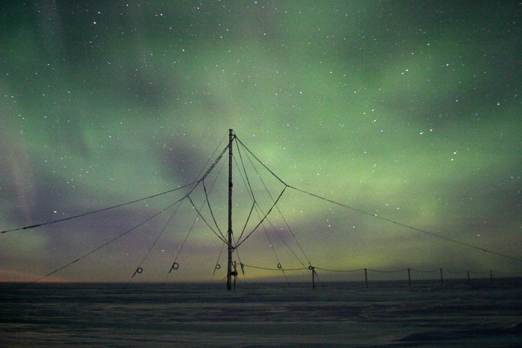
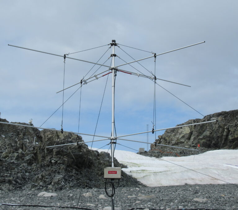
Search Coil Magnetometer
BAS operates a network of magnetometers across Antarctica that measure Earth's magnetic field and space weather, from detecting aurora-generating waves to tracking radiation belt activity and mapping ionospheric currents that affect satellites.
Very Low Frequency receiver (VLF)
The VLF receivers listen to very-low frequency radio waves as part of a network of receivers located all over the polar regions. The data gathered by this network is used by more than 35 institutions around the world.
AutoVLF (Very low frequency)
The AutoVLF system is a low-power independent instrument within the Electro-Magnetic Quiet Area (EMQA) at Halley Resarch Station.
Medium Frequency Radar
The Medium Frequency (MF) radar at Rothera Research Station measures an altitude profile of the horizontal wind in the mesosphere, between 55 and 95 km.

SkiYMET
A meteor radar that uses the scatter from meteor trails to estimate horizontal neutral winds between 80 and 110 km
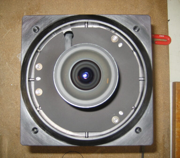
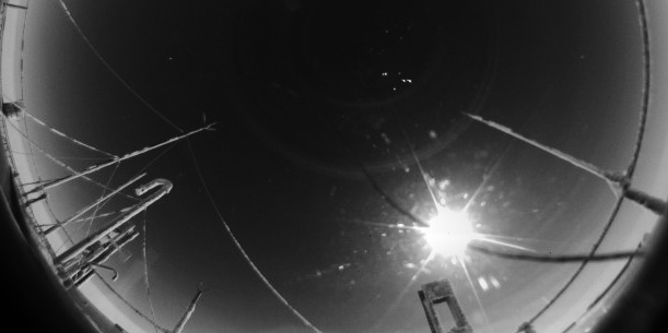
All sky camera (colour)
This instrument produces an all-sky image in visible light. Used for cloud detection and studying the properties of clouds. It can also be used for studying aurora.
All sky camera (black and white)
This instrument produces an all-sky image in visible light. Used for cloud detection and studying the properties of clouds.
Andor Airglow Spectrometer
This instrument observes the spectra of OH airglow emission from ~87 km altitude.
Multi-filter airglow imager
This instrument has a fish-eye lens and a filter wheel that allows it to observe different airglow emissions.
all-sky infrared airglow imager
This instrument observes infrared emissions during the night and operates on a high temporal cadence.
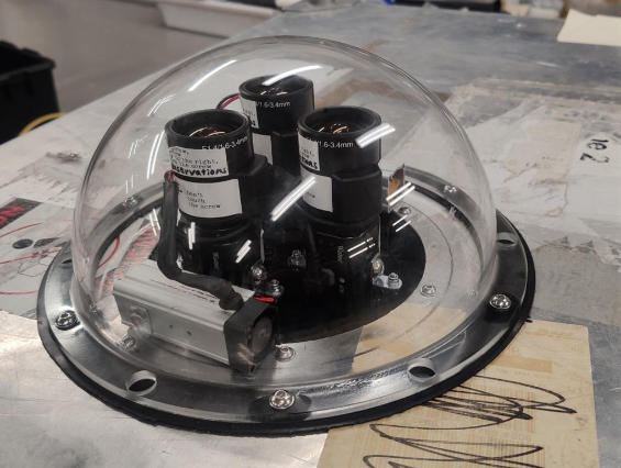
WATEC
Three compact auroral cameras have been installed at Halley Research Station to support coordinated studies of auroral and wave phenomena.
Low Powered Magnetometers (LPM)
British Antarctic Survey Low Power Magnetometers focus on studying the external magnetic field and its impact on power grid infrastructure.
Clean Air Sector Laboratory (CASLab)
Specialised observatory with a suite of instruments to measure the air and snow chemistry around Halley.
Global Navigation Satellite System (GNSS) receivers
British Antarctic Survey (BAS) maintains a network of GNSS receivers across West Antarctica
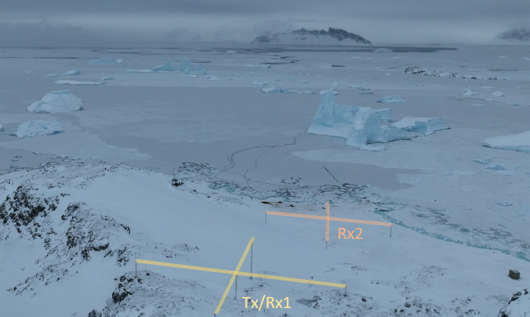
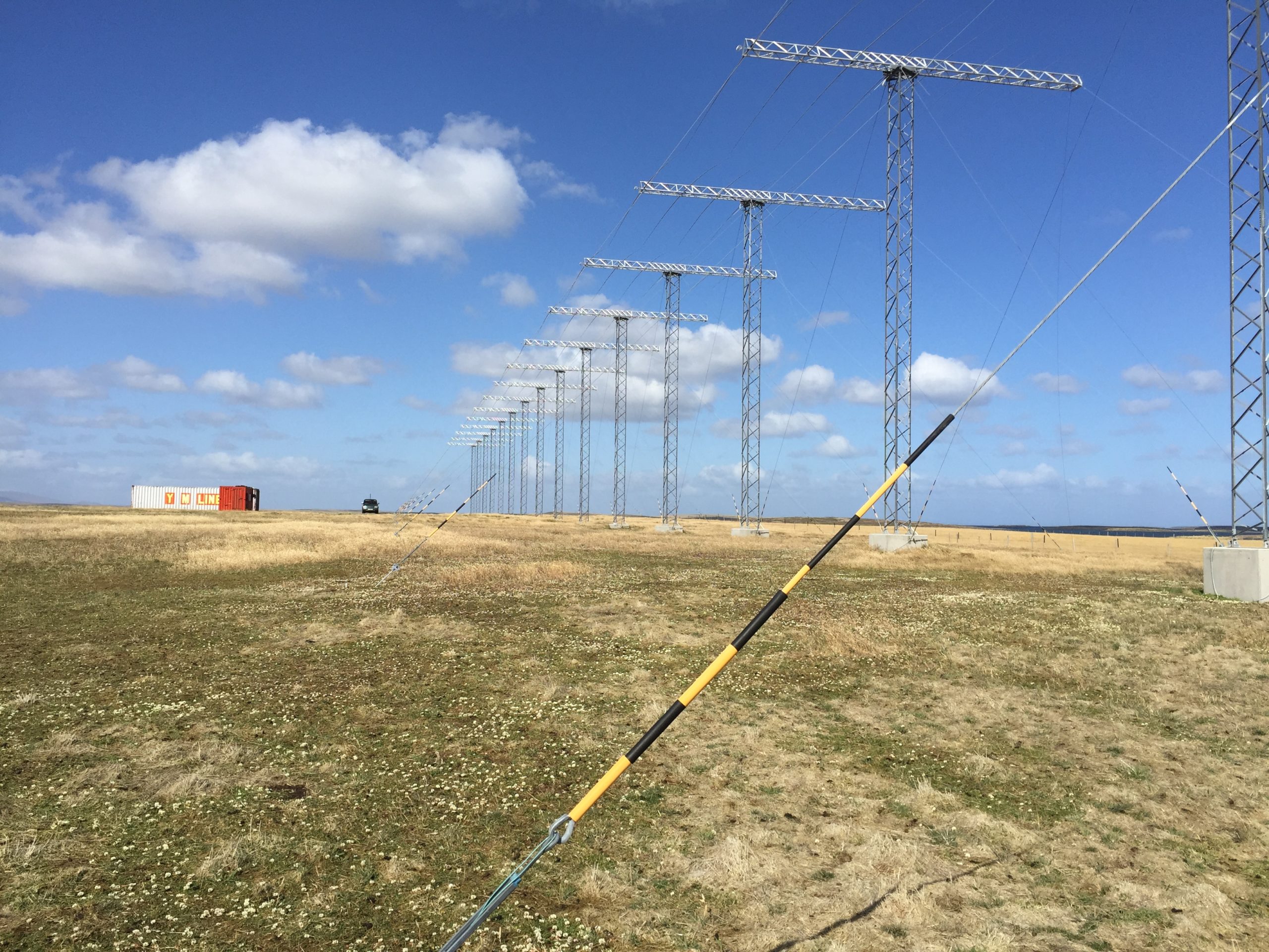
SuperDARN (Super Dual Auroral Radar Network) Halley Radar
The Super Dual Auroral Radar Network (SuperDARN) is a worldwide network of radars that studies space weather and Earth's upper atmosphere. For over 20 years, scientists from different countries have worked together to run this network.
Locations
There is a suite of instruments at both Halley and Rothera research stations that are used for both space weather and atmospheric science.
They are located in dedicated areas such as the optical hut or the Clean Air Sector Lab (CASLab) where light polluting sources are minimised.
Additionally, we have instruments located in the deep Antarctic field, as well as the SuperDARN radar located on the Falkland Islands.
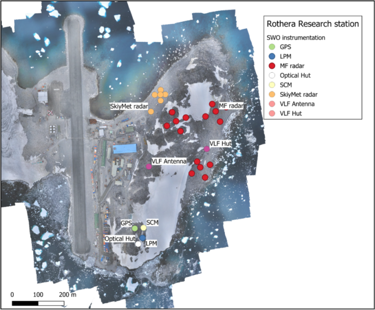
Rothera Research Station instruments
Rothera Research Station, located on the Antarctic Peninsula, is the largest British Antarctic Survey facility on the continent.
Rothera occupies a unique position for studying slot region precipitation, with an approximate L-shell value of 2.9. Its proximity to both the auroral zone and the polar cusp makes it an ideal location for observing solar wind–magnetosphere interactions, including:
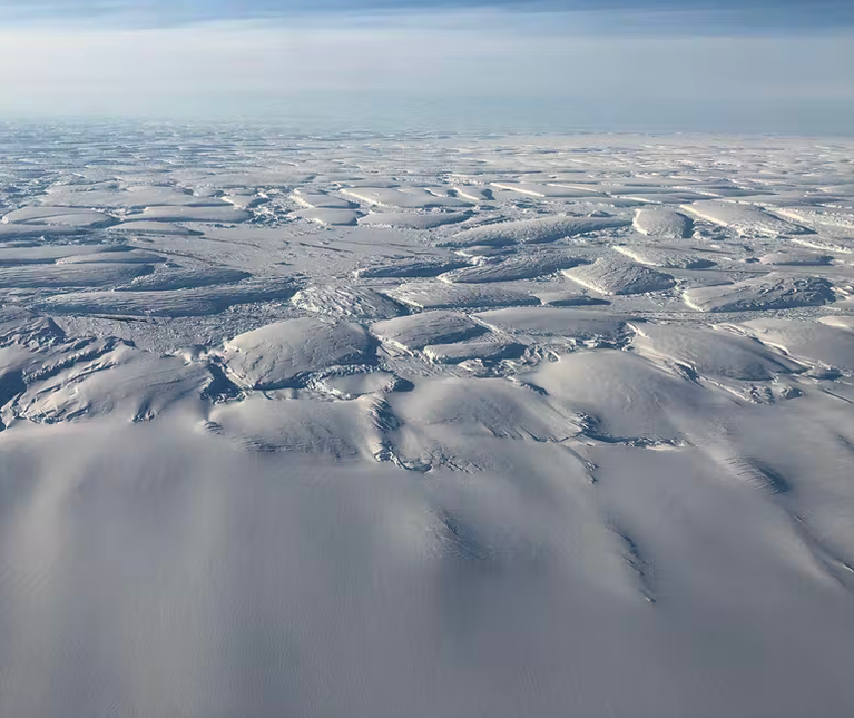
Halley Research Station instruments
Halley Research Station, situated on the Brunt Ice Shelf in Antarctica, is a key British Antarctic Survey facility focused on atmospheric and space weather science. Though only staffed during the summer months (November to February), autonomous data collection in the winter months allows Halley to play a vital role in the long-term monitoring of the upper atmosphere and near-Earth space environment.
One of Halley’s unique scientific strengths is its magnetic conjugacy with locations in the Northern Hemisphere, particularly Nain, Canada. This alignment enables valuable interhemispheric studies, allowing researchers to compare space weather phenomena across both hemispheres.
Halley has a protected Electro Magnetic Quiet Area (EMQA) that hosts most of the SWO instruments.
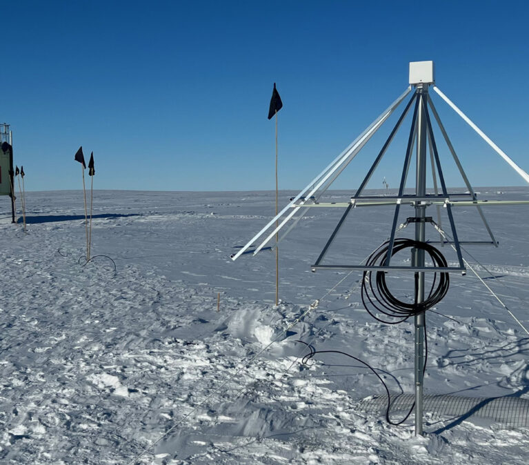
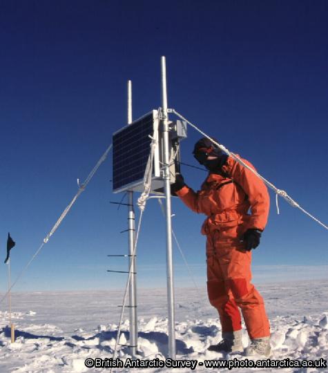
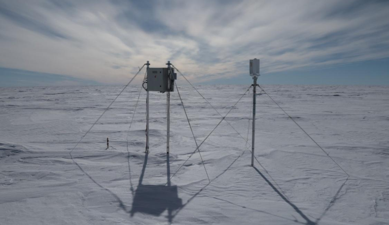
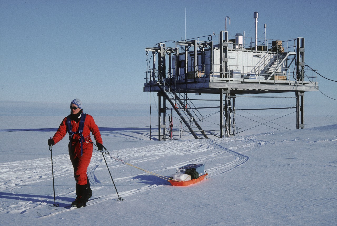
Deep field instruments
A variety of scientific instruments are deployed across the Antarctic deep field, enabling remote observations. These field sites are visited opportunistically for data retrieval and maintenance, often requiring the use of aircraft or ships due to their remote locations.
Instruments in the field are designed with low power requirements and satellite data collection systems. Most sites are powered by batteries, solar panels and/or a small wind generator. During the Antarctic winter (June–September), when sunlight is absent, some sites may temporarily lose transmitting capability due to power limitations.
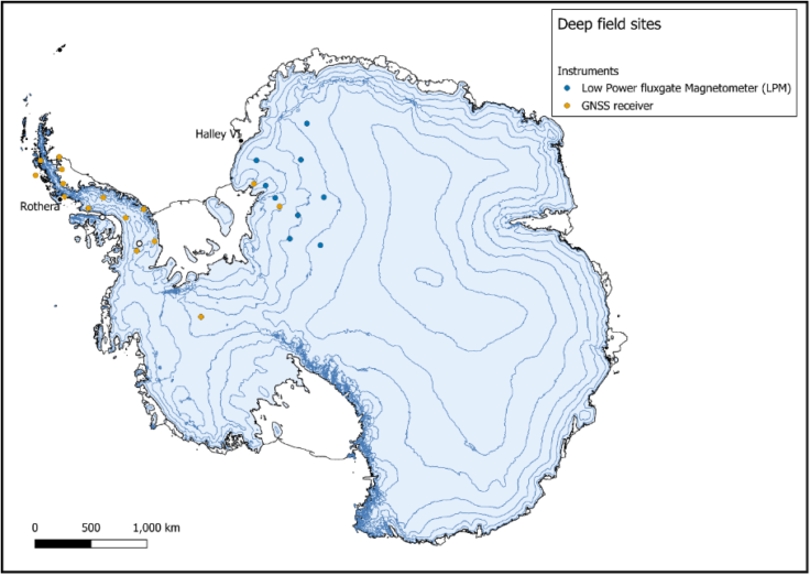
The strategic placement of these field sites provides broad latitudinal coverage. International collaboration plays a key role, with other nations maintaining similar instrumentation across the continent, contributing towards a comprehensive Antarctic space weather monitoring network.