Embedded Maps Service
Embeddable maps for visualising simple features on a suitable basemap.

I am a geospatial developer focusing on web mapping/GIS applications, data integration, APIs, cloud infrastructure and user experience.
I am the technical lead for geospatial information services and infrastructure within BAS. This includes:
I joined BAS in 2013, and until 2019 worked as a software developer with the UK Polar Data Centre. I now work in the Mapping and Geospatial Information Centre (MAGIC).
I have a degree in Geography focusing on GIS, geographies of health and perception of crime. I also worked on a JISC funded research project, Bomb Sight.
Since 2020 I have been a software development volunteer with Map Action, a GIS and Information Management charity providing support to humanitarian agencies and partners. Previously I have helped organise, and participated in, local Missing Maps events.
Embeddable maps for visualising simple features on a suitable basemap.
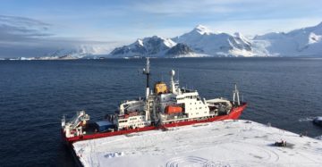
The Assets Tracking Service shows where British Antarctic Survey ships, aircraft and vehicles are at any given time.

Over the next decade Rothera Research Station will be upgraded to ensure its facilities keep the UK at the forefront of climate, biodiversity and ocean research.
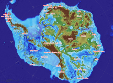
The SCAR ADD is a seamless compilation of topographic data for Antarctica to 60°S. It is the place to go to get data such as Antarctic coastline or contours for working in desktop GIS.
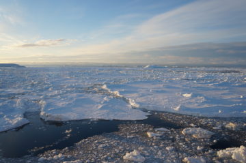
Scientists have discovered that summer sea ice in the Weddell Sea area of Antarctica has decreased by one million square kilometres – an area twice the size of Spain – […]
A newly updated Antarctic Digital Database is released today (12 May 2020). Aimed at the science and logistics communities, the maps include updates to the ice shelf front around Thwaites […]