Glacial Processes Satellite
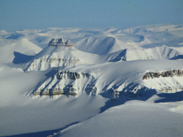
Bedmap Himalayas
Bedmap Himalayas
- Start date:
- 1 March, 2014
What Bedmap Himalayas does
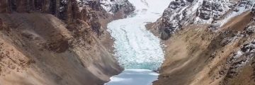
Bedmap Himalayas measures how much water is stored as glacier ice in High Mountain Asia.
The project maps ice thickness using radar. Surveys are carried out by helicopter over large and rugged mountain terrain. This approach allows safe measurement of glaciers that would be impossible to survey on foot.
Why this matters
Glacier melt provides vital water during dry seasons. It supports river flow, irrigation, and hydropower. Millions of people downstream depend on this meltwater for crops, energy, and livelihoods.
High Mountain Asia has the largest concentration of glaciers outside Alaska. About 800 million people rely on them. In the Indus catchment, 237 million people depend heavily on glacier runoff. In Bhutan, a quarter of national income comes from glacier-fed hydropower.
Climate change is shrinking glaciers. Between 2003 and 2009, the region lost between 12 and 26 billion tonnes of ice per year – equivalent to 12 River Thames volumes annually. Knowing how thick glaciers are is crucial to predicting future water supply.
How the project works
Bedmap Himalayas uses radar surveys to measure ice thickness:
- Radar method: radar waves pass through ice and reflect off the bedrock. The return time reveals ice thickness.
- Pilot studies: initial surveys in Langtang Valley (2015) and Ngozumpa Glacier (2016) tested radar in mountain conditions.
- Helicopter surveys: a helicopter-mounted radar covers large, difficult, and dangerous glacier areas.
- Field deployment: radar equipment is transported up steep mountain paths, then flown over major glaciers in the Khumbu basin, reaching altitudes over 6000 m.
- Data capture: radargrams reveal the bed beneath the ice, mapping previously unseen landscapes.
Science objectives
The project aims to:
- measure ice thickness of glaciers in High Mountain Asia
- quantify water stored in glacier ice
- improve predictions of Asia’s future water availability
- test radar techniques in complex mountain terrain
- map previously unknown glacier beds for scientific study
Who is involved
Bedmap Himalayas is led by BAS with support from core funding and grants. Fieldwork involves pilots, engineers, and local support teams including porters.
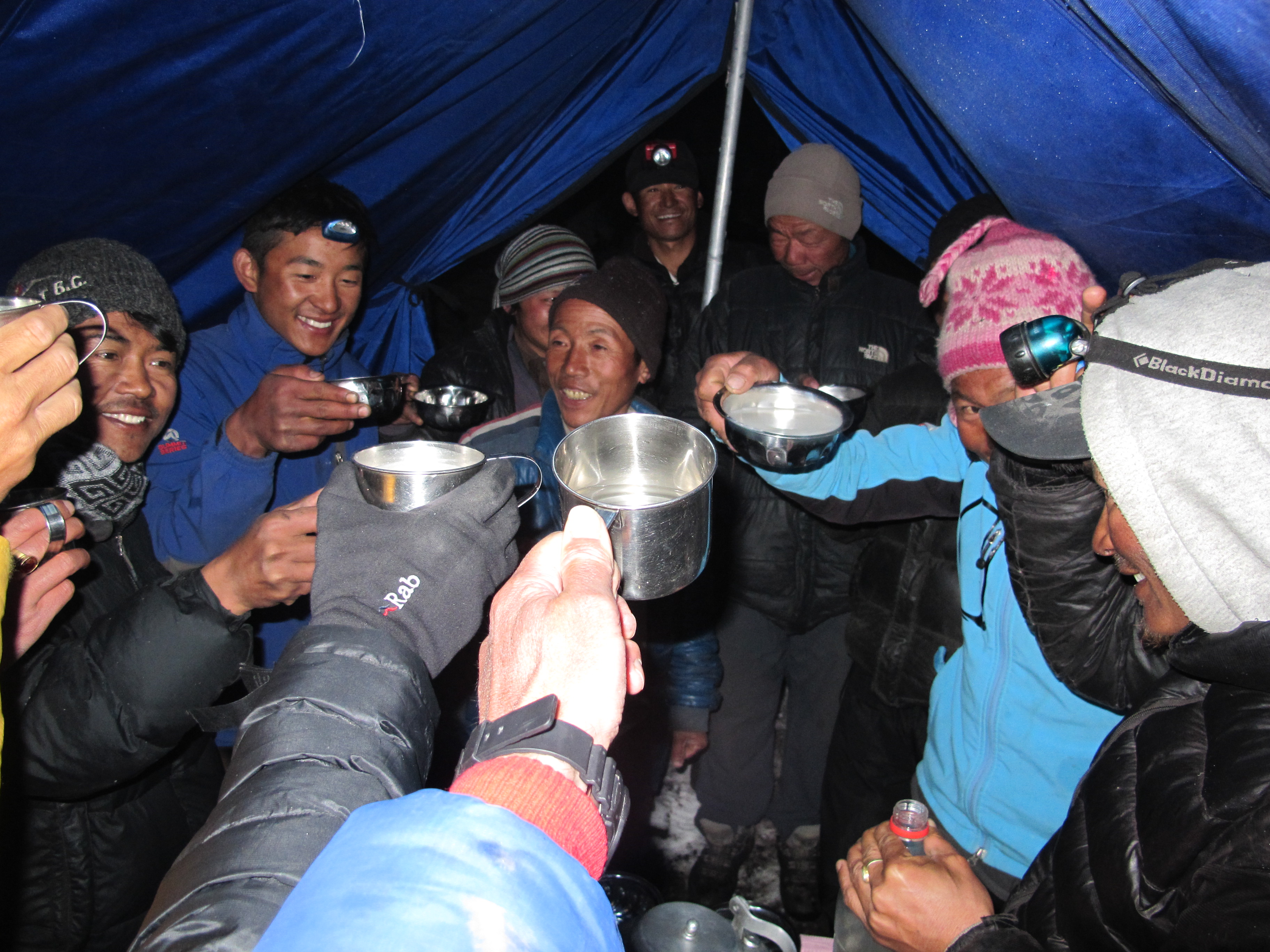
Enjoying a hot mug of chhaang with the guides and porters. (Credit: Ian Willis)
Science objectives
The project aims to:
- measure ice thickness of glaciers in High Mountain Asia
- quantify water stored in glacier ice
- improve predictions of Asia’s future water availability
- test radar techniques in complex mountain terrain
- map previously unknown glacier beds for scientific study
-
BLOG: A New Frontier – exploring the Himalaya
Read more of: BLOG: A New Frontier – exploring the HimalayaEarlier this year I spent two months doing fieldwork in the Hindu-Kush Himalaya mountain region in South and Central Asia. It hosts the largest volume of ice and snow outside the polar regions and, for this reason, […]

-
Glaciers in the spotlight on BBC’s Our Frozen Planet
Read more of: Glaciers in the spotlight on BBC’s Our Frozen PlanetHow much water the mountain glaciers of the Himalayas contain and how the mighty Thwaites Glacier in West Antarctica will contribute to global sea-level rise form part of the final […]
-
BBC’s Frozen Planet II: science into television
Read more of: BBC’s Frozen Planet II: science into televisionIn 2011, Frozen Planet gave BBC viewers an unprecedented insight into life in the Poles. The final episode featured British Antarctic Survey (BAS) glaciologist Dr Andy Smith using explosives to […]
-
Measuring glaciers in the Himalayan mountains
Read more of: Measuring glaciers in the Himalayan mountainsTechnology pioneered in Antarctica could soon be providing much-needed data on the amount of ice in the glaciers of High Mountain Asia thanks to an ingenious helicopter-mounted, low-frequency radar developed […]
-
Polar experts offer expertise to the developing world
Read more of: Polar experts offer expertise to the developing worldODA funds – expertise to address major challenges facing the developing world
-
UK Arctic Research Station
Read more of: UK Arctic Research StationThe UK’s only Arctic Research Station, also known as ‘Harland-Cox Huset’, is situation in the international research community of Ny-Ålesund, on Svalbard.