“Catastrophic” breeding failure at one of world’s largest emperor penguin colonies
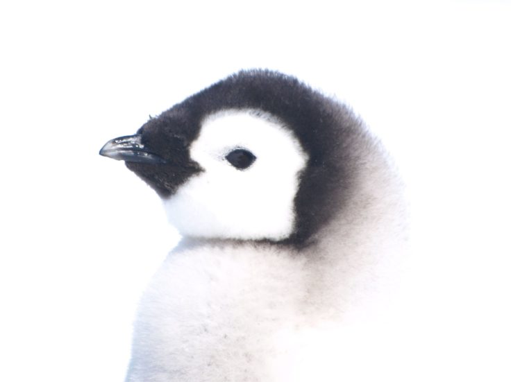
Researchers at British Antarctic Survey have discovered “catastrophic” breeding failure at one of world’s largest emperor penguin colonies.
25 to 36 of 43 results
Researchers at British Antarctic Survey have discovered “catastrophic” breeding failure at one of world’s largest emperor penguin colonies.
The aim of this project is to develop a next generation sea ice information service by integrating and building on a wide range of European and national funded activities which incorporate many of the required components.
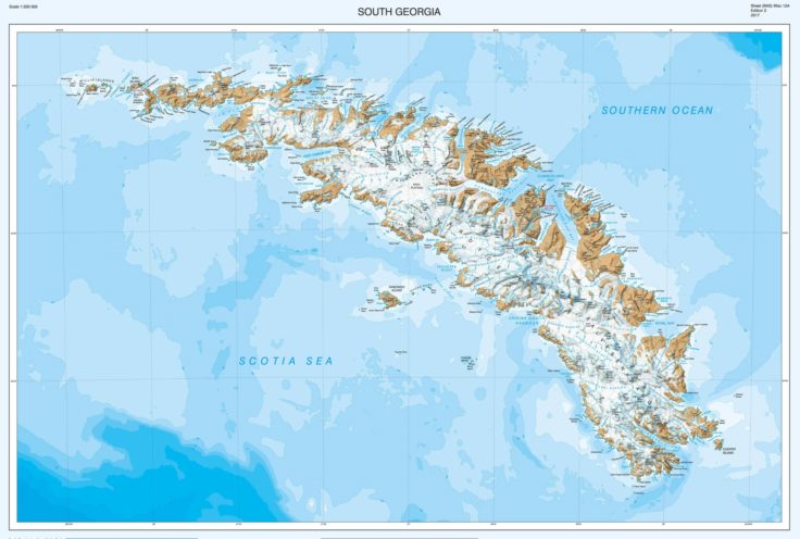
British Antarctic Survey’s detailed map of the sub-Antarctic island of South Georgia featuring the epic “Shackleton Crossing” has won an award at the 2018 British Cartography Society Awards. The map, […]
Revealing Antarctica’s hidden world
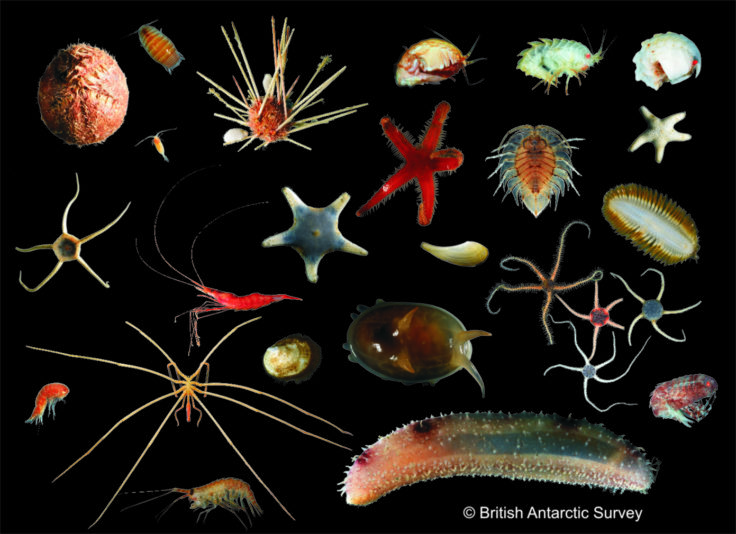
The Larsen-C Benthos project studied benthic biodiversity on the seabed exposed by the 2017 calving of the Larsen-C Ice Shelf.
Cartographers surveying Antarctica have discovered Mt Hope is the tallest mountain in the British Antarctic Territory (BAT) at 3,239 m (10,654 ft) above sea level. Until now, maps showed Mt […]
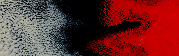
An animation of the giant iceberg that calved off the Pine Island Glacier in West Antarctica just over two months ago shows an unexpected break up. Satellite images revealed a […]
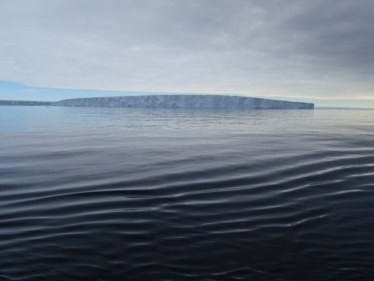
After months of ‘hanging by a thread’ a vast iceberg the size of Norfolk has finally broken off Antarctica’s Larsen C Ice Shelf. Around 30 metres of this 190m thick […]

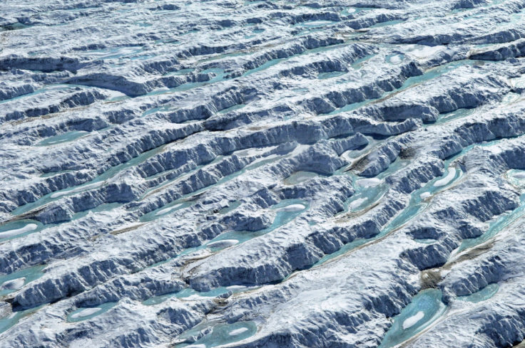
MIDAS investigates how climate warming affects the Larsen C ice shelf in Antarctica. The project studies the formation of large summer melt ponds and their influence on ice shelf structure and stability. Fieldwork, satellite observation, and computer simulations are used to understand these processes.
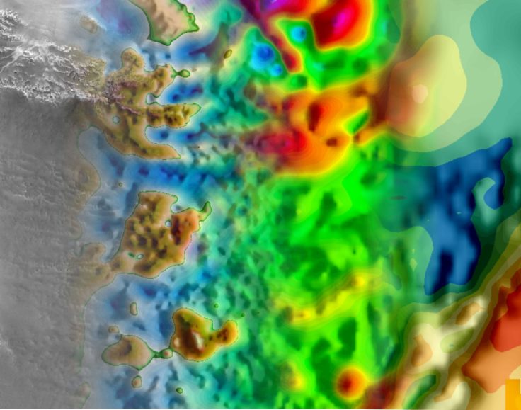
GOCE+Antarctica- Dynamic Antarctic Lithosphere uses GOCE satellite gravity gradient data, GPS data and innovative 3D modelling to study the Antarctic lithosphere and its influence on the overlying ice sheets, including the process of glacio-isostatic adjustment (GIA).
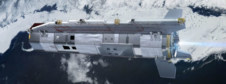
Scientists now have a new tool to investigate the deep structure of the least understood continent on Earth
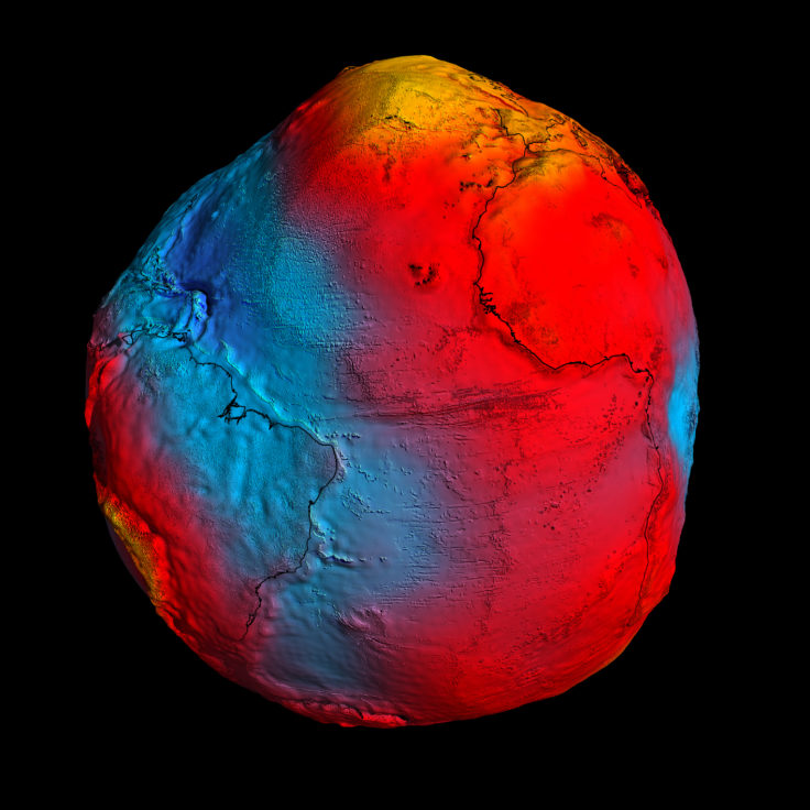
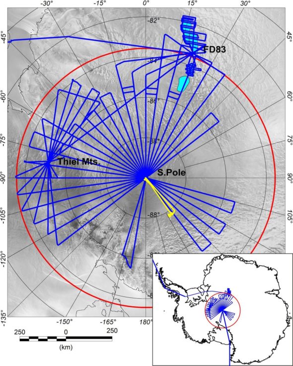
PolarGAP is an ambitious international mission to capture new and critical data about the Earth’s global gravity field.