Glacier Geophysicist
Weddell Sea ice sheet and climate
Deglaciation and climate of the Weddell Sea ice sheet
What the Weddell Sea ice sheet and climate project does
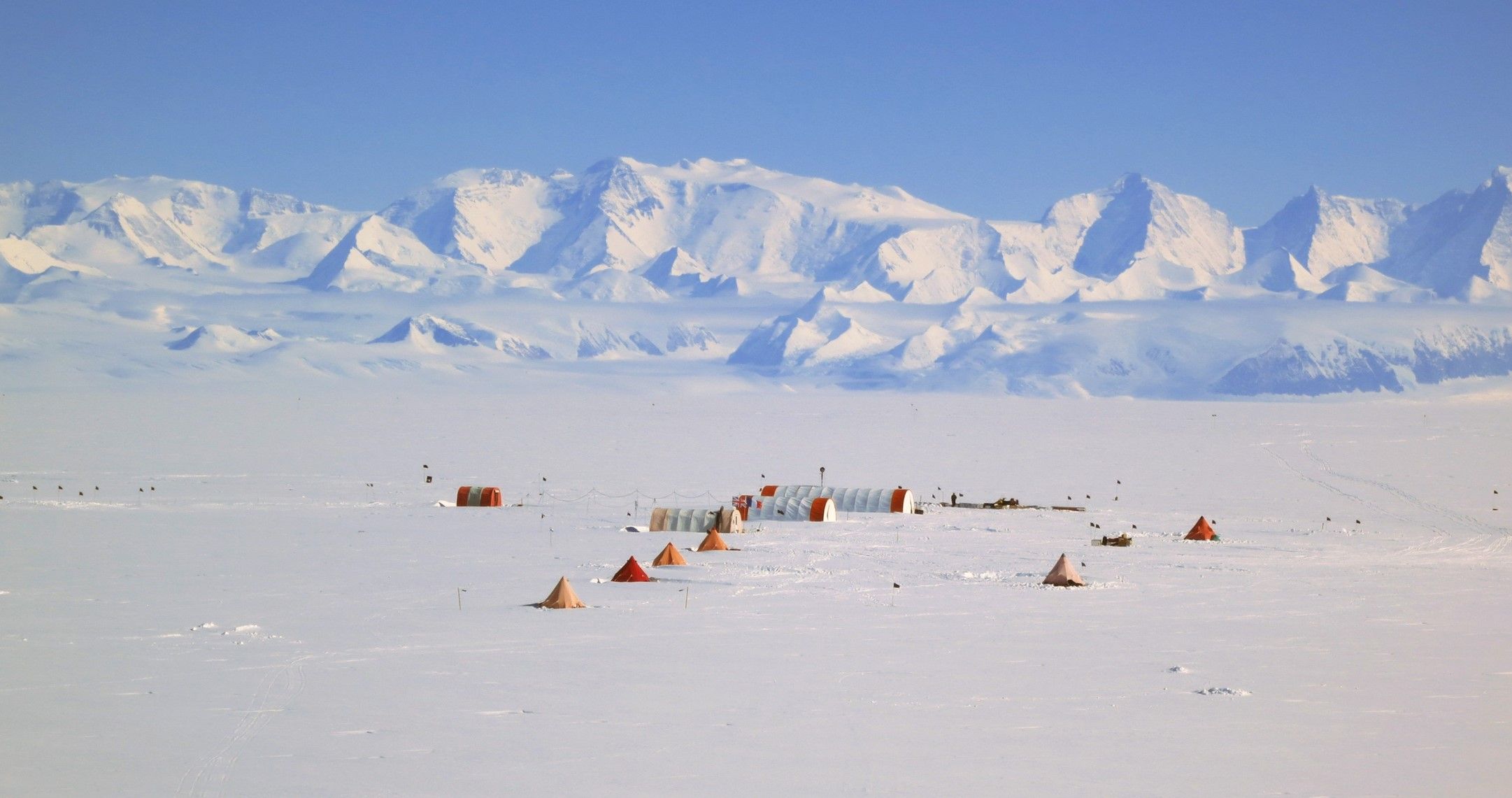
The project investigates the deglaciation and climate history of the Weddell Sea region. It focuses on the Ronne and Filchner Ice Shelves and the development of ice rises.
British Antarctic Survey uses radar, seismic surveys, and ice core drilling to study ice structure, thickness, and the underlying bed. These methods reveal how the ice sheet responded from the last glacial period to the present Holocene warm period.
Why this matters
During the last glacial period, ice in this region was up to 1000 m thicker and extended 400 km further north. This additional ice likely lowered global sea level by around 6 m.
Studying ice response during past climate changes improves understanding of Antarctic ice sheet dynamics. This knowledge helps predict how ice sheets may behave under future warming scenarios.
How the project works
The project combines multiple field and analytical techniques:
- radar surveys: to examine ice structure and thickness.
- seismic studies: to determine the type of bedrock beneath the ice.
- ice core drilling: to provide evidence of past climate conditions.
- focus on ice rises: to investigate the formation and evolution of features such as Berkner Island, Fletcher Promontory, Skytrain Ice rise and Korff Ice Rise, which developed over thousands of years during post-glacial warming.
Science objectives
The project aims to:
- reconstruct the climate history of the Weddell Sea region
- understand ice sheet response to deglaciation
- investigate formation and evolution of ice rises
- improve predictions of ice sheet behaviour under future climate change
- provide long-term context for Antarctic sea level contributions
Who is involved
The project is led by BAS glaciologists and geophysicists using international field and analytical collaboration.
- Measure the climate histories from the ice cores we have already recovered from Berkner Island (948m deep, and more than 150,000 years) and the Fletcher Promontory (654 m deep and more than 100,000 years)
- Deploy and use over-snow radar on traverses across ice rises such as Fletcher, Korff, Henry, Fowler, Skytrain to determine the depth and internal structure of the ice
- Deploy phase sensitive radar at target ice rises to measure the vertical velocity of the ice
- Interpret seismic data from example ice rise to determine the basal material
- Drill a new deep ice core to the base of the Korff Ice Rise (around 600 m deep) to recover the climate history, and determine whether the basal material contains recent marine accretion ice that would be indicative that this ice rise was until recently part of the free-floating ice shelf
- Through ice sheet and climate modelling, incorporating the physical data recovered, understand the past and likely future interaction between the stability of the ice sheet and the regional climate
-
-

Ice Stream Modelling
-
Science Programme Coordinator
-

IDP Science Leader IMP 3
BAS Science Strategy Executive Group, Ice Dynamics and Palaeoclimate team
-

Palaeoclimatolgist IMP3
- Ice core scientists (Mulvaney, Thomas, Capron, Massam)
- Laboratories (Benton, Tuckwell, Ludlow, Northrop)
- Ice sheet dynamics and modelling (Hindmarsh, Martin, Kingslake)
- Climate modelling (Sime, Hastings)
- Seismics (Smith, Brisbourne)
Collaborations:
LGGE, Grenoble; LSCE, Paris; University of East Anglia; University of Durham