Oceanographer
Melting at Thwaites Grounding Zone and its Control on Sea Level
International Thwaites Glacier Collaboration - MELT
- Start date:
- 1 June, 2018
- End date:
- 1 June, 2023
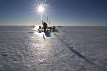
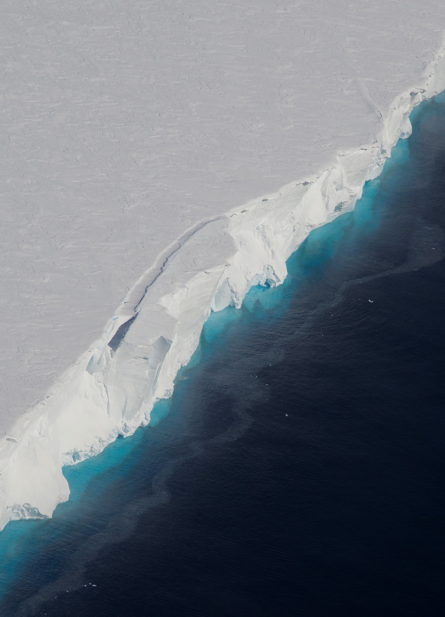
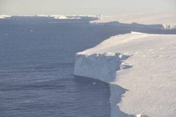
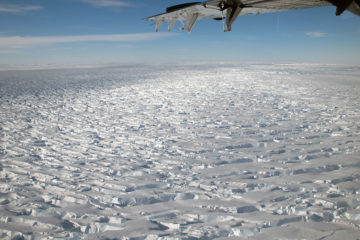
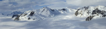
MELT is an ice-based project that will use autonomous sensors to monitor the ice column and ocean beneath the ice shelf in the critical area of the grounding line (the point where the glacier goes afloat to become ice shelf). The project will also use repeated airborne radar flights to study the way the ice flows in this area, and seismic surveys to study the ocean floor beneath the ice shelf.
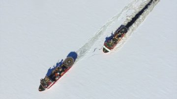
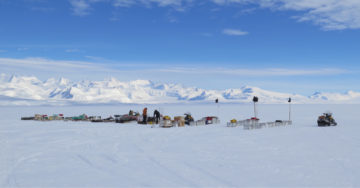
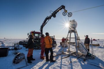
Hot water drilling will be used to make three access holes through the glacier to allow measurements to be made within the ice column and in the underlying water. Icefin, a state-of-the-art remotely-operated vehicle containing instruments such as conductivity-temperature-depth (CTD) sensors, an acoustic Doppler current profiler, a camera, a dissolved oxygen sensor and a multi-beam echosounder will be deployed via the boreholes to examine the waters beneath the ice shelf. Ocean moorings will be used to monitor the ocean conditions for a year or more and ground-based phase-sensitive radar (ApRES) will monitor the basal melt rate.
At present, the influence of these warm waters is not well understood, especially in the key area of the grounding line, and quantifying how ocean conditions affect the melt rate of Thwaites Glacier’s ice shelf will allow the glacier’s potential sea-level contribution to be more accurately predicted.
![]()
The main objective of the proposed study is to quantify how the contribution of Thwaites Glacier to sea-level rise depends on the oceanographic conditions near the glacier.
To achieve this, the team will:
- Collect observations of the rate of ocean-driven melting of Thwaites Glacier using ApRES, together with the ocean conditions beneath the ice using instruments such as Icefin.
- Collect data on the flow of the ice near the grounding line using airborne radar.
- Determine the landscape beneath the ice shelf using seismic surveys.
Results from this project will be used to help numerical models more accurately predict the contribution of the Thwaites Glacier to future sea-level rise.
-
-
Oceanographer
-

Ice Sheet Modelling
-

Ocean/Ice Scientist IMP 3
Professor David Holland – NYU
-
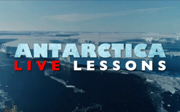
New ‘live lessons’ offer interactive learning for kids
Read more of: New ‘live lessons’ offer interactive learning for kidsAntarctica Live Lessons – a new and exciting learning resource, launches today (13 November). Aimed at engaging and inspiring the imaginations of young learners, the platform introduces an array of live, interactive lessons about Antarctica, offering a unique opportunity for students to hear from leading ice experts.
-
Scientists named on TIME100 list for Antarctic research
Read more of: Scientists named on TIME100 list for Antarctic researchScientists Dr Peter Davis (British Antarctic Survey) and Dr Britney Schmidt (Cornell University) have been named in the 2023 TIME100 annual list of the 100 most influential people in the […]
-
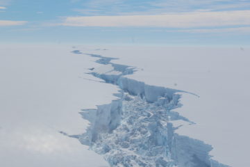
New close-up view of melting beneath Thwaites Glacier
Read more of: New close-up view of melting beneath Thwaites GlacierThe rapid retreat of Thwaites Glacier in West Antarctica appears to be driven by different processes under its floating ice shelf than researchers previously understood. Novel observations from where the […]
-
Glaciers in the spotlight on BBC’s Our Frozen Planet
Read more of: Glaciers in the spotlight on BBC’s Our Frozen PlanetHow much water the mountain glaciers of the Himalayas contain and how the mighty Thwaites Glacier in West Antarctica will contribute to global sea-level rise form part of the final […]
-
Scientists drill for first time on remote Antarctic Glacier
Read more of: Scientists drill for first time on remote Antarctic GlacierTeams from the US and UK have successfully completed scientific fieldwork in one of the most remote and hostile areas of West Antarctica – coinciding with the 200th anniversary of […]
-
Scientists head to Antarctica’s Thwaites Glacier
Read more of: Scientists head to Antarctica’s Thwaites GlacierNearly 100 scientists and support staff depart this week (13 November 2019) for the most ambitious mission to date for Thwaites Glacier in West Antarctica. In the second year of […]
-
Essential cargo delivered for science on Thwaites Glacier
Read more of: Essential cargo delivered for science on Thwaites GlacierThe British Antractic Survey’s vessel RRS Ernest Shackleton teamed up with the Royal Navy survey ship HMS Protector to help scientists begin a five-year mission to understand how West Antarctica […]
-
Ambitious UK-U.S. Antarctic research mission begins
Read more of: Ambitious UK-U.S. Antarctic research mission beginsA team of UK and U.S. polar scientists are about to embark on one of the largest joint Antarctic missions for more than 70 years. It’s the first field season […]
-
Airborne Remote Sensing
Read more of: Airborne Remote SensingTwo of the four BAS Twin Otters are equipped with a full remote sensing capability, providing scientists with data on land, ice and sea.
-
-
Instrument: Phase-sensitive radar (ApRES)
Read more of: Instrument: Phase-sensitive radar (ApRES)Research teams use phase-sensitive radars for determining ice shelf basal melt rates. Data is used to enhance climate models.