PRESCIENT
PRESCIENT supports long-term, strategically important measurements and capabilities for the wider science community.
2004-Present : Senior Data and Science Information Manager.
I oversee the electronic management of scientific data and information within the Polar Data Centre. Assisted by a small team of individuals both in Cambridge and Antarctica.
2000-2004 : British Antarctic Survey.
Data analyst and programmer on EU funded ultraviolet radiation measurement projects.
1996-2000 : University of Manchester, Institute of Science and Technology.
European Commission contract to develop a web-based data centre for ultraviolet spectral measurements.
1991-1996 : University of Reading, Dept. of Meteorology.
Participant in a series of European Commission research projects investigating a range of ultraviolet spectroradiometers and techniques. Developed software to evaluate the operational efficacy of these systems.
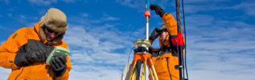
1987-1990 : British Antarctic Survey.
33 month Wintering contract in the Antarctic. Responsible for ozone and meteorological measurements and the maintenance of associated equipment.
Lam, P., Horne, R., Meredith, N., Glauert, S., & Kirsch, P. (2024). Charging Currents and Electric Fields of Satellite Cables during a reasonable worst case scenario (Version 1.0) [Data set]. NERC EDS UK Polar Data Centre. https://doi.org/10.5285/3948ce45-3430-468d-8e99-22d4d6c0a8c5
Glauert, S., Heynderickx, D., Kirsch, P., & Horne, R. (2021). The Satellite Risk Prediction and Radiation Forecast System (SaRIF) (Version 1.0) [Data set]. NERC EDS UK Polar Data Centre. https://doi.org/10.5285/bebfd99e-f2e3-46f0-9833-f59efb40be37
Glauert, S. (2021). Evaluation of SaRIF high-energy electron reconstructions and forecasts (Version 1.0) [Data set]. NERC EDS UK Polar Data Centre. https://doi.org/10.5285/9c31bc7a-6f16-4d37-8df0-2717f26c718a
Clilverd, M., & Kirsch, P. (2004). VELOX (VLF/ELF Logger Experiment) data, Halley Station, 1992 onwards (Version 1.0) [Data set]. NERC EDS UK Polar Data Centre. https://data.bas.ac.uk/full-record.php?id=GB/NERC/BAS/PDC/00055
PRESCIENT supports long-term, strategically important measurements and capabilities for the wider science community.
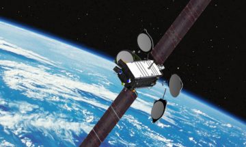
SWESNET from British Antarctic Survey provides a forecast of high energy electrons in the Earth’s radiation belts which can cause damage to satellites on orbit. These forecasts are used by satellite operators to take mitigating action.
The Sat-Risk project, led by the British Antarctic Survey (BAS), has the goal of ‘developing a real-time system to forecast radiation exposure to satellites for a range of different orbits, and quantify the risk of damage or degradation‘.
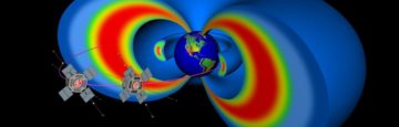
Rad-Sat is a NERC Highlight Topic that brings together a consortium of scientists from 5 different UK research groups, stakeholders from the space industry and a network of international collaborators.
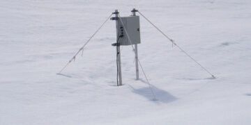
Access data from the Low Power Magnetometer (LPM) network
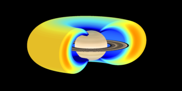
This project explored the radiation belts of the Earth, Jupiter and Saturn to help set new research goals for future spacecraft missions to the planets and develop computer models that will be of direct use to the space insurance, satellite construction and satellite service industries.
For centuries people have used magnetic compasses to guide them on their way and explore new territories. This has led scientists to embark on their own journeys of discovery about […]

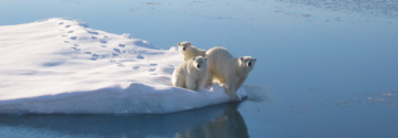
physicists, chemists, biologists, economists, and sociologists from 21 institutes in 11 countries across Europe assess the rapid retreat and collapse of Arctic sea-ice cover
Science on the move – the mission to understand the stability of the West Antarctic Ice Sheet