PRESCIENT
PRESCIENT supports long-term, strategically important measurements and capabilities for the wider science community.
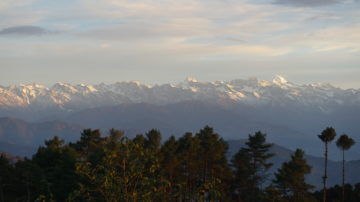
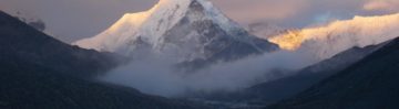
My focus is on the two great glaciology issues: ice-sheet deglaciation and sea level rise, and the role and future of mountain glaciers as a water resource. My contributions include:
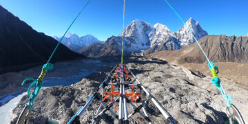
My ongoing work involves finding two of the major missing pieces in hydrology’s jigsaw: auditing glacier ice volumes on the river-basin scale using a new airborne radar survey platform that I have developed and have deployed successfully in the Nepal Himalayas; developing a better way to measure mountain snowfall (SWE) over much larger areas than has so far been possible. My technical background is in synthetic aperture radar and laser remote sensing, low-frequency radar field surveys of glaciers and ice sheets, GIS and mountain water resources.
These are tools that I apply in both a polar and alpine context, and the use of Antarctic research techniques and equipment to glaciers in High Mountain Asia fits well with the increasing focus of UK science on overseas development issues.
Muszynski, Grzegorz ORCID record for Muszynski, Grzegorz. Orr, Andrew ORCID record for Orr, Andrew. Roy, Indrani ORCID record for Roy, Indrani. Di Capua, Giorgia ORCID record for Di Capua, Giorgia. Pritchard, Hamish ORCID record for Pritchard, Hamish. Hosking, J. Scott ORCID record for Hosking, J. Scott. (2026) Using a causal effect network approach to quantify the impact of ENSO teleconnections on summer monsoon precipitation over the Himalayas and key regional circulations.
Nie, Yong ORCID record for Nie, Yong. Wang, Wen ORCID record for Wang, Wen. Pritchard, Hamish D. ORCID record for Pritchard, Hamish D.. Gu, Chang-Jun. Lyu, Qi-Yuan ORCID record for Lyu, Qi-Yuan. Wu, Yu-Hong. Li, Su-Ju. (2025) Daily imaging from China’s HJ-2A/B satellites enables yearly mapping of regional glacial lakes.
Biget, Titouan. Brun, Fanny ORCID record for Brun, Fanny. Immerzeel, Walter ORCID record for Immerzeel, Walter. Martin, Léo. Pritchard, Hamish ORCID record for Pritchard, Hamish. Collier, Emily ORCID record for Collier, Emily. Lei, Yanbin ORCID record for Lei, Yanbin. Yao, Tandong. (2025) Brief communication: Sharp precipitation gradient on the southern edge of the Tibetan Plateau during cold season.
Pritchard, Hamish ORCID record for Pritchard, Hamish. Editors: Drewry, David J (2025) Will our mountains lose their snow and ice? And does it matter if they do?.
Pritchard, Hamish D. ORCID record for Pritchard, Hamish D.. Editors: Azhgaliyeva, Dina. Rahut, Dil. Sonobe, Tetsushi (2025) Scaling Up the Collection of Mountain Snow and Ice Data for Managing Future Water Resource Risk in the Hindu Kush Himalayas.
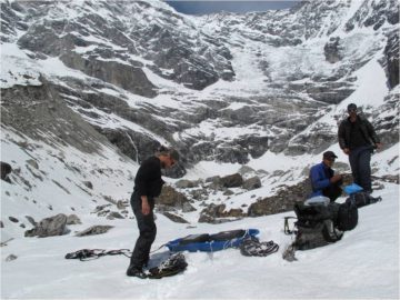
Pritchard, Hamish D. ORCID record for Pritchard, Hamish D.. King, Edward C. ORCID record for King, Edward C.. Goodger, David J. Boyle, Douglas. Goldberg, Daniel N. ORCID record for Goldberg, Daniel N.. Recinos, Beatriz ORCID record for Recinos, Beatriz. Orr, Andrew ORCID record for Orr, Andrew. Regmi, Dhananjay. (2025) Towards Bedmap Himalayas: a new airborne glacier thickness survey in Khumbu Himal, Nepal.
Liu, Wen. Li, Yiyi. Li, Dongfeng ORCID record for Li, Dongfeng. Lin, Peirong. Wang, Xiaoming ORCID record for Wang, Xiaoming. Pritchard, Hamish D. ORCID record for Pritchard, Hamish D.. Kraaijenbrink, Philip D.A. ORCID record for Kraaijenbrink, Philip D.A.. (2025) Impacts of changes in climate, cryosphere, and vegetation on freshwater supply in the southeastern Tibetan Plateau.
Hayman, Garry ORCID record for Hayman, Garry. Huntingford, Chris ORCID record for Huntingford, Chris. Kelley, Douglas ORCID record for Kelley, Douglas. Price, Jeff. Jevrejeva, Svetlana ORCID record for Jevrejeva, Svetlana. Jacobs, Zoe ORCID record for Jacobs, Zoe. Popova, Katya. Findlay, Helen S. Pritchard, Hamish ORCID record for Pritchard, Hamish. (2025) Annex 5: Natural system impacts of overshoot pathways.
Pritchard, Hamish D. ORCID record for Pritchard, Hamish D.. Fretwell, Peter T. ORCID record for Fretwell, Peter T.. Fremand, Alice C. ORCID record for Fremand, Alice C.. Bodart, Julien A. ORCID record for Bodart, Julien A.. Kirkham, James D. ORCID record for Kirkham, James D.. Aitken, Alan. Bamber, Jonathan. Bell, Robin. Bianchi, Cesidio. Bingham, Robert G. ORCID record for Bingham, Robert G.. Blankenship, Donald D. Casassa, Gino. Christianson, Knut. Conway, Howard. Corr, Hugh F.J. Cui, Xiangbin. Damaske, Detlef. Damm, Volkmar. Dorschel, Boris ORCID record for Dorschel, Boris. Drews, Reinhard ORCID record for Drews, Reinhard. Eagles, Graeme. Eisen, Olaf ORCID record for Eisen, Olaf. Eisermann, Hannes. Ferraccioli, Fausto ORCID record for Ferraccioli, Fausto. Field, Elena ORCID record for Field, Elena. Forsberg, René. Franke, Steven ORCID record for Franke, Steven. Goel, Vikram ORCID record for Goel, Vikram. Gogineni, Siva Prasad. Greenbaum, Jamin ORCID record for Greenbaum, Jamin. Hills, Benjamin. Hindmarsh, Richard C.A. ORCID record for Hindmarsh, Richard C.A.. Hoffman, Andrew O. Holschuh, Nicholas. Holt, John W. Humbert, Angelika ORCID record for Humbert, Angelika. Jacobel, Robert W. Jansen, Daniela. Jenkins, Adrian. Jokat, Wilfried. Jong, Lenneke ORCID record for Jong, Lenneke. Jordan, Tom A. ORCID record for Jordan, Tom A.. King, Edward C. ORCID record for King, Edward C.. Kohler, Jack. Krabill, William. Maton, Joséphine. Gillespie, Mette Kusk. Langley, Kirsty. Lee, Joohan ORCID record for Lee, Joohan. Leitchenkov, German. Leuschen, Cartlon. Luyendyk, Bruce ORCID record for Luyendyk, Bruce. MacGregor, Joseph A. ORCID record for MacGregor, Joseph A.. MacKie, Emma. Moholdt, Geir. Matsuoka, Kenichi ORCID record for Matsuoka, Kenichi. Morlighem, Mathieu ORCID record for Morlighem, Mathieu. Mouginot, Jérémie ORCID record for Mouginot, Jérémie. Nitsche, Frank O. ORCID record for Nitsche, Frank O.. Nost, Ole A. Paden, John ORCID record for Paden, John. Pattyn, Frank. Popov, Sergey. Rignot, Eric ORCID record for Rignot, Eric. Rippin, David M. ORCID record for Rippin, David M.. Rivera, Andrés ORCID record for Rivera, Andrés. Roberts, Jason L. ORCID record for Roberts, Jason L.. Ross, Neil ORCID record for Ross, Neil. Ruppel, Antonia. Schroeder, Dustin M. Siegert, Martin J. ORCID record for Siegert, Martin J.. Smith, Andrew ORCID record for Smith, Andrew. Steinhage, Daniel. Studinger, Michael ORCID record for Studinger, Michael. Sun, Bo. Tabacco, Ignazio. Tinto, Kirsty J. ORCID record for Tinto, Kirsty J.. Urbini, Stefano. Vaughan, David G. ORCID record for Vaughan, David G.. Wilson, Douglas S. Young, Duncan A. Zirizzotti, Achille. (2025) Bedmap3 updated ice bed, surface and thickness gridded datasets for Antarctica.
Pritchard, Hamish D. ORCID record for Pritchard, Hamish D.. (2024) A new instrumental way to measure accumulating SWE in mountain and polar catchments directly, on the kilometre-scale and in near-real time.
Nie, Yong. Deng, Qian. Pritchard, Hamish D. ORCID record for Pritchard, Hamish D.. Carrivick, Jonathan L. Ahmed, Farooq. Huggel, Christian. Liu, Lijun. Wang, Wen. Lesi, Muchu. Wang, Jida. Zhang, Huayu. Zhang, Bo. Lü, Qiyuan. Zhang, Yili. (2023) Glacial lake outburst floods threaten Asia’s infrastructure.
Wang, Shuhong. Liu, Jintao. Pritchard, Hamish D. ORCID record for Pritchard, Hamish D.. Ke, Linghong. Qiao, Xiao. Zhang, Jie. Xiao, Weihua. Zhou, Yuyan. (2023) Characterizing 4 decades of accelerated glacial mass loss in the west Nyainqentanglha Range of the Tibetan Plateau.
Frémand, Alice C. ORCID record for Frémand, Alice C.. Fretwell, Peter ORCID record for Fretwell, Peter. Bodart, Julien A. Pritchard, Hamish D. ORCID record for Pritchard, Hamish D.. Aitken, Alan. Bamber, Jonathan L. Bell, Robin. Bianchi, Cesido. Bingham, Robert G. Blankenship, Donald D. Casassa, Gino. Catania, Ginny. Christianson, Knut. Conway, Howard. Corr, Hugh F.J. Cui, Xiangbin. Damaske, Detlef. Damm, Volkmar. Drews, Reinhard. Eagles, Graeme. Eisen, Olaf. Eisermann, Hannes. Ferraccioli, Fausto ORCID record for Ferraccioli, Fausto. Field, Elena ORCID record for Field, Elena. Forsberg, René. Franke, Steven. Fujita, Shuji. Gim, Yonggyu. Goel, Vikram. Gogineni, Siva Prasad. Greenbaum, Jamin. Hills, Benjamin. Hindmarsh, Richard C.A. ORCID record for Hindmarsh, Richard C.A.. Hoffman, Andrew O. Holmlund, Per. Holschuh, Nicholas. Holt, John W. Horlings, Anneka N. Humbert, Anglika. Jacobel, Robert W. Jansen, Daniela. Jenkins, Adrian. Jokat, Wilfried. Jordan, Tom ORCID record for Jordan, Tom. King, Edward ORCID record for King, Edward. Kohler, Jack. Krabill, William. Langley, Kirsty. Lee, Joohan. Leitchenkov, German. Leuschen, Carlton. Luyendyk, Bruce. MacGregor, Joseph. MacKie, Emma. Matsuoka, Kenichi. Morlighem, Mathieu. Mouginot, Jérémie. Nitsche, Frank O. Nogi, Yoshifumi. Nost, Ole A. Paden, John. Pattyn, Frank. Popov, Sergey V. Rignot, Eric. Rippin, David M. Rivera, Andrés. Roberts, Jason. Ross, Neil. Ruppel, Anotonia. Schroeder, Dustin M. Siegert, Martin J. Smith, Andrew M. ORCID record for Smith, Andrew M.. Steinhage, Daniel. Studinger, Michael. Sun, Bo. Tabacco, Ignazio. Tinto, Kirsty. Urbini, Stefano. Vaughan, David ORCID record for Vaughan, David. Welch, Brian C. Wilson, Douglas S. Young, Duncan A. Zirizzotti, Achille. (2022) Antarctic Bedmap data: Findable, Accessible, Interoperable, and Reusable (FAIR) sharing of 60 years of ice bed, surface, and thickness data.
Su, Fengge. Pritchard, Hamish D. ORCID record for Pritchard, Hamish D.. Yao, Tandong. Huang, Jingheng. Ou, Tinghai. Meng, Fanchong. Sun, He. Li, Ying. Xu, Baiqing. Zhu, Meilin. Chen, Deliang. (2022) Contrasting fate of western Third Pole’s water resources under 21st century climate change.
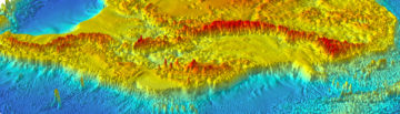
Dorschel, Boris. Hehemann, Laura. Viquerat, Sacha. Warnke, Fynn. Dreutter, Simon. Tenberge, Yvonne Schulze. Accetella, Daniela. An, Lu. Barrios, Felipe. Bazhenova, Evgenia. Black, Jenny. Bohoyo, Fernando. Davey, Craig. De Santis, Laura. Dotti, Carlota Escutia. Fremand, Alice C. ORCID record for Fremand, Alice C.. Fretwell, Peter T. ORCID record for Fretwell, Peter T.. Gales, Jenny A. Gao, Jinyao. Gasperini, Luca. Greenbaum, Jamin S. Henderson Jencks, Jennifer. Hogan, Kelly ORCID record for Hogan, Kelly. Hong, Jong Kuk. Jakobsson, Martin. Jensen, Laura. Kool, Johnathan. Larin, Sergei. Larter, Robert D. ORCID record for Larter, Robert D.. Leitchenkov, German. Loubrieu, Benoît. Mackay, Kevin. Mayer, Larry. Millan, Romain. Morlighem, Mathieu. Navidad, Francisco. Nitsche, Frank O. Nogi, Yoshifumi. Pertuisot, Cécile. Post, Alexandra L. Pritchard, Hamish D. ORCID record for Pritchard, Hamish D.. Purser, Autun. Rebesco, Michele. Rignot, Eric. Roberts, Jason L. Rovere, Marzia. Ryzhov, Ivan. Sauli, Chiara. Schmitt, Thierry. Silvano, Alessandro. Smith, Jodie. Snaith, Helen. Tate, Alex J. ORCID record for Tate, Alex J.. Tinto, Kirsty. Vandenbossche, Philippe. Weatherall, Pauline. Wintersteller, Paul. Yang, Chunguo. Zhang, Tao. Arndt, Jan Erik. (2022) The International Bathymetric Chart of the Southern Ocean Version 2.
Dell, Rebecca L. Banwell, Alison F. Willis, Ian C. Arnold, Neil S. Halberstadt, Anna Ruth W. Chudley, Thomas R. Pritchard, Hamish D. ORCID record for Pritchard, Hamish D.. (2021) Supervised classification of slush and ponded water on Antarctic ice shelves using Landsat 8 imagery.
Pritchard, Hamish D. ORCID record for Pritchard, Hamish D.. (2021) Global data gaps in our knowledge of the terrestrial cryosphere.
Individual contributors, including. Pritchard, Hamish D. ORCID record for Pritchard, Hamish D.. Turner, John ORCID record for Turner, John. (2021) State of the global climate in 2020.
Nie, Yong. Pritchard, Hamish D. ORCID record for Pritchard, Hamish D.. Liu, Qiao. Hennig, Thomas. Wang, Wenling. Wang, Wiaoming. Liu, Shiyin. Nepal, Santosh. Samyn, Denis. Hewitt, Kenneth. Chen, Xiaoqing. (2021) Glacial change and hydrological implications in the Himalaya and Karakoram.
Pritchard, Hamish D. ORCID record for Pritchard, Hamish D.. Farinotti, Daniel. Colwell, Steve. (2021) Measuring changes in snowpack SWE continuously on a landscape scale using lake water pressure.
Dell, Rebecca. Arnold, Neil. Willis, Ian. Banwell, Alison. Williamson, Andrew. Pritchard, Hamish ORCID record for Pritchard, Hamish. Orr, Andrew ORCID record for Orr, Andrew. (2020) Lateral meltwater transfer across an Antarctic ice shelf..
Pritchard, H.D. ORCID record for Pritchard, H.D.. King, E.C. ORCID record for King, E.C.. Goodger, D.J. McCarthy, M. ORCID record for McCarthy, M.. Mayer, C. Kayastha, R. (2020) Towards Bedmap Himalayas: development of an airborne ice-sounding radar for glacier thickness surveys in High-Mountain Asia.
Meredith, Michael ORCID record for Meredith, Michael. Sommerkorn, M. Cassotta, S. Derksen, C. Ekaykin, A. Hollowed, A. Kofinas, G. Mackintosh, A. Melbourn-Thomas, J. Muelbert, M.M.C. Ottersen, G. Pritchard, Hamish ORCID record for Pritchard, Hamish. Schuur, E.A.G. Editors: Pörtner, H.-O. Roberts, D.C. Masson-Delmotte, V. Zhai, P. Tignor, M. Poloczanska, E. Mintenbeck, K. Alegría, A. Nicolai, M. Okem, A. Petzold, J. Rama, B. Weyer, N.M (2020) Chapter 3: Polar Regions.
Pritchard, Hamish ORCID record for Pritchard, Hamish. (2019) Asia’s shrinking glaciers protect large populations from drought stress.
Nicholson, Lindsey I. McCarthy, Michael ORCID record for McCarthy, Michael. Pritchard, Hamish D. ORCID record for Pritchard, Hamish D.. Willis, Ian. (2018) Supraglacial debris thickness variability: impact on ablation and relation to terrain properties.
Christie, Frazer D.W. Bingham, Robert G. Gourmelen, Noel. Steig, Eric J. Bisset, Rosie R. Pritchard, Hamish D. ORCID record for Pritchard, Hamish D.. Snow, Kate. Tett, Simon F.B. (2018) Glacier change along West Antarctica’s Marie Byrd Land Sector and links to inter-decadal atmosphere–ocean variability.
Felikson, Denis. Urban, Timothy J. Gunter, Brian C. Pie, Nadege. Pritchard, Hamish D. ORCID record for Pritchard, Hamish D.. Harpold, Robert. Schutz, Bob E. (2017) Comparison of elevation change detection methods from ICESat altimetry over the Greenland Ice Sheet.
Spagnolo, Matteo. Bartholomaus, Timothy C. Clark, Chris D. Stokes, Chris R. Atkinson, Nigel. Dowdeswell, Julian A. Ely, Jeremy C. Graham, Alistair G.C. Hogan, Kelly A. ORCID record for Hogan, Kelly A.. King, Edward C. ORCID record for King, Edward C.. Larter, Robert D. ORCID record for Larter, Robert D.. Livingstone, Stephen J. Pritchard, Hamish D. ORCID record for Pritchard, Hamish D.. (2017) The periodic topography of ice stream beds: insights from the Fourier spectra of mega-scale glacial lineations.
Pritchard, Hamish D. ORCID record for Pritchard, Hamish D.. (2017) Asia’s glaciers are a regionally important buffer against drought [Retracted article].
McCarthy, Michael ORCID record for McCarthy, Michael. Pritchard, Hamish ORCID record for Pritchard, Hamish. Willis, Ian. King, Edward ORCID record for King, Edward. (2017) Ground-penetrating radar measurements of debris thickness on Lirung Glacier, Nepal.
King, Edward C. ORCID record for King, Edward C.. Pritchard, Hamish D. ORCID record for Pritchard, Hamish D.. Smith, Andy M. ORCID record for Smith, Andy M.. (2016) Subglacial landforms beneath Rutford Ice Stream, Antarctica: detailed bed topography from ice-penetrating radar.
Smith, E.C. Smith, A.M. ORCID record for Smith, A.M.. White, R.S. Brisbourne, A.M. ORCID record for Brisbourne, A.M.. Pritchard, H.D. ORCID record for Pritchard, H.D.. (2015) Mapping the ice-bed interface characteristics of Rutford Ice Stream, West Antarctica, using microseismicity.
Matsuoka, Kenichi. Hindmarsh, Richard C.A. ORCID record for Hindmarsh, Richard C.A.. Moholdt, Geir. Bentley, Michael J. Pritchard, Hamish D. ORCID record for Pritchard, Hamish D.. Brown, Joel. Conway, Howard. Drews, Reinhard. Durand, Gael. Goldberg, Daniel. Hatterman, Tore. Kingslake, Jonathan. Lenaerts, Jan T.M. Martin, Carlos ORCID record for Martin, Carlos. Mulvaney, Robert ORCID record for Mulvaney, Robert. Nicholls, Keith ORCID record for Nicholls, Keith. Pattyn, Frank. Ross, Neil. Scambos, Ted. Whitehouse, Pippa L. (2015) Antarctic ice rises and rumples: their properties and significance for ice-sheet dynamics and evolution.
Kingslake, Jonathan. Hindmarsh, Richard C.A. ORCID record for Hindmarsh, Richard C.A.. Aðalgeirsdóttir, Guðfinna. Conway, Howard. Corr, Hugh F.J. Gillet-Chaulet, Fabien. Martin, Carlos ORCID record for Martin, Carlos. King, Edward C. ORCID record for King, Edward C.. Mulvaney, Robert ORCID record for Mulvaney, Robert. Pritchard, Hamish D. ORCID record for Pritchard, Hamish D.. (2014) Full-depth englacial vertical ice-sheet velocities measured using phase-sensitive radar.
Pritchard, Hamish ORCID record for Pritchard, Hamish. (2014) Bedgap – where next for Antarctic subglacial mapping?.
Harland, S.R. Kendall, J.-M. Stuart, G.W. Lloyd, G.E. Baird, A.F. Smith, A.M. ORCID record for Smith, A.M.. Pritchard, H.D. ORCID record for Pritchard, H.D.. Brisbourne, A.M. (2013) Deformation in Rutford Ice Stream, West Antarctica: measuring shear-wave anisotropy from icequakes.
Fretwell, P. ORCID record for Fretwell, P.. Pritchard, H.D. ORCID record for Pritchard, H.D.. Vaughan, D.G. ORCID record for Vaughan, D.G.. Bamber, J.L. Barrand, N.E. Bell, R. Bianchi, C. Bingham, R. G. Blankenship, D.D. Casassa, G. Catania, G. Callens, D. Conway, H. Cook, A.J. Corr, H.F.J. Damaske, D. Damm, V. Ferraccioli, F. ORCID record for Ferraccioli, F.. Forsberg, R. Fujita, S. Gim, Y. Gogineni, P. Griggs, J.A. Hindmarsh, R.C.A. ORCID record for Hindmarsh, R.C.A.. Holmlund, P. Holt, J.W. Jacobel, R.W. Jenkins, A. ORCID record for Jenkins, A.. Jokat, W. Jordan, T. ORCID record for Jordan, T.. King, E.C. ORCID record for King, E.C.. Kohler, J. Krabill, W. Riger-Kusk, M. Langley, K.A. Leitchenkov, G. Leuschen, C. Luyendyk, B.P. Matsuoka, K. Mouginot, J. Nitsche, F.O. Nogi, Y. Nost, O.A. Popov, S.V. Rignot, E. Rippin, D.M. Rivera, A. Roberts, J. Ross, N. Siegert, M.J. Smith, A.M. ORCID record for Smith, A.M.. Steinhage, D. Studinger, M. Sun, B. Tinto, B.K. Welch, B.C. Wilson, D. Young, D.A. Xiangbin, C. Zirizzotti, A. (2013) Bedmap2: improved ice bed, surface and thickness datasets for Antarctica.
Shepherd, Andrew. Ivins, Erik R. A, Geruo. Barletta, Valentina R. Bentley, Mike J. Bettadpur, Srinivas. Briggs, Kate H. Bromwich, David H. Forsberg, René. Galin, Natalia. Horwath, Martin. Jacobs, Stan. Joughin, Ian. King, Matt A. Lenaerts, Jan T.M. Li, Jilu. Ligtenberg, Stefan R.M. Luckman, Adrian. Luthcke, Scott B. McMillan, Malcolm. Meister, Rakia. Milne, Glenn. Mouginot, Jeremie. Muir, Alan. Nicolas, Julien P. Paden, John. Payne, Antony J. Pritchard, Hamish ORCID record for Pritchard, Hamish. Rignot, Eric. Rott, Helmut. Sandberg Sørensen, Louise. Scambos, Ted A. Scheuchl, Bernd. Schrama, Ernst J.O. Smith, Ben. Sundal, Aud V. van Angelen, Jan H. van de Berg, Willem J. van den Broeke, Michiel R. Vaughan, David G. ORCID record for Vaughan, David G.. Velicogna, Isabella. Wahr, John. Whitehouse, Pippa. Wingham, Duncan J. Yi, Donghui. Young, Duncan. Zwally, H. Jay. (2012) A reconciled estimate of ice sheet mass balance.
Pritchard, Hamish ORCID record for Pritchard, Hamish. (2012) Review of Polar remote sensing. Vol. II: Ice sheets by R. Massom and D. Lubin. Berlin, Springer; Chichester, Praxis, 2006.
Bingham, Robert G. Ferraccioli, Fausto ORCID record for Ferraccioli, Fausto. King, Edward C. ORCID record for King, Edward C.. Larter, Robert D. ORCID record for Larter, Robert D.. Pritchard, Hamish D. ORCID record for Pritchard, Hamish D.. Smith, Andrew M. ORCID record for Smith, Andrew M.. Vaughan, David G. ORCID record for Vaughan, David G.. (2012) Inland thinning of West Antarctic Ice Sheet steered along subglacial rifts.
Pritchard, H.D. ORCID record for Pritchard, H.D.. Ligtenberg, S.R.M. Fricker, H.A. Vaughan, D.G. ORCID record for Vaughan, D.G.. van den Broeke, M.R. Padman, L. (2012) Antarctic ice-sheet loss driven by basal melting of ice shelves.
Humbert, A. Pritchard, H.D. ORCID record for Pritchard, H.D.. (2011) Numerical simulations of the ice flow dynamics of the Brunt Ice Shelf – Stancomb Wills Ice Tongue System.
Pritchard, Hamish D. ORCID record for Pritchard, Hamish D.. Vaughan, David G. ORCID record for Vaughan, David G.. (2011) Widespread acceleration of tidewater glaciers on the Antarctic Peninsula.
Pritchard, Hamish ORCID record for Pritchard, Hamish. Editors: Riffenburgh, B (2011) Antarctic Peninsula, glaciology of.
Pritchard, Hamish D. ORCID record for Pritchard, Hamish D.. Luthcke, S.B. Fleming, Andrew H. ORCID record for Fleming, Andrew H.. (2011) Understanding ice-sheet mass balance: progress in satellite altimetry and gravimetry.
Holland, Paul R. ORCID record for Holland, Paul R.. Corr, Hugh F.J. Pritchard, Hamish D. ORCID record for Pritchard, Hamish D.. Vaughan, David G. ORCID record for Vaughan, David G.. Arthern, Robert J. ORCID record for Arthern, Robert J.. Jenkins, Adrian ORCID record for Jenkins, Adrian. Tedesco, Marco. (2011) The air content of Larsen Ice Shelf.
Bingham, Robert G. King, Edward C. ORCID record for King, Edward C.. Smith, Andrew M. ORCID record for Smith, Andrew M.. Pritchard, Hamish D. ORCID record for Pritchard, Hamish D.. (2011) Glacial geomorphology: towards a convergence of glaciology and geomorphology.
Vaughan, David G. ORCID record for Vaughan, David G.. Corr, Hugh F.J. Smith, Andy M. ORCID record for Smith, Andy M.. Pritchard, Hamish D. ORCID record for Pritchard, Hamish D.. Shepherd, Andrew. (2011) Flow-switching and water piracy between Rutford Ice Stream and Carlson Inlet, West Antarctica.
Martin, Carlos ORCID record for Martin, Carlos. Gudmundsson, G. Hilmar ORCID record for Gudmundsson, G. Hilmar. Pritchard, Hamish D. ORCID record for Pritchard, Hamish D.. Gagliardini, Olivier. (2010) On the effects of anisotropic rheology on ice flow, internal structure, and the age-depth relationship at ice divides.
Pritchard, H.D. ORCID record for Pritchard, H.D.. Arthern, R.J. ORCID record for Arthern, R.J.. Vaughan, D.G. ORCID record for Vaughan, D.G.. Edwards, L.A. (2010) Extensive dynamic thinning on the margins of the Greenland and Antarctic ice sheets.
Scott, J.B.T. Gudmundsson, G.H. ORCID record for Gudmundsson, G.H.. Smith, A.M. ORCID record for Smith, A.M.. Bingham, R.G. Pritchard, H.D. ORCID record for Pritchard, H.D.. Vaughan, D.G. ORCID record for Vaughan, D.G.. (2010) Increased rate of acceleration on Pine Island Glacier strongly coupled to changes in gravitational driving stress.
Pritchard, Hamish ORCID record for Pritchard, Hamish. Murray, Tavi. Luckman, Adrian. Strozzi, Tazio. Barr, Stuart. (2008) Glacier surge dynamics of Sortebræ, east Greenland, from synthetic aperture radar feature tracking.
Rignot, E. Casassa, G. Gogineni, S. Kanagaratnam, P. Krabill, W. Pritchard, H. ORCID record for Pritchard, H.. Rivera, A. Thomas, R. Turner, J. ORCID record for Turner, J.. Vaughan, D. ORCID record for Vaughan, D.. (2008) Recent ice loss from the Fleming and other glaciers, Wordie Bay, West Antarctic Peninsula.
Pritchard, H., King, E., Goodger, D., Boyle, D., Goldberg, D., Recinos, B., & Orr, A. (2025). Raw and processed helicopter-borne radio-echo sounding ice thickness data from the glaciers of the Khumbu Himal, Nepal (2019) (Version 1.0) [Data set]. NERC EDS UK Polar Data Centre. https://doi.org/10.5285/e39647f5-fb72-4d16-acbd-9784ed2167b8
Pritchard, H., Fretwell, P., Fremand, A., Bodart, J., Kirkham, J., Aitken, A., Bamber, J., Bell, R., Bianchi, C., Bingham, R., Blankenship, D., Casassa, G., Catania, G., Christianson, K., Conway, H., Corr, H., Cui, X., Damaske, D., Damn, V., … Zirizzotti, A. (2024). BEDMAP3 – Ice thickness, bed and surface elevation for Antarctica – gridding products (Version 1.0) [Data set]. NERC EDS UK Polar Data Centre. https://doi.org/10.5285/2d0e4791-8e20-46a3-80e4-f5f6716025d2
Arthern, R., Williams, R., Hindmarsh, R., & Pritchard, H. (2022). Fields and parameters related to the flow of ice in the Antarctic Ice Sheet recovered using inverse methods and satellite data (Version 1.0) [Data set]. NERC EDS UK Polar Data Centre. https://doi.org/10.5285/5f0ac285-cca3-4a0e-bcbc-d921734395ab
Fretwell, P., Pritchard, H., Fremand, A., Bodart, J., Aitken, A., Bamber, J., Bell, R., Bianchi, C., Bingham, R., Blankenship, D., Casassa, G., Catania, G., Christianson, K., Conway, H., Corr, H., Cui, X., Damaske, D., Damn, V., Drews, R., … Zirizzotti, A. (2022). BEDMAP3 – Ice thickness, bed and surface elevation for Antarctica – standardised shapefiles and geopackages (Version 1.0) [Data set]. NERC EDS UK Polar Data Centre. https://doi.org/10.5285/a72a50c6-a829-4e12-9f9a-5a683a1acc4a
Fremand, A., Fretwell, P., Bodart, J., Pritchard, H., Aitken, A., Bamber, J., Bell, R., Bianchi, C., Bingham, R., Blankenship, D., Casassa, G., Catania, G., Christianson, K., Conway, H., Corr, H., Cui, X., Damaske, D., Damn, V., Drews, R., … Zirizzotti, A. (2022). BEDMAP3 – Ice thickness, bed and surface elevation for Antarctica – standardised data points (Version 1.0) [Data set]. NERC EDS UK Polar Data Centre. https://doi.org/10.5285/91523ff9-d621-46b3-87f7-ffb6efcd1847
Fretwell, P., Pritchard, H., Vaughan, D., Bamber, J., Barrand, N., Bell, R., Bianchi, C., Bingham, R., Blankenship, D., Casassa, G., Catania, G., Callens, D., Conway, H., Cook, A., Corr, H., Damaske, D., Damn, V., Ferraccioli, F., Forsberg, R., … Bodart, J. (2022). BEDMAP2 – Ice thickness, bed and surface elevation for Antarctica – standardised shapefiles and geopackages (Version 1.0) [Data set]. NERC EDS UK Polar Data Centre. https://doi.org/10.5285/0f90d926-99ce-43c9-b536-0c7791d1728b
Fretwell, P., Fremand, A., Bodart, J., Pritchard, H., Vaughan, D., Bamber, J., Barrand, N., Bell, R., Bianchi, C., Bingham, R., Blankenship, D., Casassa, G., Catania, G., Callens, D., Conway, H., Cook, A., Corr, H., Damaske, D., Damn, V., … Zirizzotti, A. (2022). BEDMAP2 – Ice thickness, bed and surface elevation for Antarctica – standardised data points (Version 1.0) [Data set]. NERC EDS UK Polar Data Centre. https://doi.org/10.5285/2fd95199-365e-4da1-ae26-3b6d48b3e6ac
Fretwell, P., Pritchard, H., Vaughan, D., Bamber, J., Barrand, N., Bell, R., Bianchi, C., Bingham, R., Blankenship, D., Casassa, G., Catania, G., Callens, D., Conway, H., Cook, A., Corr, H., Damaske, D., Damn, V., Ferraccioli, F., Forsberg, R., … Zirizzotti, A. (2022). BEDMAP2 – Ice thickness, bed and surface elevation for Antarctica – gridding products (Version 1.0) [Data set]. NERC EDS UK Polar Data Centre. https://doi.org/10.5285/fa5d606c-dc95-47ee-9016-7a82e446f2f2
Pritchard, H., Farinotti, D., & Colwell, S. (2021). Time series of water pressure, water temperature and ground temperature from lakes Orajarvi (Finland), and Tomasee and Silsersee (Switzerland) from winters 2018-2021 (Version 1.0) [Data set]. UK Polar Data Centre, Natural Environment Research Council, UK Research & Innovation. https://doi.org/10.5285/170fc6fa-9878-43fc-9abd-e6196bad60a2
Pritchard, H. (2017). Ground-penetrating radar data from Lirung and Langtang Glaciers, Nepal, 2015 (Version “1.0”) [Data set]. Polar Data Centre; British Antarctic Survey, Natural Environment Research Council; Cambridge, CB3 0ET, UK.. https://doi.org/10.5285/b14057b1-1951-45a0-a055-7d0d17102263
King, E., Pritchard, H., & Smith, A. (2015). Rutford Ice Stream bed elevation DEM from radar data (Version 1.0) [Data set]. NERC EDS UK Polar Data Centre. https://doi.org/10.5285/54757cbe-0b13-4385-8b31-4dfaa1dab55e
PRESCIENT supports long-term, strategically important measurements and capabilities for the wider science community.
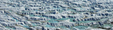
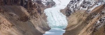
The Big Thaw studies snow and glacier changes in the Alps and Himalayas to improve forecasts of mountain water resources for global communities.
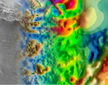
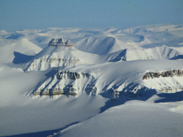
Bedmap3 is a collaborative community project with the aim to produce a new map and datasets of Antarctic ice thickness and bed topography.
Bedmap is a collaborative community that has produced maps and datasets of Antarctic ice thickness and bed topography
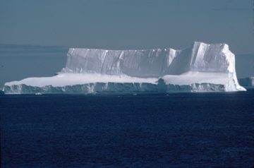
SURFEIT unites UK and international scientists to study Antarctic ice and atmosphere interactions, improve sea-level projections, and support climate action.
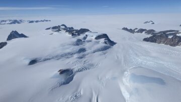
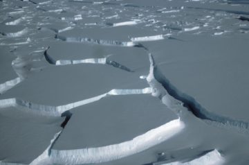
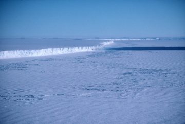
The aim of this programme was to image englacial layering and bedrock topography over this sensitive catchment of the West Antarctic Ice Sheet and Antarctic Peninsula.
This project investigated how much water is stored in the glaciers and snow of the Upper Indus Basin, and how climate variability influences water availability.
Polar Expertise – Supporting Development
Bedmap2 is a suite of gridded products describing surface elevation, ice-thickness and the sea floor and subglacial bed elevation of the Antarctic.
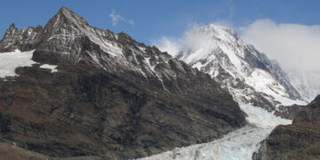
Bedmap Himalayas measures how much water is stored as glacier ice in High Mountain Asia by mapping ice thickness using radar.
By exploiting advances in ice sheet modelling, and new Antarctic-wide datasets, this project aims to predict how far and how fast the observed ocean-driven thinning of floating ice shelves will propagate into the interior of the Antarctic ice sheet, and assess the consequences for global sea level over decadal-to-centennial timescales.
A scientist from the British Antarctic Survey has contributed to a major new international publication, coordinated by the UK National Commission for UNESCO, which highlights the accelerating decline of glaciers […]
The most detailed map yet of the landscape beneath Antarctica’s ice sheet has been assembled by a team of international scientists led from the British Antarctic Survey.
British Antarctic Survey glaciologist Hamish Pritchard has won the 2023 Harry Otten Prize for Innovation in Meteorology.
How much water the mountain glaciers of the Himalayas contain and how the mighty Thwaites Glacier in West Antarctica will contribute to global sea-level rise form part of the final […]
In 2011, Frozen Planet gave BBC viewers an unprecedented insight into life in the Poles. The final episode featured British Antarctic Survey (BAS) glaciologist Dr Andy Smith using explosives to […]
A new study featuring contributions from British Antarctic Survey (BAS) scientists has identified 100 pressing research questions on climate change and water resources in the Upper Indus Basin (UIB) that must be answered to protect the communities that live there.
Technology pioneered in Antarctica could soon be providing much-needed data on the amount of ice in the glaciers of High Mountain Asia thanks to an ingenious helicopter-mounted, low-frequency radar developed […]
Bedmap2 gives scientists a more detailed view of Antarctica”s landmass Scientists at the British Antarctic Survey have been working with a host of international collaborators to present the most detailed […]
British Antarctic Survey researchers part of landmark study to improve projections for future sea level An international team of satellite experts including researchers at British Antarctic Survey has produced the […]
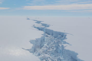
Hidden rift valley discovered beneath West Antarctica reveals new insight into accelerating ice loss Scientists have discovered a one mile deep rift valley hidden beneath the ice in West Antarctica, […]
New studies improve scientists’ understanding of the potential contribution of the Antarctic Ice Sheet to global sea level rise Three peer-reviewed papers in Nature and Nature Geoscience published in recent […]
Warm ocean currents cause majority of ice loss from Antarctica Reporting this week (Thursday 26 April) in the journal Nature, an international team of scientists led by British Antarctic Survey […]
Scientists at British Antarctic Survey (BAS) have produced the most detailed map of underneath Antarctica — its rock bed. BEDMAP is a close-up view of the landscape beneath the Antarctic […]
Lasers from space show thinning of Greenland and Antarctic ice sheets The most comprehensive picture of the rapidly thinning glaciers along the coastline of both the Antarctic and Greenland ice […]
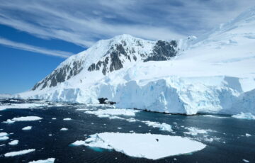
Hundreds of glaciers on the Antarctic Peninsula are flowing faster, further adding to sea level rise according to new research published this week in the Journal of Geophysical Research. Climate […]
Hundreds of glaciers on the Antarctic Peninsula are flowing faster, further adding to sea-level rise. Climate warming, that is already causing Antarctic Peninsula increased summer snow melt and ice shelf […]