Space Weather Researcher
SuperDARN (Super Dual Auroral Radar Network) Halley Radar
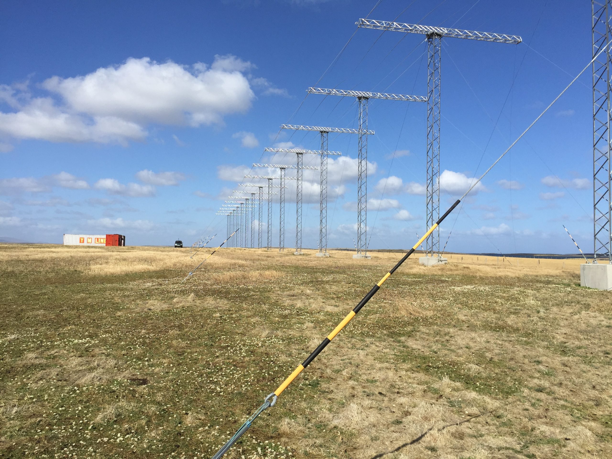
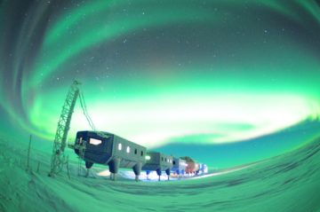
SuperDARN (Super Dual Auroral Radar Network) Halley Radar, Halley Research Station
- Position
- Lat: -75.56821, Long: -25.50852
What is SuperDARN?
The Super Dual Auroral Radar Network (SuperDARN) is a worldwide network of radars that studies space weather and Earth’s upper atmosphere. For over 20 years, scientists from different countries have worked together to run this network.
SuperDARN uses 33 radars spread across the Arctic and Antarctic regions. These radars work like a team, scanning large areas of the sky near the North and South Poles. They help scientists understand how energy from the sun affects our planet.
SuperDARN at BAS
British Antarctic Survey (BAS) operates two SuperDARN radars—one in Antarctica at Halley and one in the Falkland Islands. BAS also runs one of two data centers that collect information from all SuperDARN radars worldwide. Scientists around the world can access this data for their research.
SuperDARN has helped BAS scientists answer important questions about how the sun’s magnetic field connects with Earth’s magnetic field, how charged particles move through the atmosphere, and how atmospheric waves behave.
It now has a key role in the Space Weather and Atmosphere team’s project to routinely measure Joule heating in the upper atmosphere, and assess its contribution to satellite drag.
What Has SuperDARN Discovered?
SuperDARN has made several important contributions to science:
- It created better maps of how charged particles flow through the atmosphere near the poles, revealing unexpected patterns when the sun’s magnetic field points in certain directions.
- It measured how much energy enters and leaves Earth’s magnetic bubble through a process called magnetic reconnection.
- It tracked electric currents that flow between different atmospheric layers.
- It detected small atmospheric waves that other instruments can’t measure.
- It monitors patches of extra ionization in the atmosphere that can disrupt radio signals and GPS.
- It tracks wind patterns in the mesosphere, a layer of atmosphere about 50-80 kilometers above Earth’s surface.
Scientists have published over 700 research papers using SuperDARN data, making it one of the most valuable tools for studying space weather.
SuperDARN facilitates a wide breadth of both magnetospheric and ionospheric science, particularly in the area of magnetosphere-ionosphere coupling, with notable unique results and breakthroughs:
- Revolutionised the global mapping of ionospheric convection, with particular highlights being the observation of reverse convection cells during northward IMF, and the understanding of transient ionospheric flows driven by bursty and patchy magnetic reconnection.
- Facilitated global measurements of energy flow into and out of the Earth’s magnetosphere via magnetic reconnection. SuperDARN measurements allowed the remote sensing of reconnection rates across the merging regions on both the dayside and nightside of the Earth.
- Allowed the direct measurement of ionospheric vorticity, which provides a proxy for the field-aligned currents that couple processes in the magnetosphere and ionosphere.
- Revolutionised the measurement and characterisation of small-scale ULF waves that cannot be measured by other ground-based instrumentation.
- Allow the measurement and tracking of polar patches – regions of enhanced ionisation in the ionosphere that disrupt radio communications.
- Through using the SuperDARN radars as meteor radars it has been possible to build up a global picture of tides in the mesosphere/lower thermosphere region of the atmosphere.
There are over 700 papers in the ISI Web of Science database which contain ‘SuperDARN’ in the title, abstract, or keywords.
Data Access – The BAS SuperDARN data mirror is one of two SuperDARN data mirrors, the other being located at the University of Saskatchewan in Saskatoon, Canada.
Given a connecting host address, username, and corresponding SSH public key, we can create a secure, isolated account for that user on our external-facing mirror node. This mirror node provides read-only access to the data, supporting rsync, sftp, and scp data transfer methods. The data are then accessible under the mirror directory structure – /sddata/<type>/<year>/<month>/.
To set this up, e-mail bassuperdarndata@bas.ac.uk
Data Catalogue – The files on the mirror and the radars that make up SuperDARN, are described in the SuperDARN Mirror Catalogue.
The catalogue is exposed via an API, available at https://api.bas.ac.uk/superdarn/mirror/v3/.
Full documentation is also available.
The temporal coverage of the catalogue can also be queried and visualised.
Data Format – The raw data on the SuperDARN data mirror exists in the form of *.rawacf files. Software to read and analyse these data is available in a range of SuperDARN software modules which can be freely downloaded from http://superdarn.org/tiki-index.php?page=software
Data Usage and Acknowledgements – Data are freely available to scientists or for scientific purposes. Data should not be used for defence or commercial purposes. These data should not be made available on non-official database sites.
When using SuperDARN data please acknowledge their source. In particular please include the following acknowledgement in any publications – “The authors acknowledge the use of SuperDARN data. SuperDARN is a collection of radars funded by the national scientific funding agencies of Australia, Canada, China, France, Italy, Japan, Norway, South Africa, United Kingdom and United States of America.” In addition, we recommend the following general references for the SuperDARN network:
Chisham, G., et al. (2007), A decade of the Super Dual Auroral Radar Network (SuperDARN): Scientific achievements, new techniques and future directions, Surv. Geophys., 28, 33-109.
Greenwald, R. A., et al. (1995), DARN/SuperDARN: A global view of the dynamics of high-latitude convection, Space Sci. Rev., 71, 761-796.
-
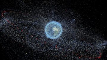
Atmospheric warming impacts on satellite debris
Read more of: Atmospheric warming impacts on satellite debrisJoule Heating investigated how space weather affects the upper atmosphere’s ability to slow down orbiting satellite debris.
-