New map of South Orkney Islands published for the first time in 40 years
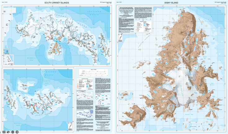
A new map of the South Orkney Islands has been released by British Antarctic Survey (BAS) – the first UK published, topographic map of the region in almost 40 years. The map offers a detailed topographic view of the entire South Orkney archipelago on one side, with a focused, high-resolution map of Signy Island on the reverse.