High resolution vector polygon seamask for areas south of 60°S
A high resolution seamask for regions south of 60°S, comprised of a roundel polygon with all land and ice shelves erased.


85 to 96 of 1444 results
A high resolution seamask for regions south of 60°S, comprised of a roundel polygon with all land and ice shelves erased.
Antarctic coastline south of 60°S, consisting of ice coastline, rock coastline, grounding line, ice shelf and front, ice rumple, and ‘rock against ice shelf’ line features.
We present here unprocessed shot gathers from active seismic surveys acquired over an ice surface elevation anomaly, inferred to be caused by an active subglacial lake, on Isunnguata Sermia, West […]
The ice-penetrating radar data were acquired over two ice surface elevation anomalies on Isunnguata Sermia, West Greenland. The elevation anomalies are inferred to result from the drainage of active subglacial […]
In 2024, a 14.4 km long seismic reflection profile was collected near to Ghost Ridge, Thwaites Glacier, West Antarctica (~65 km upstream of the grounding line). Normal-incidence and wide-angle data […]
Researchers from the University of Calgary and Government of Nunavut, Canada and from the University of Glasgow, UK, conducted an investigation into muskox mortalities on Ellesmere and Axel Heiberg islands, […]
This dataset contains 92 georeferenced GeoTIFF products comprising 46 orthophotos and 46 digital surface models (DSMs) derived from low-cost UAV surveys of landfast sea ice in the Pond Inlet / […]
This dataset provides a 21 year (2000 – 2020) time series of Arctic sea ice surface roughness at 1km aggregated at a monthly timescale. Roughness is defined as the standard […]
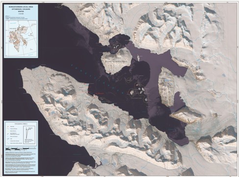
Map of Kongsfjorden local area, showing locations of huts, tracks and nature reserves as of June 2023, mapped over a satellite image from May 2025.
As short-term Antarctic summer temperatures approach 20 degrees C, parameterising temperature tolerance for snow algal species is key to determining how climate change may affect community composition and primary productivity […]
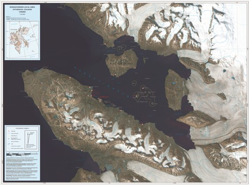
Map of Kongsfjorden local area, showing locations of huts, tracks and nature reserves as of June 2023, mapped over a satellite image from August 2025.
This data product comprises 5 documents outlining biogeochemical data from three fjords along the West Antarctic Peninsula: Sheldon Cove (Adelaide Island), Borgen Bay (Anvers Island), and Marian Cove (King George […]